6.2 km
~1 hrs 24 min
104 m
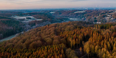
“The Ruhrtalblick via Baldney Steig offers a scenic 6 km hike with history, natural beauty, and panoramic views.”
Starting near Essen, Germany, the Ruhrtalblick via Baldney Steig is a picturesque loop trail that spans approximately 6 km (3.7 miles) with an elevation gain of around 100 meters (328 feet). This medium-difficulty trail offers a delightful mix of natural beauty, historical landmarks, and panoramic views of the Ruhr Valley.
### Getting There To reach the trailhead, you can either drive or use public transportation. If driving, set your GPS to the vicinity of Baldeneysee, a large reservoir in Essen. There are several parking areas nearby. For those using public transport, take the S-Bahn to Essen-Hügel station, which is a short walk from the trailhead.
### Trail Overview The trail begins near the shores of Baldeneysee, a popular recreational area. As you start your hike, you'll be greeted by the serene waters of the reservoir, which is a great spot for a quick photo or a moment of reflection. The path initially follows a gentle incline, making it accessible for most hikers.
### Key Landmarks and Points of Interest #### Baldeneysee At the beginning of your hike, you'll encounter Baldeneysee, a man-made lake created in the 1930s. This reservoir is not only a hub for water sports but also a crucial part of the region's flood control system. The lake is surrounded by lush greenery and offers several spots for picnicking and bird-watching.
#### Villa Hügel Approximately 2 km (1.2 miles) into the hike, you'll come across Villa Hügel, the former residence of the Krupp family, one of Germany's most influential industrial dynasties. This grand mansion, built in the late 19th century, is now a museum and cultural center. While the trail doesn't take you directly through the villa grounds, it's worth a short detour if you're interested in history and architecture.
### Flora and Fauna As you continue along the trail, you'll traverse through dense forests and open meadows. The area is rich in biodiversity, with a variety of plant species and wildlife. Keep an eye out for native birds like the European robin and the Eurasian blue tit. In the spring and summer months, the meadows are adorned with wildflowers, adding a splash of color to your hike.
### Elevation and Terrain The trail features a moderate elevation gain of about 100 meters (328 feet), with some sections being steeper than others. The terrain is a mix of well-maintained paths and more rugged, natural trails. Good hiking boots are recommended, especially after rain, as some parts can become slippery.
### Navigation To ensure you stay on track, it's advisable to use a reliable navigation tool like HiiKER. The app provides detailed maps and real-time updates, making it easier to navigate the various twists and turns of the trail.
### Historical Significance The Ruhr Valley has a rich industrial history, and this trail offers glimpses into its past. The region was once the heart of Germany's coal and steel industries, and remnants of this industrial heritage can still be seen. Old railway tracks, abandoned mines, and historical markers dot the landscape, providing a fascinating backdrop to your hike.
### Final Stretch As you near the end of the loop, the trail descends back towards Baldeneysee. The final stretch offers stunning views of the reservoir and the surrounding hills, making for a perfect end to your hike. There are several cafes and restaurants near the trailhead where you can relax and enjoy a meal or a drink.
This trail is a wonderful blend of natural beauty, historical intrigue, and moderate physical challenge, making it a rewarding experience for hikers of all levels.
Reviews
User comments, reviews and discussions about the Ruhrtalblick via Baldney Steig, Germany.
0.0
average rating out of 5
0 rating(s)


