10.0 km
~2 hrs 21 min
216 m
“Explore the Ww Karl Stuelpner Rundweg, a 10 km trail blending history, nature, and cultural landmarks.”
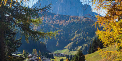
Starting near Erzgebirgskreis, Germany, the Ww Karl Stuelpner Rundweg is a captivating loop trail that spans approximately 10 km (6.2 miles) with an elevation gain of around 200 meters (656 feet). This medium-difficulty trail offers a blend of natural beauty, historical landmarks, and cultural significance, making it a rewarding experience for hikers.
### Getting There To reach the trailhead, you can either drive or use public transport. If you're driving, set your GPS to the nearest known address: Annaberg-Buchholz, Erzgebirgskreis, Germany. For those using public transport, take a train to Annaberg-Buchholz and then a local bus or taxi to the trailhead.
### Trail Highlights
#### Historical Significance The trail is named after Karl Stülpner, a legendary figure in the Erzgebirge region known for his exploits as a poacher and folk hero in the 18th century. As you hike, you'll encounter several landmarks and plaques that provide insights into his life and the local history.
#### Natural Beauty The trail meanders through dense forests, open meadows, and along serene streams. The diverse landscape offers a variety of flora and fauna, making it a haven for nature enthusiasts. Keep an eye out for native wildlife such as deer, foxes, and a variety of bird species.
#### Key Landmarks - Stülpnerhöhle (Stülpner's Cave): Located about 3 km (1.9 miles) into the hike, this cave is said to have been one of Karl Stülpner's hideouts. It's a fascinating spot to explore and offers a glimpse into the life of the legendary figure. - Ruins of Scharfenstein Castle: Approximately 5 km (3.1 miles) into the trail, you'll come across the ruins of this medieval castle. The site offers panoramic views of the surrounding landscape and is a great spot for a rest and some photos. - Observation Tower: Near the 8 km (5 miles) mark, an observation tower provides sweeping views of the Erzgebirge region. It's a perfect place to take a break and soak in the scenery.
### Navigation and Safety The trail is well-marked, but it's always a good idea to have a reliable navigation tool. Use HiiKER to download the trail map and keep track of your progress. The app will also provide real-time updates and alerts, ensuring you stay on the right path.
### What to Bring - Footwear: Sturdy hiking boots are recommended due to the varied terrain. - Clothing: Dress in layers, as the weather can change rapidly in the Erzgebirge region. - Water and Snacks: There are limited facilities along the trail, so bring enough water and snacks to keep you energized. - First Aid Kit: Always carry a basic first aid kit for emergencies.
### Wildlife and Flora The trail offers a rich tapestry of plant life, including beech, oak, and pine trees. In spring and summer, the meadows are adorned with wildflowers, adding a splash of color to your hike. Wildlife is abundant, so keep your camera ready for unexpected encounters.
### Final Tips Start early to make the most of your day and avoid the midday heat. The trail can be muddy after rain, so check the weather forecast and plan accordingly. Enjoy the blend of history, nature, and adventure that the Ww Karl Stuelpner Rundweg has to offer.

Reviews
User comments, reviews and discussions about the Ww Karl Stuelpner Rundweg, Germany.
0.0
average rating out of 5
0 rating(s)