5.6 km
~1 hrs 19 min
128 m
“The Talsperre Cranzahl Loop in Erzgebirgskreis, Germany, offers a scenic, moderately challenging 6 km hike.”
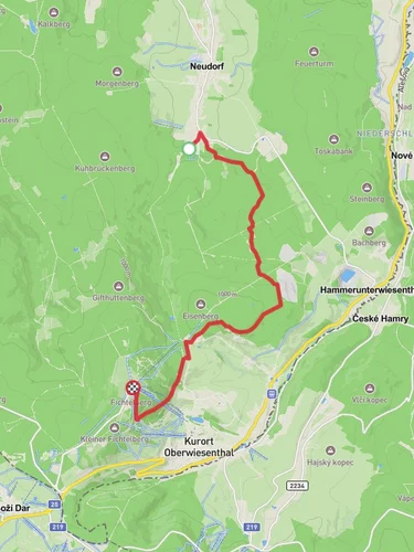
Starting your hike near Erzgebirgskreis, Germany, the Talsperre Cranzahl Loop offers a delightful 6 km (approximately 3.7 miles) journey with an elevation gain of around 100 meters (328 feet). This loop trail is rated as medium difficulty, making it suitable for moderately experienced hikers.
### Getting There To reach the trailhead, you can drive or use public transport. If driving, set your GPS to the nearest known address: Cranzahl Dam, 09465 Sehmatal, Germany. For those using public transport, take a train to the Cranzahl station, which is well-connected from major cities like Dresden. From the station, it's a short walk to the trailhead.
### Trail Overview The trail begins near the Cranzahl Dam, a significant landmark in the Erzgebirge region. The dam itself is an engineering marvel, constructed in the early 20th century to provide water supply and flood protection. As you start your hike, you'll be greeted by the serene waters of the reservoir, reflecting the lush greenery surrounding it.
### Nature and Wildlife As you progress along the trail, you'll traverse through dense forests and open meadows. The area is rich in biodiversity, home to various species of birds, deer, and small mammals. Keep an eye out for the European robin and the Eurasian jay, both commonly spotted in this region. The flora is equally impressive, with a mix of deciduous and coniferous trees, including beech, oak, and spruce.
### Significant Landmarks Around the 2 km (1.2 miles) mark, you'll come across a charming wooden bridge that crosses a small stream. This is a great spot for a short break and some picturesque photos. Continuing on, the trail will take you to a vantage point offering panoramic views of the Erzgebirge mountains. This viewpoint is roughly 4 km (2.5 miles) into the hike and provides a perfect backdrop for a rest and some snacks.
### Historical Significance The Erzgebirge region, also known as the Ore Mountains, has a rich history of mining dating back to the 12th century. The trail itself passes near several old mining sites, remnants of the area's once-thriving silver and tin mining industry. Informational plaques along the route provide insights into the historical significance of these sites, making your hike both a physical and educational experience.
### Navigation and Safety For navigation, it's highly recommended to use the HiiKER app, which provides detailed maps and real-time updates. The trail is well-marked, but having a reliable navigation tool ensures you stay on track. Wear sturdy hiking boots, as some sections can be rocky and uneven. Carry enough water and snacks, especially if you plan to take your time exploring the various points of interest.
### Final Stretch The last leg of the trail loops back towards the Cranzahl Dam, offering a different perspective of the reservoir. As you near the end, you'll pass through a beautiful grove of birch trees, their white bark standing in stark contrast to the surrounding greenery. The trail concludes back at the starting point, where you can take a moment to relax by the water and reflect on your hike.
This loop trail offers a perfect blend of natural beauty, historical intrigue, and moderate physical challenge, making it a rewarding experience for any hiker.
Reviews
User comments, reviews and discussions about the Talsperre Cranzahl Loop, Germany.
4.0
average rating out of 5
2 rating(s)


