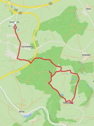
7.9 km
~1 hrs 56 min
213 m
“The Burgrain Loop near Erding blends natural beauty, historical landmarks, and moderate challenge for a rewarding hike.”
Starting near the charming town of Erding, Germany, the Burgrain Loop is an 8 km (approximately 5 miles) trail with an elevation gain of around 200 meters (656 feet). This loop trail offers a medium difficulty rating, making it suitable for moderately experienced hikers.
### Getting There To reach the trailhead, you can either drive or use public transport. If you're driving, set your GPS to Erding, a town well-known for its thermal baths and breweries. There is ample parking available near the trailhead. For those using public transport, take the S-Bahn S2 line to Erding station. From there, it's a short bus ride or a 15-minute walk to the starting point of the trail.
### Trail Overview The Burgrain Loop begins with a gentle ascent through mixed forests, offering a serene start to your hike. The initial 2 km (1.2 miles) will take you through dense woodlands, where you might spot local wildlife such as deer and various bird species. The forest floor is often carpeted with wildflowers in the spring, adding a splash of color to your journey.
### Historical Significance As you continue, you'll come across the remnants of old farmhouses and barns, some dating back to the 18th century. These structures offer a glimpse into the agricultural history of the region. Around the 4 km (2.5 miles) mark, you'll encounter a small chapel, a perfect spot for a short rest and some reflection. This chapel has been a place of local pilgrimage for centuries and adds a spiritual dimension to your hike.
### Scenic Views and Landmarks The trail then opens up to rolling meadows, providing panoramic views of the Bavarian countryside. On a clear day, you can even catch a glimpse of the distant Alps. At approximately 5 km (3.1 miles), you'll reach the highest point of the trail, offering a fantastic vantage point for photography enthusiasts.
### Navigation and Safety The trail is well-marked, but it's always a good idea to have a reliable navigation tool. I recommend using HiiKER for accurate trail maps and real-time updates. The path can be muddy after rain, so waterproof hiking boots are advisable. Also, carry enough water and snacks, as there are no facilities along the trail.
### Flora and Fauna As you descend back towards Erding, the trail meanders through a mix of deciduous and coniferous trees. Keep an eye out for squirrels and the occasional fox. The final stretch of the trail takes you along a small stream, where you can enjoy the soothing sounds of flowing water.
### Final Stretch The last 1 km (0.6 miles) brings you back to the outskirts of Erding, where you can reward yourself with a visit to one of the local breweries or the famous Erding Thermal Spa. This trail offers a perfect blend of natural beauty, historical landmarks, and moderate physical challenge, making it a rewarding experience for any hiker.
Reviews
User comments, reviews and discussions about the Burgrain Loop, Germany.
0.0
average rating out of 5
0 rating(s)


