2.7 km
~33 min
6 m
“The Tunxdorfer Wald Loop is a serene, accessible 3 km trail rich in natural beauty and history.”
Starting near Emsland, Germany, the Tunxdorfer Waldsee and Tunxdorfer Wald Loop is a delightful 3 km (approximately 1.86 miles) trail with no significant elevation gain, making it accessible for most hikers. The trailhead is conveniently located near the Tunxdorfer Waldsee, a serene lake that sets the tone for the rest of your hike.
### Getting There To reach the trailhead, you can drive or use public transport. If driving, set your GPS to Tunxdorfer Waldsee, Emsland, Germany. For those using public transport, the nearest significant landmark is the town of Lingen (Ems), from where you can take a local bus or taxi to the trailhead.
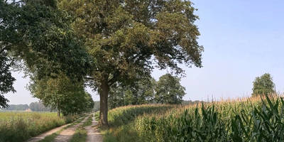
### Trail Overview The loop trail meanders through the lush Tunxdorfer Wald, a forested area rich in biodiversity. The path is well-marked and maintained, making navigation straightforward. For added assurance, consider using the HiiKER app to stay on track.
### Points of Interest - Tunxdorfer Waldsee: Starting at the lake, you’ll be greeted by tranquil waters and the opportunity to spot various waterfowl. This is an excellent spot for a brief rest or a picnic before you embark on the loop. - Flora and Fauna: As you venture deeper into the forest, keep an eye out for native wildlife such as deer, foxes, and a variety of bird species. The forest floor is often carpeted with wildflowers in the spring and summer, adding a splash of color to your hike. - Historical Significance: The Emsland region has a rich history, with remnants of ancient settlements and old forestry practices evident along the trail. Look for informational plaques that provide context about the area's past.
### Trail Conditions The trail is predominantly flat, with an elevation gain of around 0 meters (0 feet), making it suitable for families and casual hikers. However, the path can become muddy after rain, so waterproof footwear is advisable.
### Navigation and Safety While the trail is well-marked, using the HiiKER app can provide additional peace of mind. The app offers detailed maps and real-time navigation to ensure you stay on course. Always carry sufficient water, especially during warmer months, and be mindful of local wildlife.
### Accessibility Given its moderate difficulty rating, the trail is accessible to most hikers, including children and older adults. However, the lack of significant elevation change does not mean it’s entirely without challenges; some sections may have uneven terrain or roots.
### Final Stretch As you near the end of the loop, you’ll return to the Tunxdorfer Waldsee, where you can take a moment to relax by the water. The entire hike should take around 1 to 1.5 hours, depending on your pace and how often you stop to enjoy the scenery.
This trail offers a perfect blend of natural beauty and historical intrigue, making it a rewarding experience for anyone looking to explore the Emsland region.
Reviews
User comments, reviews and discussions about the Tunxdorfer Waldsee and Tunxdorfer Wald Loop, Germany.
5.0
average rating out of 5
2 rating(s)


