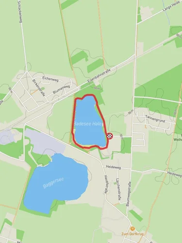
11.1 km
~2 hrs 15 min
33 m
“Explore 11 km of scenic beauty and historical landmarks on this medium-difficulty loop near Cloppenburg, Germany.”
Starting near the Cloppenburg district in Germany, this 11 km (approximately 6.8 miles) loop trail offers a delightful mix of natural beauty and historical significance. With an elevation gain of around 0 meters, it is accessible to a wide range of hikers, though it is rated as medium difficulty due to the varied terrain.
### Getting There To reach the trailhead, you can drive or use public transport. If driving, head towards the Cloppenburg district and look for parking near the Thülsfelder Talsperre. For those using public transport, take a train or bus to Cloppenburg and then a local bus or taxi to the Thülsfelder Talsperre area. The nearest significant landmark is the Thülsfelder Dam, which is well-signposted and easy to find.
### Trail Overview The trail begins near the Thülsfelder Dam, a significant landmark in the region. Constructed in the early 20th century, the dam was built to regulate water levels and prevent flooding. As you start your hike, you'll notice the serene waters of the reservoir, which provide a picturesque backdrop for the initial part of your journey.
### Nature and Wildlife As you continue, the trail meanders through a mix of forested areas and open landscapes. The region is known for its diverse flora and fauna. Keep an eye out for various bird species, including herons and kingfishers, especially near the water bodies. The forested sections are home to deer, foxes, and a variety of smaller mammals. In spring and summer, the trail is adorned with wildflowers, adding a splash of color to your hike.
### Significant Landmarks Around the 5 km (3.1 miles) mark, you'll come across the Soeste River. This river is a tributary of the Hunte and has historical significance as a vital waterway for the region's early settlers. The trail follows the river for a short distance, offering beautiful views and a peaceful ambiance.
### Navigation For navigation, it is recommended to use the HiiKER app, which provides detailed maps and real-time updates. The trail is well-marked, but having a reliable navigation tool can enhance your hiking experience and ensure you stay on track.
### Points of Interest One of the highlights of this trail is the Geestweg section, which showcases the unique geological features of the region. The Geest landscape is characterized by sandy soils and gentle hills, formed during the last Ice Age. This part of the trail offers a stark contrast to the lush greenery of the forested areas, providing a diverse hiking experience.
### Final Stretch As you near the end of the loop, you'll return to the vicinity of the Thülsfelder Dam. This is a great spot to take a break, enjoy a picnic, or simply relax by the water. The dam area also has informational plaques detailing the history and engineering of the structure, adding an educational element to your hike.
This trail offers a rich blend of natural beauty, wildlife, and historical significance, making it a rewarding experience for any hiker.
Reviews
User comments, reviews and discussions about the Thülsfelder Talsperre and Soeste via Geestweg, Germany.
5.0
average rating out of 5
6 rating(s)


