5.6 km
~1 hrs 21 min
143 m
“Explore a scenic 6 km loop near Böblingen, blending natural beauty, wildlife, and historical charm.”
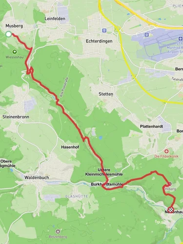
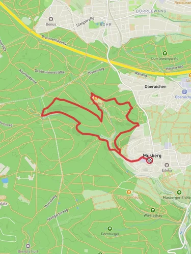
Starting near Böblingen, Germany, the Hochwasserrückhaltebecken Sulzbach via Auf der Höhe trail is a delightful 6 km (approximately 3.7 miles) loop with an elevation gain of around 100 meters (328 feet). This medium-difficulty trail offers a mix of natural beauty and historical significance, making it a rewarding hike for those looking to explore the region.
### Getting There To reach the trailhead, you can either drive or use public transport. If driving, head towards Böblingen and look for parking near the Hochwasserrückhaltebecken Sulzbach. For those using public transport, take a train to Böblingen station. From there, local buses can take you closer to the trailhead, or you can opt for a short taxi ride.
### Trail Overview The trail begins near the Hochwasserrückhaltebecken Sulzbach, a flood retention basin that plays a crucial role in managing water levels in the area. As you start your hike, you'll notice the well-marked paths that guide you through a mix of forested areas and open landscapes.
### Key Landmarks and Points of Interest - Hochwasserrückhaltebecken Sulzbach: This flood retention basin is not only functional but also a serene spot to start your hike. The area around the basin is often teeming with birdlife, making it a great place for birdwatching. - Auf der Höhe: As you ascend to this high point, you'll gain approximately 100 meters (328 feet) in elevation. The climb is gradual, making it manageable for most hikers. From the top, you'll be rewarded with panoramic views of the surrounding countryside. - Forested Sections: The trail meanders through dense forests, offering shade and a cool respite, especially during the warmer months. Keep an eye out for local wildlife such as deer and various bird species. - Open Meadows: Interspersed between the forested sections are open meadows that provide a different kind of beauty. These areas are often filled with wildflowers in the spring and summer, adding a splash of color to your hike.
### Historical Significance The region around Böblingen has a rich history dating back to Roman times. While the trail itself is primarily a natural experience, the surrounding area is dotted with historical landmarks. Böblingen itself was first mentioned in historical records in the 12th century and has a history of being a significant settlement in the region.
### Navigation and Safety For navigation, it's recommended to use HiiKER, which provides detailed maps and real-time updates. The trail is generally well-marked, but having a reliable navigation tool can enhance your hiking experience and ensure you stay on track.
### Flora and Fauna The trail offers a diverse range of flora and fauna. In the forested sections, you'll find a variety of trees including oak, beech, and pine. The open meadows are home to numerous wildflowers and grasses. Wildlife enthusiasts might spot deer, foxes, and a variety of bird species, making it a great trail for nature lovers.
### Final Stretch As you loop back towards the starting point, the trail descends gently, offering a relaxing end to your hike. The final stretch takes you back to the Hochwasserrückhaltebecken Sulzbach, where you can take a moment to relax and enjoy the peaceful surroundings before heading back.
This 6 km loop trail near Böblingen offers a perfect blend of natural beauty, moderate physical challenge, and a touch of historical context, making it a must-visit for hikers in the region.

Reviews
User comments, reviews and discussions about the Hochwasserrückhaltebecken Sulzbach via Auf der Höhe, Germany.
5.0
average rating out of 5
3 rating(s)