12.0 km
~3 hrs 2 min
379 m
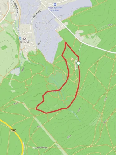
“Explore the Langweiler and Steinbachtalsperre Loop: a 12 km hike through forests, villages, and scenic reservoirs.”
Starting near the charming town of Birkenfeld, Germany, the Langweiler and Steinbachtalsperre Loop is a captivating 12 km (7.5 miles) trail with an elevation gain of approximately 300 meters (984 feet). This loop trail offers a medium difficulty rating, making it suitable for moderately experienced hikers.
### Getting There To reach the trailhead, you can drive to Birkenfeld, which is well-connected by road. If you prefer public transport, take a train to the Birkenfeld station and then a local bus or taxi to the trailhead. The nearest significant landmark to the trailhead is the Birkenfeld town center, which is a convenient starting point.
### Trail Overview The trail begins with a gentle ascent through lush forests, providing a serene atmosphere as you make your way deeper into nature. The first 3 km (1.9 miles) of the trail will take you through dense woodland, where you might spot local wildlife such as deer, foxes, and a variety of bird species. The forest floor is often carpeted with wildflowers in the spring and summer, adding a splash of color to your hike.
### Langweiler Village Around the 4 km (2.5 miles) mark, you will reach the quaint village of Langweiler. This village is a perfect spot to take a short break and explore its traditional German architecture. Langweiler has a few historical buildings that date back several centuries, offering a glimpse into the region's past.
### Steinbachtalsperre Reservoir Continuing on, the trail leads you to the Steinbachtalsperre Reservoir at approximately 6 km (3.7 miles). This reservoir is a significant landmark, providing water to the surrounding areas. The reservoir area is particularly scenic, with clear waters reflecting the surrounding hills and forests. It's an ideal spot for a picnic or a moment of reflection. The elevation gain here is gradual, making it a comfortable section of the hike.
### Wildlife and Flora As you loop around the reservoir and head back towards Birkenfeld, the trail takes you through a mix of open meadows and forested areas. This section, spanning roughly 4 km (2.5 miles), is rich in biodiversity. Keep an eye out for various species of butterflies and bees, especially in the summer months. The meadows are often filled with wildflowers, creating a vibrant and picturesque landscape.
### Final Stretch The final 2 km (1.2 miles) of the trail bring you back through the forest towards Birkenfeld. This section includes a few steeper inclines, adding a bit of challenge before you complete the loop. The forest here is dense, providing ample shade and a cool environment, which is particularly refreshing during warmer months.
### Navigation and Safety For navigation, it's highly recommended to use the HiiKER app, which provides detailed maps and real-time updates. The trail is well-marked, but having a reliable navigation tool can enhance your hiking experience and ensure you stay on track.
### Historical Significance The region around Birkenfeld has a rich history, with evidence of settlements dating back to the Roman era. The trail itself passes through areas that have been inhabited for centuries, and you may come across old stone walls and remnants of past agricultural practices.
This loop trail offers a perfect blend of natural beauty, wildlife, and historical intrigue, making it a rewarding hike for those looking to explore the scenic landscapes of Germany.
Reviews
User comments, reviews and discussions about the Langweiler and Steinbachtalsperre Loop, Germany.
5.0
average rating out of 5
5 rating(s)


