Download
3D Flyover
Add to list
More
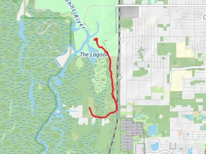
112.4 km
~4 days
270 m
Multi-Day
“Embark on a vibrant trek through the Ocala National Forest, brimming with wildlife, historical touchstones, and natural springs.”
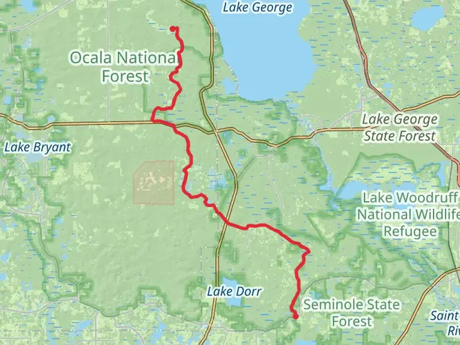
Spanning approximately 70 miles (112 kilometers) with an elevation gain of around 656 feet (200 meters), the Florida National Scenic Trail - Ocala section offers a unique hiking experience through the diverse ecosystems of Central Florida. This point-to-point trail begins near Lake County, Florida, and winds through the expansive Ocala National Forest, showcasing the region's natural beauty and wildlife.
Getting to the Trailhead
The starting point of the trail can be accessed by car, with the nearest significant landmark being the Clearwater Lake Recreation Area, just off Highway 42. For those relying on public transportation, options are limited due to the remote nature of the trailhead. However, hikers can reach nearby towns such as Eustis or Altoona by bus and then take a taxi or rideshare service to the trailhead.
Navigating the Trail
Hikers can utilize the HiiKER app for detailed maps and navigation assistance throughout their journey. The trail is well-marked with orange blazes, but having a digital tool can be invaluable for staying on track and locating nearby amenities.
Trail Highlights and Landmarks
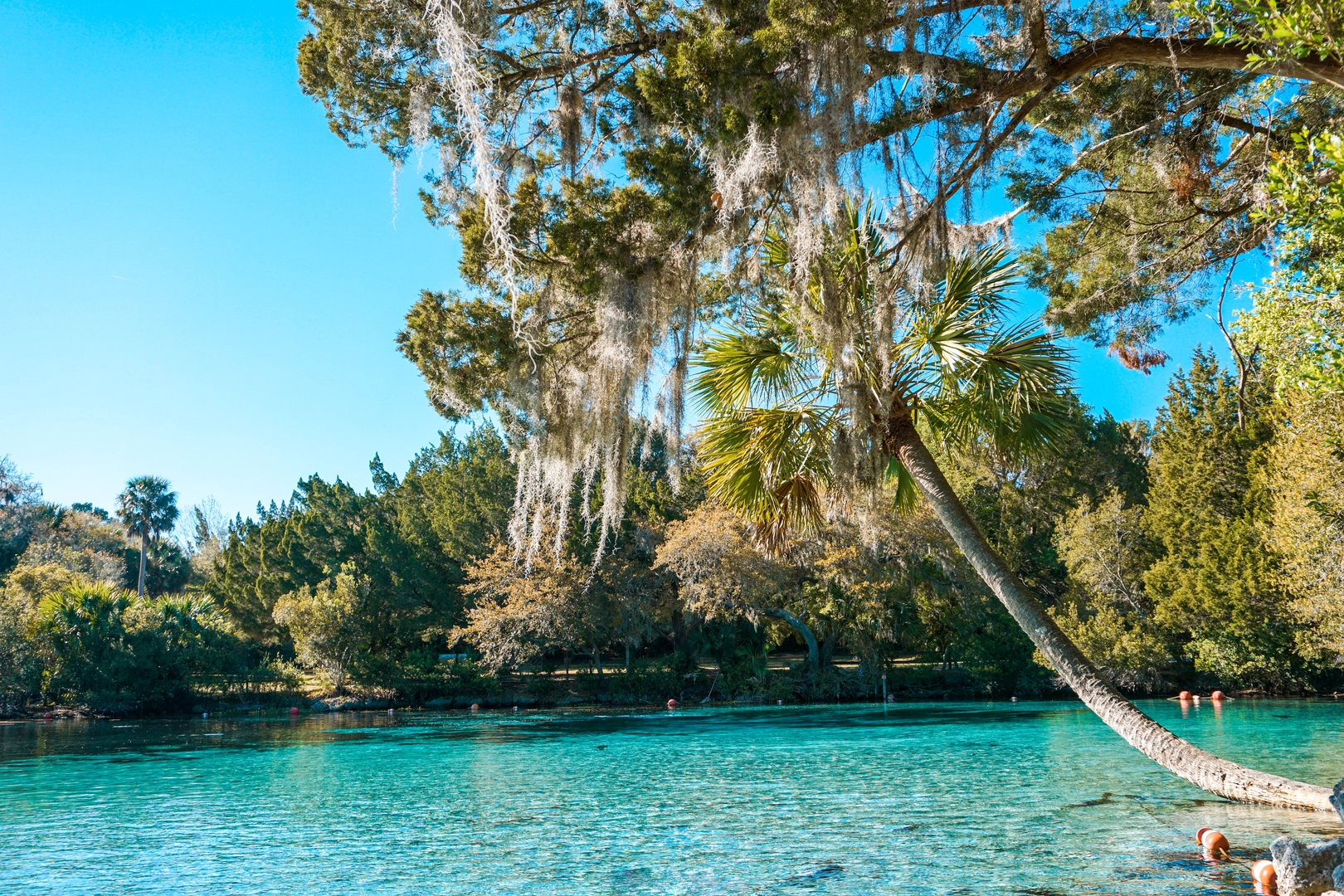
As you embark on the trail, you'll traverse pine flatwoods, scrubby flatwoods, and hardwood forests. The trail crosses several forest roads, which can serve as access points or exit points if needed. Approximately 10 miles (16 kilometers) in, hikers will encounter the Juniper Springs Recreation Area, a perfect spot for a rest or a swim in the refreshing springs.
Continuing on, the trail meanders through the Juniper Prairie Wilderness, an area known for its diverse wildlife, including the Florida black bear, white-tailed deer, and numerous bird species. The wilderness area is also home to the historic Yearling Trail, which highlights sites from the classic novel "The Yearling" by Marjorie Kinnan Rawlings.
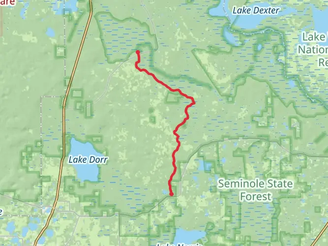
Around the halfway mark, near the 35-mile (56-kilometer) point, the trail skirts the edges of Alexander Springs, another crystalline water source ideal for cooling off. The trail's gentle elevation changes become more pronounced as it approaches the Paisley Woods Bicycle Trail, offering a change of pace and scenery.
Flora and Fauna
Throughout the hike, you'll be surrounded by a tapestry of flora, including longleaf pines, saw palmettos, and a variety of wildflowers, especially during the spring bloom. The trail's ecosystem is a haven for birdwatchers, with opportunities to spot red-cockaded woodpeckers, bald eagles, and ospreys.
Historical Significance
The Ocala section of the Florida National Scenic Trail traverses land rich in history. The Ocala National Forest itself was established in 1908 and is the second oldest national forest in the U.S. East of the Mississippi River. The region has been shaped by various cultural influences, from the indigenous peoples who first inhabited the land to the settlers who later developed the area.
Preparation and Planning
Before setting out, hikers should be prepared for the subtropical climate, which can be hot and humid with the potential for sudden rain showers. It's essential to pack plenty of water, as sources along the trail may not always be reliable or potable. Additionally, consider the time of year, as hunting seasons can affect trail accessibility.
For those planning to complete the trail in sections or as a multi-day hike, there are designated campsites along the route, some of which require permits. It's advisable to plan your stops in advance and be aware of the regulations in each camping area.
Safety and Etiquette
As with any trail, it's crucial to practice Leave No Trace principles to preserve the environment for future hikers. Be mindful of wildlife, keeping a safe distance and not feeding animals. Lastly, always let someone know your itinerary and expected return time when embarking on a long-distance hike like the Florida National Scenic Trail - Ocala section.

What to expect?
Activity types
Comments and Reviews
User comments, reviews and discussions about the Florida National Scenic Trail - Ocala, Florida.
4.77
average rating out of 5
22 rating(s)