242.3 km
~11 day
5159 m
“Embark on the Reiver's Way, a 150-mile journey through Northumberland's historic landscapes and breathtaking natural beauty.”
Embarking on the Reiver's Way, hikers will traverse approximately 150 miles (242 kilometers) of diverse landscapes, with an elevation gain of roughly 16,732 feet (5100 meters). The journey begins near the historical village of Corbridge in Northumberland, England, which is accessible by public transport with regular bus services from Newcastle upon Tyne, as well as by car with parking available in the village.
As you set out from the trailhead, you'll be walking through a region steeped in history, once the stage for the Border Reivers—lawless clans of the Anglo-Scottish borderlands during the 14th to 17th centuries. Their stories are etched into the very fabric of the countryside, with ancient pele towers and bastle houses dotting the landscape.
Navigating the Trail
The Reiver's Way meanders through the rugged terrain of the Northumberland National Park, offering panoramic views of the Cheviot Hills. Hikers can rely on the HiiKER app for up-to-date navigation and trail information, ensuring they stay on the right path while enjoying the scenic vistas.
Landmarks and Natural Beauty
The trail takes you past the iconic Hadrian's Wall, a UNESCO World Heritage site, where you can explore Roman history and the remnants of forts and milecastles. Approximately 30 miles (48 kilometers) into the hike, you'll reach the wall, which is also the highest point of the trail with an elevation gain of about 345 feet (105 meters) over a short distance.
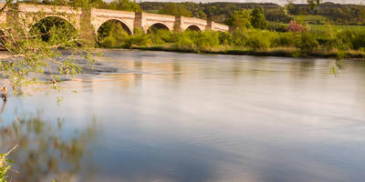
Continuing through the heart of the Northumberland countryside, the path winds along riverbanks, through woodlands, and across open moorland. The route crosses the River Tyne multiple times, offering a chance to see a variety of wildlife, including otters and kingfishers.
Flora and Fauna
The diverse habitats along the Reiver's Way support an array of wildlife. In the woodlands, keep an eye out for red squirrels, while the open moorlands are home to ground-nesting birds such as the curlew and lapwing. Heather blooms create a purple spectacle in late summer, and the ancient woodlands are rich with oak, birch, and pine.
Historical Significance
The trail's passage through the town of Rothbury, roughly 70 miles (113 kilometers) in, allows hikers to delve deeper into the region's history. Here, the influence of the Reivers is still present in the architecture and local folklore. The town also provides an opportunity for rest and resupply before continuing on the journey.
End of the Trail
The Reiver's Way concludes at the coastal village of Alnmouth, where the River Aln meets the North Sea. This picturesque village offers a sense of completion and reflection, with its beautiful beaches and the opportunity to explore the coastal castle ruins nearby.
Preparation and Planning
Hikers should be prepared for changeable weather, as the Northumberland region can experience all four seasons in a single day. Waterproof gear and layers are essential. It's also important to plan for resupply points along the way, as some stretches of the trail are remote with limited facilities.
For those looking to complete the trail in sections, there are various accommodation options along the route, including campsites, B&Bs, and hostels. It's advisable to book these in advance, especially during the peak summer months.
Access to the Trailhead
To reach the starting point near Corbridge, travelers can take a train to Corbridge Station from major cities like Newcastle upon Tyne, which is well-connected to the rest of the UK. From the station, the trailhead is just a short walk away. For those driving, Corbridge is accessible via the A69, with parking available in the village.

Reviews
User comments, reviews and discussions about the Reiver's Way, England.
4.0
average rating out of 5
2 rating(s)