Download
3D Preview
Add to list
More
161.1 km
~7 days
4657 m
Multi-Day
“Embark on the Cotswold Way for historical discovery and natural splendor across England's rolling hills.”
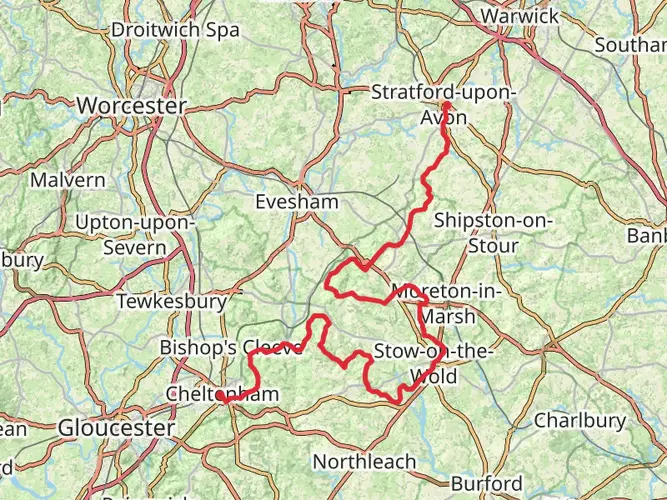
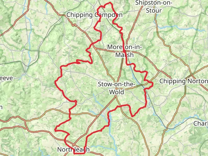
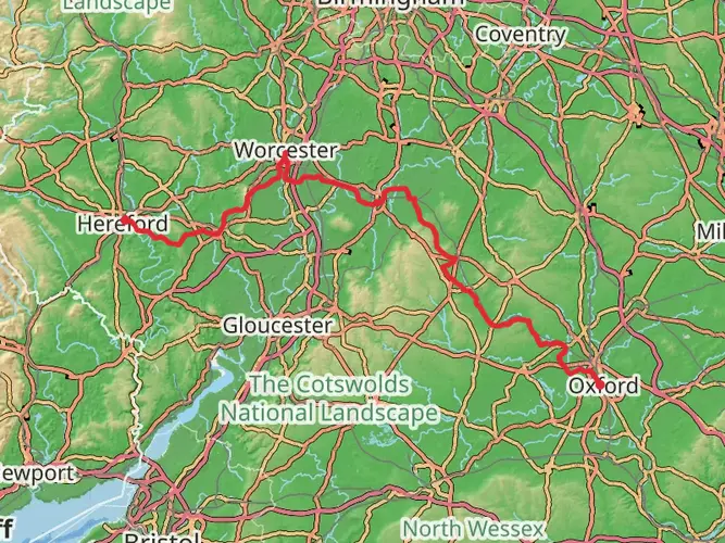
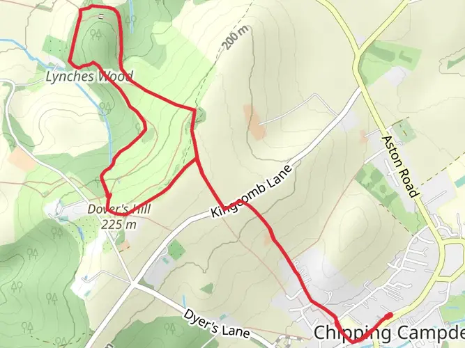
The Cotswold Way offers an immersive journey through the quintessentially English countryside, spanning approximately 161 kilometers (100 miles) with an elevation gain of around 3200 meters (10,500 feet). This point-to-point trail begins near the market town of Chipping Campden in Gloucestershire and winds its way south to the historic city of Bath.
Getting to the Trailhead
To reach the northern trailhead in Chipping Campden, hikers can use public transport by catching a train to Moreton-in-Marsh station, followed by a short bus ride to Chipping Campden. If driving, the start of the trail is accessible via the B4035, with parking available in the town.
Navigating the Trail
The Cotswold Way is well-marked with the National Trail acorn symbols, making navigation straightforward. For additional support, hikers can use the HiiKER app to access detailed maps and GPS tracking to ensure they stay on the right path.
Historical Significance and Landmarks
As you traverse the Cotswold Way, you'll be walking through history. The trail passes numerous historical sites, including the ancient Neolithic burial chamber at Belas Knap, Sudeley Castle near Winchcombe, and the Roman heritage in Bath. The Cotswolds region itself is famed for its centuries-old limestone villages and rolling hills, which have been designated as an Area of Outstanding Natural Beauty.
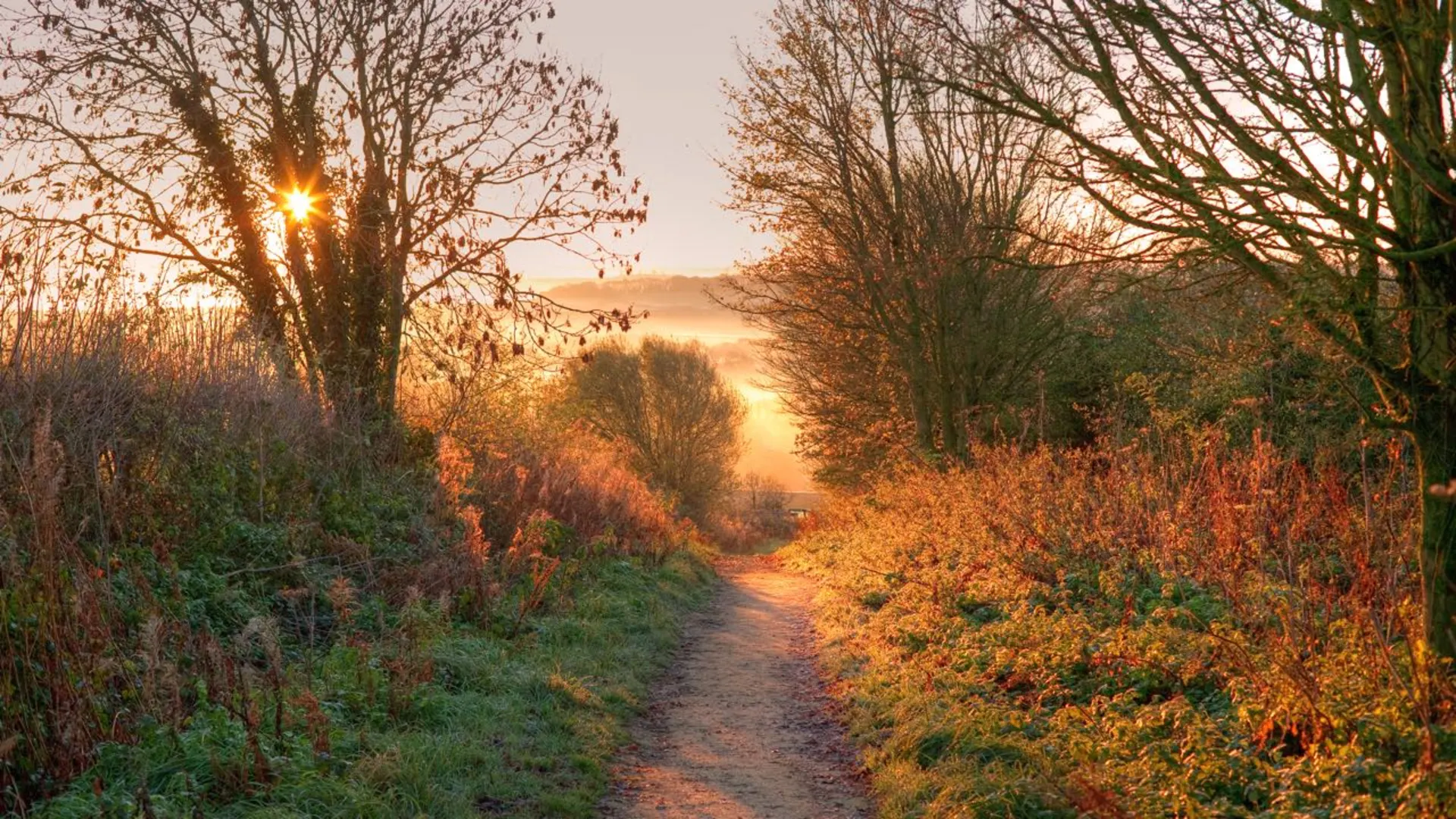
Natural Beauty and Wildlife
The trail offers a diverse range of landscapes, from open grassland to beech woodlands and wildflower meadows. Wildlife enthusiasts may spot a variety of birds, such as skylarks and buzzards, as well as deer and badgers. The spring and summer months are particularly vibrant with wildflowers, including the rare pasqueflower near Haresfield Beacon.
Challenges and Terrain
The Cotswold Way is considered to have a medium difficulty rating. Hikers should be prepared for a mix of terrains, including steep inclines, woodland paths, and stony tracks. The highest point is Cleeve Hill, near Cheltenham, which stands at 330 meters (1,083 feet) and offers panoramic views of the surrounding countryside.
Accommodation and Resupply Points
There are plenty of options for accommodation along the route, ranging from camping sites to bed and breakfasts. Resupply points are available in the towns and villages along the way, such as Broadway, Winchcombe, and Wotton-under-Edge, where hikers can stock up on provisions and enjoy local hospitality.
Weather and Preparation
The English weather can be unpredictable, so it's essential to be prepared for all conditions. Waterproof gear and layers are recommended, as well as sturdy hiking boots. The trail can be hiked year-round, but the most popular times are from spring to autumn when the weather is milder.
Conclusion
The Cotswold Way is a trail that offers not just a physical challenge but also a rich tapestry of English heritage, stunning landscapes, and diverse wildlife. With proper preparation and an appreciation for the natural and historical significance of the region, hikers will find this trail to be a rewarding experience.

What to expect?
Activity types
Frequently asked questions
How long does it take to walk the Cotswold Way from Chipping Campden to Bath?
The Cotswold Way is 161.1 km long, so most walkers split it into about 7 to 10 days. That pace fits the route’s medium difficulty and 4,657 m of total ascent, with common overnight stops in places such as Winchcombe, Painswick, Dursley, Wotton-under-Edge, and Cold Ashton before finishing in Bath.
Where does the Cotswold Way start and finish?
The Cotswold Way is a point-to-point National Trail that starts in Chipping Campden in Gloucestershire and finishes in Bath. Walking north to south follows the classic direction along the Cotswold escarpment, ending at the Roman city of Bath after passing landmarks including Belas Knap, Sudeley Castle, and Hailes Abbey.
Is the Cotswold Way well marked and easy to follow?
The Cotswold Way is generally straightforward to follow because it is waymarked as a National Trail with the acorn symbol. It is still a 161.1 km multi-day route with frequent field paths, woodland sections, and road crossings, so navigation is easier with a detailed map or offline route guidance, especially in poor visibility or after rain.
Can dogs go on the Cotswold Way?
Dogs can go on much of the Cotswold Way, but they need close control because the route crosses farmland, livestock areas, and wildlife-rich sections of the Cotswolds National Landscape. Some places to stay along the trail, including some campsites and guesthouses, do not accept pets, so dog-friendly lodging needs to be checked stage by stage.
Can you wild camp on the Cotswold Way?
Wild camping is generally not permitted on the Cotswold Way in England without the landowner’s permission. Walkers who want to camp usually need to use official campsites or other booked accommodation along the route, particularly on stages around places such as Dursley, Wotton-under-Edge, and the approaches to Bath.
What is the best time of year to walk the Cotswold Way?
Spring and autumn are often the best seasons for the Cotswold Way because the escarpment views are usually clearer and temperatures are better suited to long daily mileage. Summer brings longer daylight for a 161.1 km walk, while winter can be rewarding on crisp clear days but often means muddier paths, shorter days, and more demanding footing on the climbs.
How much road walking is there on the Cotswold Way?
The Cotswold Way is mostly off-road. National Trails notes that only about 8% of the route is on roads, and much of that is on quieter roads, so the trail is far more about field paths, woodland tracks, commons, and escarpment walking than sustained pavement miles.
Comments and Reviews
User comments, reviews and discussions about the Cotswold Way, England.
4.82
average rating out of 5
109 rating(s)