Download
3D Flyover
Add to list
More
25.1 km
~5 hrs 39 min
380 m
Multi-Day
“Embark on the Menunkatuck Trail for a historic hike through Connecticut's diverse landscapes and breathtaking ridgeline vistas.”
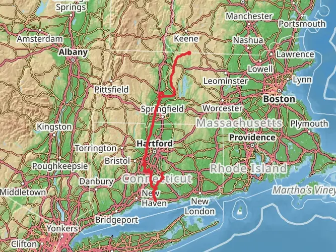
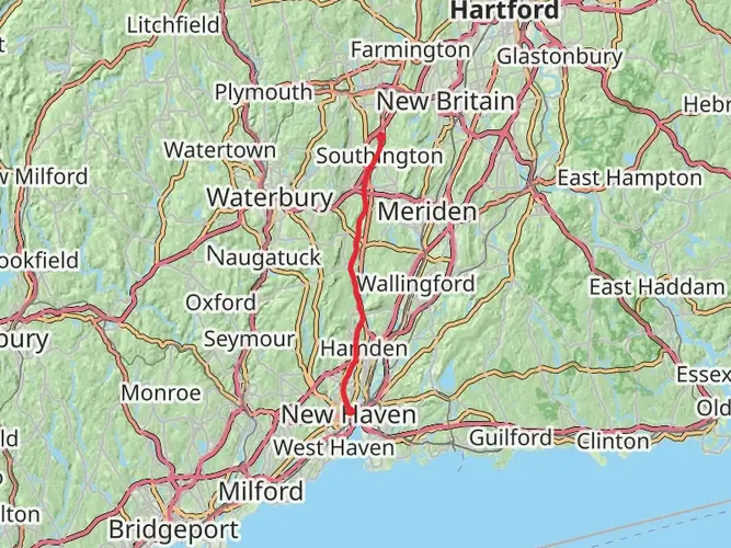
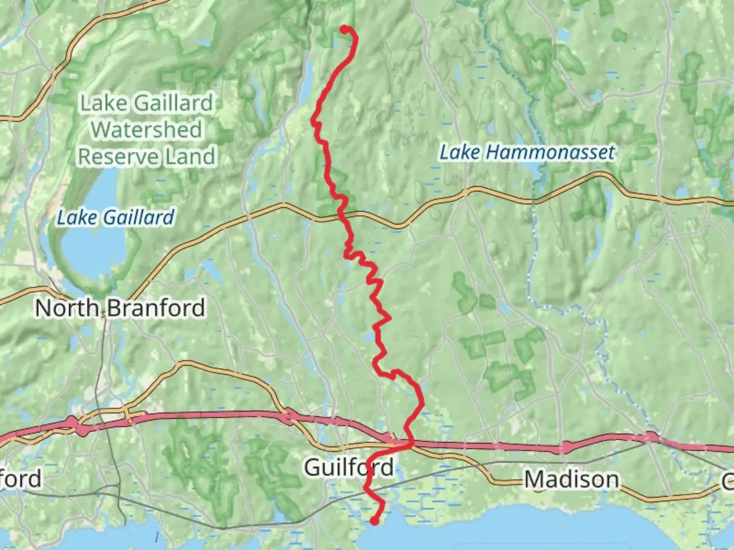
The Menunkatuck Trail, spanning approximately 25 kilometers (about 15.5 miles) with an elevation gain of around 300 meters (roughly 984 feet), offers a medium-difficulty hiking experience through the scenic landscapes near New Haven County, Connecticut. This point-to-point trail is part of the larger New England Trail system and provides a diverse journey through coastal forests, wetlands, and ridgelines with sweeping views.
Getting to the Trailhead
To reach the trailhead, hikers can drive to the area near New Haven County, where parking is available. For those preferring public transport, local bus services can be used to get closer to the starting point, followed by a short walk or taxi ride to the trailhead itself. It's advisable to use the HiiKER app to navigate to the exact starting location and to track progress along the trail.
Trail Experience
As you embark on the Menunkatuck Trail, you'll traverse through a variety of ecosystems. The early sections of the trail meander through dense woodlands, where the canopy provides a cool, shaded environment. The path is well-marked, but it's always wise to have a navigation tool like HiiKER on hand to ensure you stay on course.
Historical Significance
The region is steeped in history, with the trail itself taking its name from the Menunkatuck people who once inhabited the area. As you hike, you may come across stone walls and old foundations, remnants of Connecticut's colonial past and agricultural heritage.
Flora and Fauna
The trail offers a chance to observe the rich biodiversity of Connecticut. Keep an eye out for various bird species, especially during migration seasons. The forests are home to oak, maple, and birch trees, and in the spring and summer, the trail is lined with wildflowers. Be mindful of wildlife, and remember to respect their habitat by keeping a safe distance and not feeding any animals you encounter.
Landmarks and Views
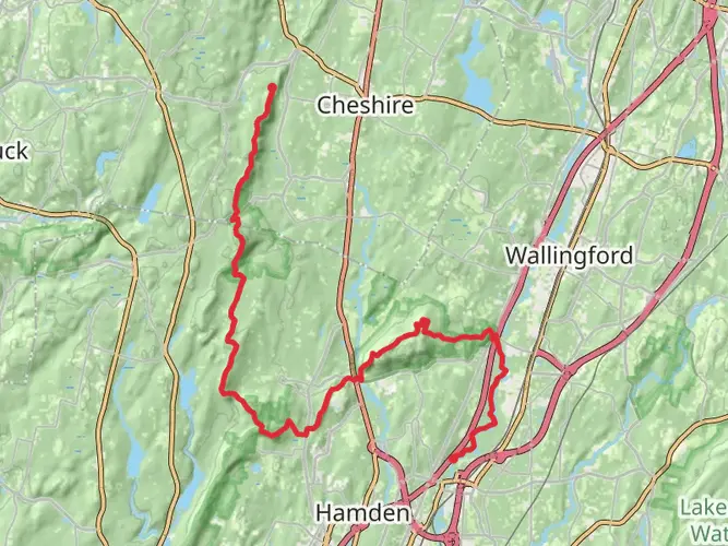
One of the highlights of the Menunkatuck Trail is the panoramic views from the ridgelines. Approximately halfway through the hike, you'll reach an elevation where you can see the Long Island Sound and the surrounding countryside. This is a perfect spot to take a break and enjoy the scenery.
Trail Conditions and Preparation
The trail's terrain includes rocky sections, gradual ascents, and some steep climbs, which contribute to its medium difficulty rating. It's essential to wear sturdy hiking boots and bring trekking poles for additional support. Weather can be variable, so pack layers and be prepared for changes in temperature and conditions.
Safety and Etiquette
Always carry enough water and snacks for the journey, and consider the Leave No Trace principles to minimize your impact on the environment. It's also a good idea to inform someone of your hiking plans and expected return time.
By following these guidelines and being prepared, hikers can enjoy a rewarding experience on the Menunkatuck Trail, taking in the natural beauty and historical significance of this Connecticut pathway.

Frequently asked questions
How long is the Menunkatuck Trail in Connecticut and how hard is it to hike?
The Menunkatuck Trail is about 25.14 kilometers, or roughly 15.6 miles, with around 380 meters of elevation gain. It is generally rated medium difficulty, so it is better suited to hikers comfortable with a full-day point-to-point walk or a shorter multi-day outing rather than a casual stroll.
Where does the Menunkatuck Trail go and what are the main landmarks along it?
The Menunkatuck Trail is the southernmost section of the New England Trail in Connecticut. It connects the Mattabessett Trail to Long Island Sound in Guilford, crossing land owned by the South Central Connecticut Regional Water Authority, town preserves, and Guilford Land Conservation Trust properties before reaching the shoreline at Chittenden Park.
Is the Menunkatuck Trail part of the New England Trail?
Yes. The Menunkatuck Trail is one of the Connecticut sections of the New England National Scenic Trail and is blazed as part of the Connecticut Forest and Park Association’s Blue-Blazed Hiking Trail system. In Connecticut, the New England Trail includes the historic Mattabesett, Metacomet, and Menunkatuck sections.
Can the Menunkatuck Trail be hiked as a day hike or is it better as a multi-day route?
At roughly 25 kilometers with moderate climbing, the Menunkatuck Trail can be completed in a long day by strong hikers, but many people break it into shorter sections. Because it is a point-to-point route rather than a loop, planning a car shuttle or pickup is often the deciding factor in whether it feels like a day hike or a multi-day trip.
What kind of terrain and scenery should hikers expect on the Menunkatuck Trail?
The Menunkatuck Trail passes through a mix of wooded sections, wetlands, conservation land, and road-linked segments before finishing near the coast. The route is known for linking inland forest and preserve land with the shoreline at Chittenden Park, so the scenery changes noticeably over the course of the hike rather than staying in one type of landscape.
Are there any recent route changes on the Menunkatuck Trail?
Yes. In November 2024, a section of the Menunkatuck Trail in Guilford was relocated off Hart Road onto adjoining state land. That means older directions, printed descriptions, or saved tracks may not match the current on-the-ground route in that area, so current navigation is important.
Comments and Reviews
User comments, reviews and discussions about the Menunkatuck Trail, Connecticut.
4.51
average rating out of 5
1686 rating(s)