Download
Preview
Add to list
More
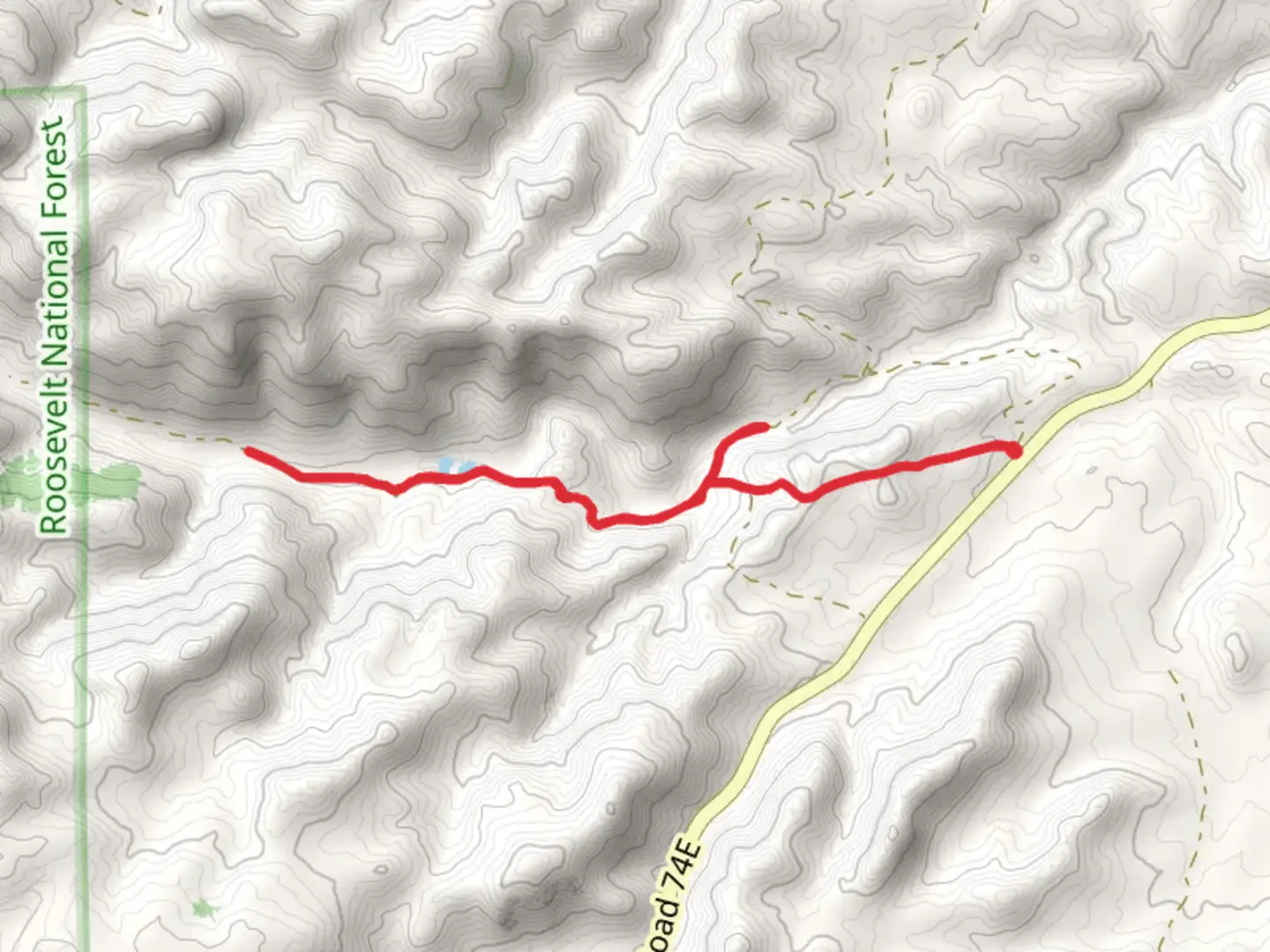
8.8 km
~2 hrs 17 min
318 m
Loop
“The Lone Pine Creek Walk, a 9-kilometer loop, combines scenic beauty, historical landmarks, and diverse wildlife.”
Starting near Larimer County, Colorado, the Lone Pine Creek Walk is a scenic loop trail that spans approximately 9 kilometers (about 5.6 miles) with an elevation gain of around 300 meters (approximately 984 feet). This medium-difficulty trail offers a blend of natural beauty, historical significance, and diverse wildlife, making it a rewarding experience for hikers of various skill levels.### Getting ThereTo reach the trailhead, you can drive or use public transport. If driving, head towards the nearest known address, which is the intersection of County Road 38E and South Centennial Drive. From there, follow the signs to the trailhead parking area. For those using public transport, the nearest bus stop is at the Harmony Transfer Center in Fort Collins. From there, you can take a taxi or rideshare service to the trailhead.### Trail OverviewThe trail begins with a gentle ascent through a mixed forest of ponderosa pines and Douglas firs. As you progress, you'll encounter Lone Pine Creek, which runs parallel to the trail for the first 2 kilometers (about 1.2 miles). This section is relatively flat, making it an excellent warm-up for the more challenging parts ahead.### Significant Landmarks#### Lone Pine CreekAt around the 2-kilometer (1.2-mile) mark, you'll come across a picturesque wooden bridge that crosses Lone Pine Creek. This is a great spot for a short break and some photos. The creek is home to various species of fish and is a popular spot for birdwatching.#### Historical CabinApproximately 4 kilometers (2.5 miles) into the hike, you'll find the remnants of an old cabin. This cabin dates back to the early 1900s and was once used by settlers in the area. It's a fascinating glimpse into the region's history and offers a unique photo opportunity.### Flora and FaunaThe trail is rich in biodiversity. In the spring and summer months, you'll see a variety of wildflowers, including columbines and Indian paintbrushes. The forested areas are home to deer, elk, and occasionally black bears, so it's essential to stay alert and make noise to avoid surprising any wildlife.### Elevation GainThe most challenging part of the hike begins around the 5-kilometer (3.1-mile) mark, where the trail starts to ascend more steeply. Over the next 2 kilometers (1.2 miles), you'll gain approximately 200 meters (656 feet) in elevation. This section offers stunning views of the surrounding mountains and valleys, making the effort well worth it.### NavigationGiven the trail's loop nature, it's relatively easy to navigate. However, it's always a good idea to have a reliable navigation tool. HiiKER is an excellent app for this purpose, providing detailed maps and real-time location tracking to ensure you stay on course.### Final StretchThe last 2 kilometers (1.2 miles) of the trail are a gentle descent back to the trailhead. This section takes you through a meadow that is particularly beautiful in the late afternoon when the sun casts a golden hue over the landscape.### Practical Tips- Water: Ensure you carry enough water, especially during the summer months. - Footwear: Sturdy hiking boots are recommended due to the uneven terrain. - Weather: Check the weather forecast before you go, as conditions can change rapidly in the mountains. - Wildlife: Be aware of your surroundings and follow Leave No Trace principles to minimize your impact on the environment.The Lone Pine Creek Walk offers a perfect blend of natural beauty, historical intrigue, and moderate physical challenge, making it a must-visit for any hiking enthusiast.

What to expect?
Activity types
Comments and Reviews
User comments, reviews and discussions about the Lone Pine Creek Walk, Colorado.
4.43
average rating out of 5
7 rating(s)