Download
Preview
Add to list
More
12.3 km
~3 hrs 52 min
853 m
Out and Back
“Embark on the Cimarrona Trail for a medium-difficulty hike offering stunning views and rich history.”
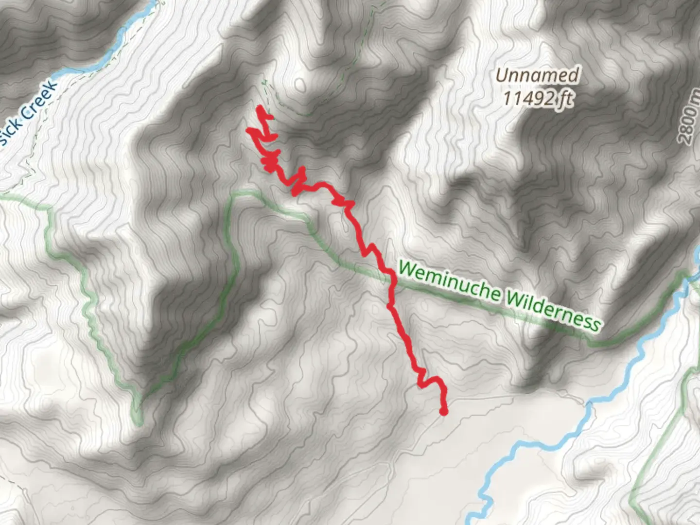
Starting near Hinsdale County, Colorado, the Cimarrona Trail - Short is an invigorating out-and-back hike that spans approximately 12 kilometers (7.5 miles) with an elevation gain of around 800 meters (2,625 feet). This trail is rated as medium difficulty, making it suitable for moderately experienced hikers looking for a rewarding challenge.### Getting There To reach the trailhead, you can drive to the area near Williams Creek Reservoir, which is the closest significant landmark. If you're using public transport, the nearest major town is Pagosa Springs, Colorado. From Pagosa Springs, you can take a local shuttle or taxi service to the Williams Creek Reservoir area. Ensure you have a reliable navigation tool like HiiKER to guide you to the exact starting point.### Trail Overview The trail begins with a gradual ascent through a dense forest of aspen and pine trees. Early on, you'll encounter a series of switchbacks that help you gain elevation steadily. After about 2 kilometers (1.2 miles), the forest opens up to offer stunning views of the surrounding San Juan Mountains. This is a great spot to take a short break and hydrate.### Key Landmarks and Points of Interest As you continue, you'll come across a small creek at around the 4-kilometer (2.5-mile) mark. This is a good place to refill your water bottles if you have a filtration system. The trail then becomes steeper, and you'll notice the vegetation changing as you gain altitude. Keep an eye out for wildlife; deer and elk are commonly seen in this area, and if you're lucky, you might spot a black bear or a mountain lion from a safe distance.### Historical Significance The region around the Cimarrona Trail has a rich history. The Ute Native American tribe originally inhabited this area, and you might find remnants of their presence in the form of ancient tools or pottery shards. The trail itself was used by early settlers and miners in the late 19th century, adding a layer of historical intrigue to your hike.### Final Ascent and Views The final 2 kilometers (1.2 miles) of the trail are the most challenging, with a steep ascent that will test your endurance. However, the effort is well worth it. As you reach the highest point of the trail, you'll be rewarded with panoramic views of the Piedra River Valley and the distant peaks of the San Juan Mountains. This is an excellent spot for photography and a well-deserved rest.### Return Journey The return journey follows the same path, allowing you to enjoy the scenery from a different perspective. Be cautious on the descent, as the steep sections can be tricky. Make sure to leave no trace and pack out all your trash to preserve the natural beauty of the area.### Preparation Tips Given the elevation gain and the medium difficulty rating, it's essential to be well-prepared. Wear sturdy hiking boots, bring plenty of water, and pack layers as the weather can change rapidly at higher elevations. A reliable navigation tool like HiiKER is crucial for staying on track, especially in the more remote sections of the trail.By following these guidelines, you'll be well-prepared to tackle the Cimarrona Trail - Short and enjoy all the natural beauty and historical richness it has to offer.

What to expect?
Activity types
Comments and Reviews
User comments, reviews and discussions about the Cimarrona Trail - Short, Colorado.
4.43
average rating out of 5
7 rating(s)