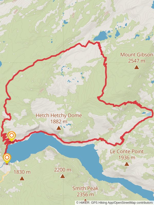
37.8 km
~2 day
1551 m
“Embark on the historic Hetchy Hetch Loop for breathtaking vistas and diverse wildlife encounters.”
The Hetchy Hetch Loop, spanning approximately 38 kilometers (about 23.6 miles) with an elevation gain of around 1500 meters (roughly 4921 feet), is a point-to-point trail located near Tuolumne County, California. This medium-difficulty hike offers a blend of scenic vistas, diverse ecosystems, and a glimpse into the area's rich history.
### Getting to the Trailhead
To reach the trailhead, hikers can drive to the O'Shaughnessy Dam at Hetch Hetchy Reservoir, which serves as the starting point. The dam is accessible via Evergreen Road, which branches off from Highway 120, the Big Oak Flat Road. For those relying on public transportation, options are limited, but during the peak season, there may be shuttle services available from Yosemite Valley to Hetch Hetchy. It's advisable to check the latest schedules and availability before planning your trip.
### The Trail Experience
As you embark on the Hetchy Hetch Loop, the trail will take you along the contours of the Hetch Hetchy Reservoir, providing stunning views of waterfalls, including the impressive Wapama Falls, which you'll encounter early in your hike. The trail continues through a variety of terrains, from oak woodlands to alpine meadows, and hikers should be prepared for the changing conditions.
Wildlife is abundant in the area, with opportunities to spot mule deer, black bears, and a variety of bird species. It's crucial to practice bear safety by storing food and scented items in bear-proof containers.
### Historical Significance
The region holds historical significance, particularly due to the construction of the O'Shaughnessy Dam in the early 20th century, which was a controversial project that flooded the Hetch Hetchy Valley to provide water to San Francisco. The trail offers a chance to reflect on the environmental debates that have shaped conservation efforts in the United States.
### Navigation and Preparation
Hikers should come well-prepared with adequate water, food, and layers for the changing weather conditions. Navigation can be managed with the HiiKER app, which provides detailed maps and trail information to keep you on the right path. It's also wise to check the weather forecast and trail conditions before setting out, as parts of the trail can become difficult to navigate after heavy rain or snow.
### Landmarks and Points of Interest
Throughout the hike, you'll pass by several notable landmarks, including the aforementioned Wapama Falls, as well as Rancheria Falls, which is a great spot to rest and enjoy the serene environment. The trail reaches its highest elevation at Tiltill Valley, offering panoramic views of the surrounding Sierra Nevada mountains.
Remember to leave no trace and respect the natural environment throughout your journey on the Hetchy Hetch Loop, ensuring that this beautiful trail can be enjoyed by future generations of hikers.
Reviews
User comments, reviews and discussions about the Hetchy Hetch Loop, California.
4.0
average rating out of 5
7 rating(s)


