
Download
3D Flyover
Add to list
More
7.7 km
~1 hrs 47 min
148 m
Loop
“A rugged ridge loop of red earth, pale limestone and gulf views, best for prepared walkers.”
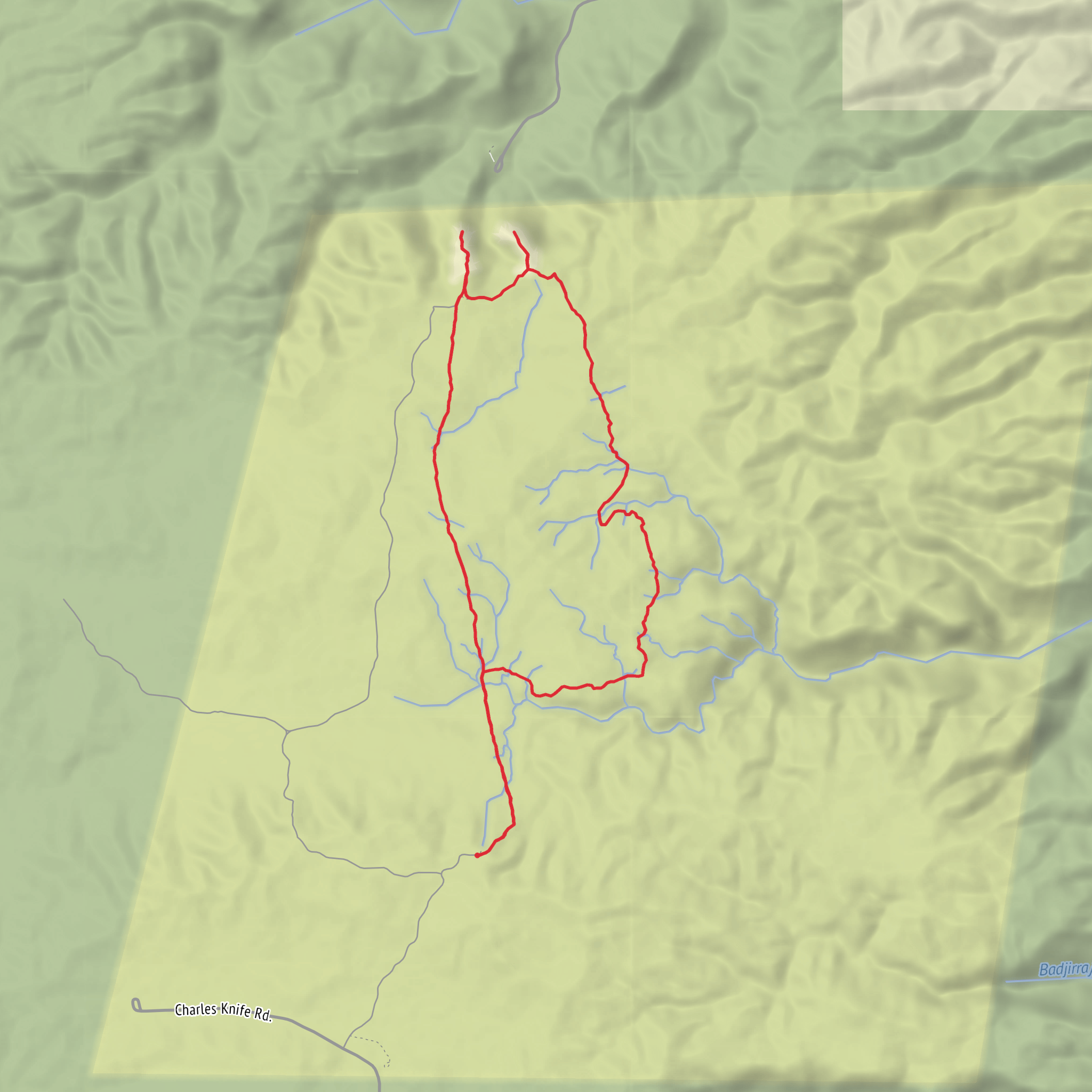
This is a rugged but very manageable loop across the top of Cape Range, starting from Thomas Carter Lookout on Charles Knife Road, Cape Range National Park, near Exmouth, Western Australia. The walk is usually listed at about 8 km (5 miles), with roughly 200 m (about 656 ft) of elevation gain, though some sources place it closer to 7.6 km (4.7 miles) and 187 m (614 ft). Either way, it is best planned as a 3 to 4 hour outing with steady footing and plenty of water. (trailswa.com.au)
Although you’ve estimated it as easy, this is better approached as an easy-to-moderate desert ridge walk rather than a casual stroll. The trail is officially described as Class 4 / moderate because the surface is uneven limestone with loose rock, rocky gullies, and very little shade. Hikers should expect more concentration underfoot than the distance alone suggests. (trailswa.com.au)
Getting to the start is straightforward by car and much less practical by public transport. The trailhead is at Thomas Carter Lookout, Charles Knife Road, Cape Range National Park, Exmouth WA 6707, a scenic lookout south of Exmouth. The Charles Knife Road turnoff is about 22 km (13.7 miles) south of Exmouth, and from there the road climbs into the range; the car park and start of the walk are about 1 km (0.6 miles) from the turn-off to the lookout spur. A gravel section is involved, and official park information recommends four-wheel drive on the gravel section, while also noting that caravans and camper trailers are not recommended because turning space is limited. Public transport to the trailhead is generally not available, so most hikers use a private vehicle or arranged tour transport from Exmouth. (exploreparks.dbca.wa.gov.au)
What the walk is like
From Thomas Carter Lookout, the route heads out across the high, exposed top of the range. The character of the walk is defined by rocky gullies, small gorges, open spinifex bushland, and broad views over Shothole Canyon and Exmouth Gulf. Rather than a single summit push, the elevation is gained and lost in smaller undulations as the loop threads through broken limestone country. (exploreparks.dbca.wa.gov.au)
The opening section is usually the most open and panoramic, with the escarpment and canyon country immediately setting the tone. Around the first 1 to 2 km (0.6 to 1.2 miles), expect a stony tread and a sense of exposure more than steepness. The terrain then becomes more textured as the loop moves through shallow gullies and along the top of the range. Midway through, the trail’s best features are the repeated lookouts into the folded limestone landscape and the contrast between red earth, pale rock, and the blue water of Exmouth Gulf in the distance. (trailswa.com.au)
Navigation is usually helped by the defined trail corridor and markers, but this is still a place where route awareness matters because the country is open, dry, and visually repetitive in places. For planning and on-trail orientation, use HiiKER and avoid relying on assumptions about side tracks or informal viewpoints.
Landmarks, scenery, and natural features
The standout landmark is Thomas Carter Lookout, which serves as both trailhead and one of the best vantage points on the route. From the loop itself, the major visual anchor is Shothole Canyon, with repeated views into rugged gullies and eroded limestone formations across the top of Cape Range. The walk is less about dense vegetation or water features and more about geology, scale, and light. (exploreparks.dbca.wa.gov.au)
Cape Range is geologically significant as part of the Ningaloo Coast, where the limestone terraces and wave-cut features record ancient sea levels and the long emergence of the peninsula from the sea. This broader landscape is one reason the Ningaloo Coast holds both National Heritage and World Heritage significance. (dcceew.gov.au)
The region also has deep Aboriginal cultural significance. Trails WA identifies this as Warnangura, Baiyungu, Thalanyji and Yinigurdira Country, and notes that **
Surfaces
Ground
Unknown
Unpaved
Comments and Reviews
User comments, reviews and discussions about the Badjirrajirra Loop Trail, Western Australia.
average rating out of 5
0 rating(s)
