Download
3D Flyover
Add to list
More
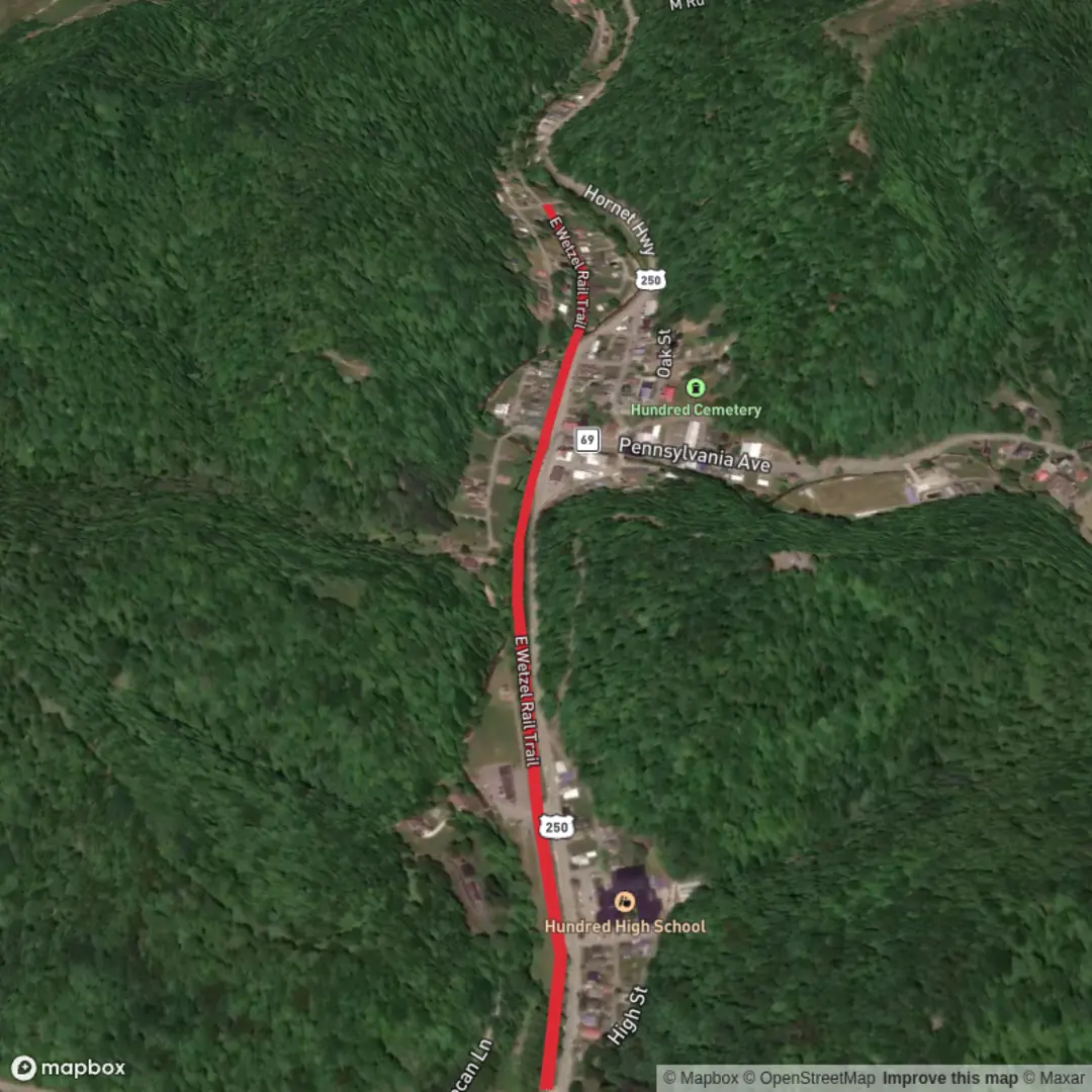
1.4 km
~16 min
0 m
Point-to-Point
“A breezy, nearly level rail-corridor wander—wildflowers, birdlife, and history, weather permitting.”
This is a short, flat rail-trail stroll of about 1 km (0.6 mi) with essentially 0 m (0 ft) of climbing, best suited to families, casual walkers, mobility aids, and anyone looking for an easy out-and-back. Expect a wide, gently graded corridor typical of former railway alignments: straight sightlines, minimal slope, and a surface that’s usually compacted gravel or fine crushed stone (conditions vary with maintenance and recent rain).
Getting to the start (car + public transport)
Because the start location is listed only as “near” (with no coordinates, town, or state), I can’t reliably convert it to a nearest address or landmark yet. If you share a lon/lat (even just one point for the trailhead) or the nearest town, I’ll pin it to the closest recognizable address/landmark and tailor directions precisely.
In the meantime, here’s how these short rail-trail segments are typically accessed: - By car: Look for a signed rail-trail access point with a small pull-off or municipal lot near where the old rail line crosses a main road. If there’s no formal lot, parking is often along a shoulder near a road crossing—only use it if it’s clearly legal and doesn’t block gates or driveways. - By public transport: If the trail is near a town center, the most reliable approach is usually bus to the nearest main street stop, then a short walk to the rail corridor. If you tell me the nearest town/county, I can identify the most practical transit stop and walking approach.
What the walk is like (surface, grade, and pacing)
With ~1 km (0.6 mi) total distance, most hikers will cover it in 10–20 minutes one-way, depending on stops. The rail grade keeps things nearly level, so the main “effort” factors are surface firmness and weather: - Surface: Often firm enough for sneakers; after rain, expect soft spots or shallow puddles in low areas. - Width: Commonly wide enough for two people side-by-side, with room to step aside for bikes. - Exposure: Rail corridors can be sunny where trees were cleared, but shaded where the line runs through second-growth woodland.
If you’re using a navigation app, load the route in HiiKER and check for any short spurs, road-crossings, or parallel paths that can be confusing on compact trail networks.
Landmarks and what to notice along the way
Even on a short segment, rail-trails tend to pack in a few distinctive features: - Railway remnants: Watch for subtle clues like a raised embankment, old ballast (angular stone), or a straight “cut” through a small rise. Occasionally you’ll see leftover ties, mileposts, or bridge abutments (don’t climb on unstable structures). - Drainage features: Small culverts or ditches are common; these can create muddy patches and are where you’ll often see animal tracks. - Edges and wildflowers: The sunny margins of rail-trails are prime for seasonal blooms and pollinators. In warmer months, the edges can also host thorny brambles and tall grasses.
Nature and wildlife (what’s realistic to expect)
Rail-trails create a long, narrow habitat edge that many species use as a travel corridor: - Birdlife: Songbirds in shrubs and young trees; raptors sometimes hunt along the open corridor. - Mammals: Deer are common in many regions; smaller mammals (rabbits, squirrels) are often seen near brushy edges. - Insects: Ticks can be present anywhere with grass and leaf litter—especially where the trail narrows or vegetation encroaches. Long socks and a quick post-walk check are smart. - Reptiles/amphibians: On warm days, you may see turtles near wet ditches or snakes basking on sunny gravel—give them space and step carefully.
Safety and “easy-trail” hazards to look out for
Easy, flat trails still have a few predictable gotchas: - Bikes and faster users: Rail-trails often attract cyclists. Walk predictably, keep right, and listen for passing calls. - Road crossings: Even if the trail is quiet, treat every crossing as active—some are unsigned or have limited sightlines. - Poison ivy / stinging plants: Common along disturbed corridors. Stay centered on the tread if vegetation is brushing your legs. - After-rain conditions: Puddles can hide soft gravel; step around the edges carefully to avoid slipping.
Historical context (why rail-trails feel the way they do)
A rail-trail’s defining traits—straight alignment, gentle grades, and broad corridors—come directly from railroad engineering. Rail lines were built to keep slopes minimal for heavy trains, which is why today’s walk feels so level. Many communities converted abandoned rail corridors into public paths to preserve right-of-way access, connect neighborhoods, and protect a slice of local transportation history. If you share the state/town for “E Wetzel Rail Trail,” I can add the specific railroad era and local industrial/agricultural history that shaped the corridor.
If you send any one of the following, I’ll refine this into a fully location-specific plan (including the nearest address/landmark and exact access point):
- a trailhead coordinate (lon/lat), or
- the nearest town + state, or
- a HiiKER link to the route.

Surfaces
Paved
Comments and Reviews
User comments, reviews and discussions about the E Wetzel Rail Trail, West Virginia.
average rating out of 5
0 rating(s)