Download
3D Flyover
Add to list
More
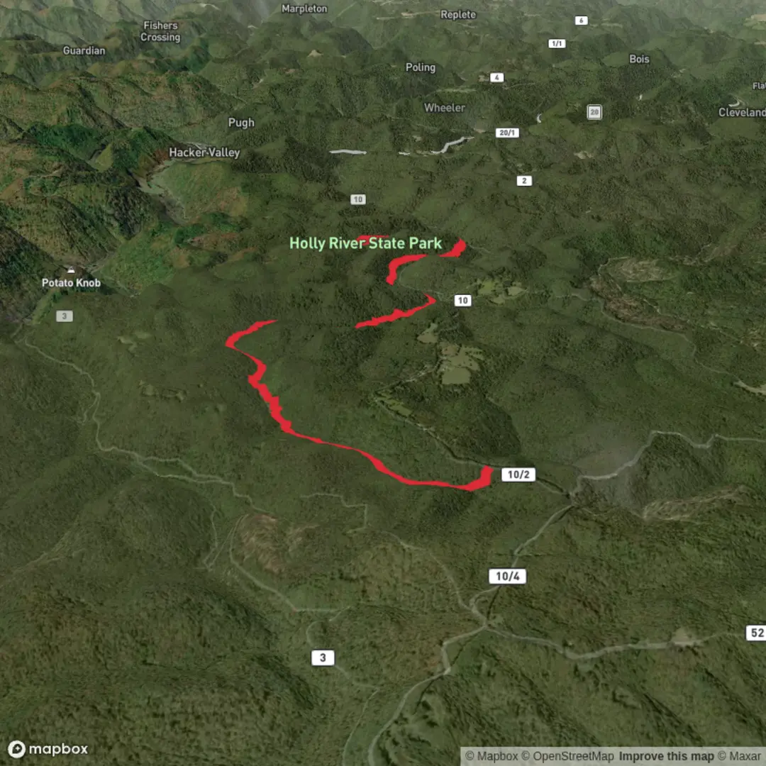
11.5 km
~2 hrs 23 min
54 m
Point-to-Point
“Help me pin down the right Railroad Grade Trail, and I’ll paint a planning-ready hike portrait.”
I’m missing a few key pieces needed to write this accurately (especially because there are multiple “Railroad Grade Trail” routes in different places). Share either the trail’s GPS coordinates (lat/long) for the trailhead or the state/park/mountain name, and I’ll convert the coordinates to the nearest known address/landmark and tailor the description.
To make sure I match what you mean, please fill in any you know:
- Trailhead location: (lat/long or nearest town/park)
- “Hike head: near …” (it’s currently blank)
- Hike type: out-and-back, loop, or point-to-point (or “not sure”)
- If you have it: a map image or a HiiKER link
Once you send that, I’ll produce a full planning-ready description for an ~11 km / ~6.8 mi, ~100 m / ~330 ft easy hike, including: - parking + public transport options to the exact start point, - surface/grade expectations and any muddy/overgrown sections, - notable landmarks and viewpoints with approximate distances, - local ecology + realistic wildlife considerations, - any railroad/land-use history tied to the specific corridor.

Surfaces
Ground
Unknown
Unpaved
Comments and Reviews
User comments, reviews and discussions about the Railroad Grade Trail, West Virginia.
average rating out of 5
0 rating(s)