Download
3D Flyover
Add to list
More
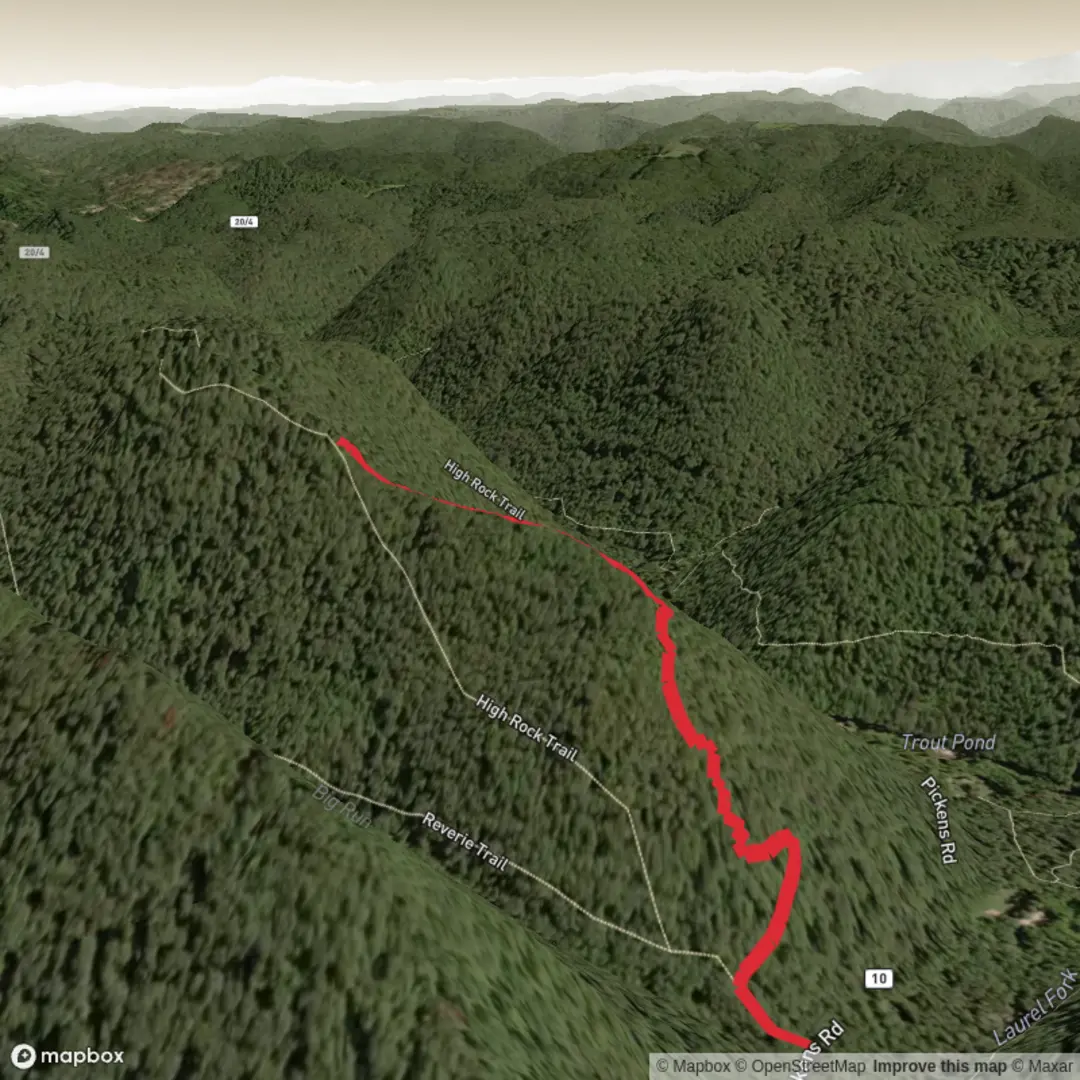
1.8 km
~30 min
83 m
Point-to-Point
“A colourful High Rock ramble awaits—share the trailhead, and I’ll tailor safe, vivid guidance.”
I’m missing a few key details needed to write an accurate, safety-useful description—there are multiple “High Rock Trail” hikes (often in different states/countries), and your start location line is incomplete (“Hike head: near …”). If you share the trailhead coordinates or a link, I can also convert the lon/lat to the nearest known address or landmark as you requested.
Send any one of the following and I’ll write the full hike description immediately: - Trailhead coordinates (lat, lon) (best), or - Nearest town/park + state, or - A HiiKER link to the route.
Also confirm (if you know):
- Hike type: out-and-back, loop, or point-to-point
- Any time of year you’re planning (helps with conditions/wildlife notes)
Once I have the location, I’ll include: - Turn-by-turn expectations over ~2 km / 1.2 mi with ~100 m / 328 ft gain - Landmarks, terrain, typical hazards, and wildlife - Historical context specific to that region - How to reach the trailhead by car and public transport - The nearest address/landmark for the trailhead based on your coordinates

Comments and Reviews
User comments, reviews and discussions about the High Rock Trail, West Virginia.
average rating out of 5
0 rating(s)