Download
3D Flyover
Add to list
More
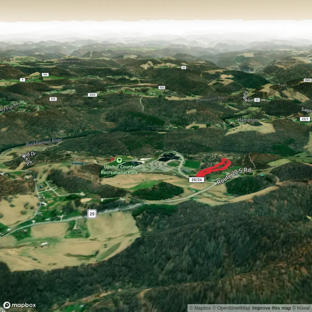
3.8 km
~47 min
18 m
Loop
“A gentle, near-level wander where sun, wind, and shifting surfaces shape a calm nature pause.”
A roughly 4 km (2.5 mi) easy walk with essentially flat elevation change (about 0 m / 0 ft) is ideal for a relaxed outing, families, or anyone looking for a low-effort nature break. With minimal climbing, the main things that shape how this hike feels are surface conditions (paved path vs. compacted gravel vs. sand), exposure (sun/wind), and any wet or muddy sections after rain.
Before I can tailor this properly—especially the “nearest known address or significant landmark” for the trailhead and any local history/wildlife—I need the missing location details.
Send one of the following and I’ll turn it into a complete, plan-ready hike description: - A HiiKER link to “Xxx Trail”, or - The trailhead coordinates (lat, lon), or - The nearest town/park name (even approximate), plus the hike type (loop/out-and-back/point-to-point), or - A static map image of the route.
Once I have the location, I’ll include: - Where to park and the closest recognizable start point (converted to a nearby address/landmark) - Public transport options to the trailhead (nearest stop/station + walking distance) - Step-by-step route flow with approximate distance markers in km/mi - Surface and accessibility notes (strollers, wheelchairs, road crossings, gates) - Key landmarks and viewpoints (and when you reach them) - Likely wildlife/plant communities for that specific area and what to watch for (ticks, snakes, mosquitoes, nesting birds, etc.) - Any historical/cultural context tied to the region (settlement, industry, indigenous history where appropriate) - Practical prep: footwear, water, sun/wind cover, and seasonal considerations - Navigation guidance using HiiKER only
Reply with the trailhead coordinates or a HiiKER link and I’ll write the full description in one go.

Comments and Reviews
User comments, reviews and discussions about the Xxx Trail, West Virginia.
average rating out of 5
0 rating(s)