Download
Preview
Add to list
More
4.9 km
~1 hrs 8 min
102 m
Point-to-Point
“Wander Canaan Valley’s river-edge boardwalks and old fields, where quiet rises invite wildlife watching.”
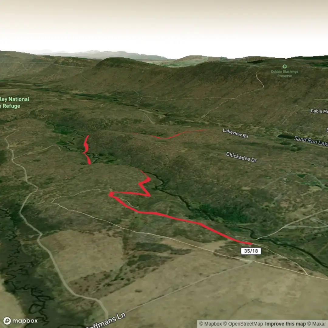
This medium outing sits in the heart of Canaan Valley National Wildlife Refuge near Davis, West Virginia, where high-elevation wetlands, old farm fields, and river corridors create some of the best wildlife habitat in the central Appalachians. The route you’re planning (about 5 km / 3.1 mi with roughly 100 m / 328 ft of gain) matches well with hiking the Blackwater View Trail as an out-and-back from the Beall Parking Area, turning around at a natural “time-and-energy” point (often near the river bridge/boardwalk sections) rather than committing to the full one-way length shown on refuge maps. The terrain is varied—gravel access road, doubletrack, short singletrack, boardwalk, and a river crossing—so it feels more engaging than the modest elevation suggests. (mtbproject.com)
Getting to the trailhead (car + public transport reality check)
Trailhead access is from the Beall Parking Area at the end of Beall Lane Road, off Cortland Road, on the west side of Canaan Valley near Davis. This is the most reliable “known landmark” to navigate to; once parked, you’ll pass through an iron gate and find trail information kiosks just beyond it. (mtbproject.com)
- By car: From Davis, WV, you’re only a short drive to the Beall parking area via local roads (Cortland Rd → Beall Lane). Expect a gravel lot and typical refuge-style facilities (minimal services at the trailhead), so arrive with water and layers already sorted.
- By public transport: There isn’t dependable, frequent public transit directly to this trailhead. The closest practical approach is usually getting to the Davis/Thomas area by regional means and then using a taxi/rideshare (availability can be limited) to reach the Beall parking area. If you must go car-free, plan extra time and have a backup plan for the return.
For navigation, download the route on HiiKER before you arrive—cell coverage can be inconsistent in the valley and along the river corridor.
What the hike is like underfoot (and where the “medium” comes from)
From the Beall Parking Area, the trail begins immediately through the gate and settles into a gentle warm-up on gravel and doubletrack. Early on, you’ll notice the landscape opening into former farm fields now managed as grasslands and shrublands, with the Blackwater River corridor nearby—this is prime habitat edge, which is why wildlife sightings can be excellent even close to the trailhead. (fws.gov)
As you continue, the character changes in small chapters: - Boardwalk section(s): These protect sensitive wet ground and keep your feet out of the worst mud, but they can be slick when wet, frosty, or leaf-covered. The boardwalk also signals you’re moving through wetter habitat—expect spongy ground and standing water nearby after rain. - River crossing (bridge): A key landmark on this trail system is the bridge over the Blackwater River. It’s a natural turnaround point for a ~5 km / 3.1 mi plan if you want a satisfying “destination” without committing to longer mileage. (mtbproject.com) - Gradual climb segments: The elevation gain is not a single steep push; it’s more of a steady, rolling accumulation. That’s why it can feel “medium” despite the modest numbers—soft ground, damp air, and small rises add up.
Landmarks, scenery, and the best “look-for” moments
This hike is all about valley-scale views and river/wetland detail rather than big summits.
- Blackwater River corridor: The trail parallels the river for long stretches, so keep scanning for movement along the banks and over the water. The refuge specifically notes belted kingfishers along the river and bald eagles overhead—both are realistic targets here. (fws.gov)
- Wetlands and ponds: In spring, you’re likely to hear **wood frogs

Surfaces
Ground
Unpaved
Unknown
Gravel
Comments and Reviews
User comments, reviews and discussions about the Blackwater View Trail, West Virginia.
average rating out of 5
0 rating(s)