Download
3D Flyover
Add to list
More
3.9 km
~1 hrs 8 min
215 m
Point-to-Point
“A short, punchy climb with rocky surprises—pack layers, tread lightly, and savour the view.”
I’m missing a few key details needed to write this accurately (especially the start location). Please paste either the trailhead coordinates (lat, lon) or a HiiKER link, and if you have it, the region/park/state. Once I have that, I’ll convert the coordinates to the nearest known address/landmark and tailor the route description, access, landmarks, wildlife, and local history.
To keep things moving, here’s what I can already tell you based on your stats (and what I’ll refine once you share the location):
You’re looking at a moderate, short climb: about 4 km (2.5 mi) with roughly 200 m (656 ft) of gain. That’s a fairly punchy elevation profile for the distance—expect sustained uphill for at least one main section rather than a gentle grade throughout. Many hikers will take 1.5–2.5 hours depending on footing, stops, and how continuous the climb is.
What the effort typically feels like
- Climbing rate: 200 m over 4 km averages a 5% grade, but real trails rarely climb evenly—plan for short steeper pitches where you’ll slow down and your calves/quads will notice it.
- Footing: On medium-rated trails with this gain, the “difficulty” often comes from uneven tread (roots/rocks), narrow bench-cut sections, or loose gravel on the steeper bits rather than sheer distance.
- Weather sensitivity: A 4 km route can still feel serious if it’s exposed (wind/sun) or if the surface turns slick after rain.
What to pack and wear (for a 4 km / 2.5 mi, 200 m / 656 ft hike)
- Footwear: Trail shoes are usually fine, but if the area is rocky or frequently wet, light boots help with ankle stability.
- Water: At least 1 liter (34 oz) per person; 1.5 liters (51 oz) if it’s warm, exposed, or you run hot.
- Layers: A light insulating layer and a shell—short hikes still get cold fast if you stop at a viewpoint.
- Navigation: Download the route for offline use in HiiKER before you arrive (cell service is often weakest right where you need it).
- Trekking poles (optional): Very helpful for the descent if the trail is steep or loose.
Common things to look out for on a “medium” short-climb trail
- Downhill hazards: Most slips happen on the way back—watch for ball-bearing gravel, wet roots, and smooth rock.
- Trail braiding: If the climb gets steep, people sometimes create side paths. Stick to the main tread shown in HiiKER to avoid erosion and wrong turns.
- Ticks/biting insects: Especially in brushy edges and tall grass; long socks and a quick post-hike check help a lot.
- Wildlife etiquette: Give animals space, keep food secured, and be alert around dawn/dusk when wildlife is most active.
Getting to the trailhead (I’ll make this specific once you share the location)
- By car: I’ll identify the closest signed parking area or roadside pull-off, note typical capacity, and flag any seasonal road closures.
- By public transport: If transit is realistic, I’ll outline the nearest stop and the walking connection to the trailhead (with approximate distance and safety notes like shoulder walking).
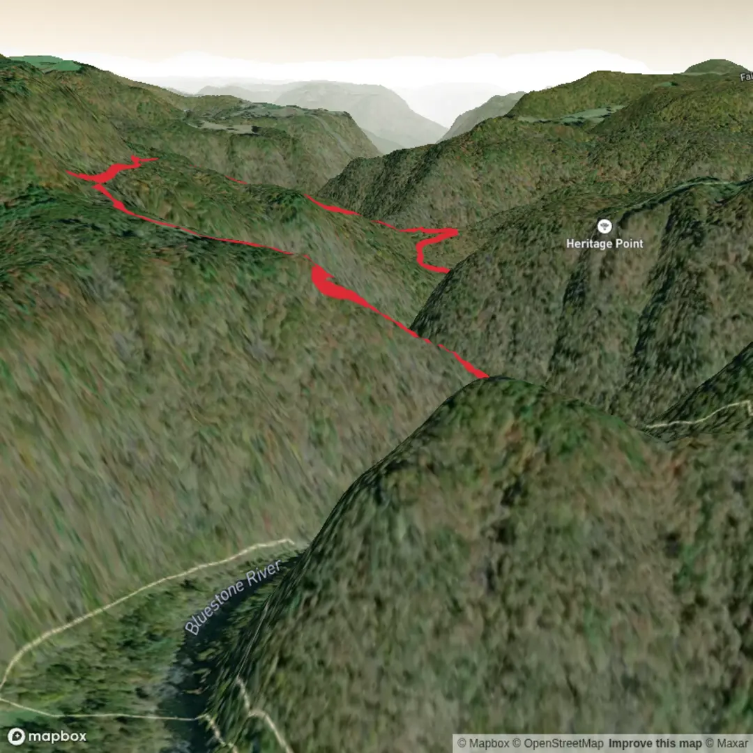
Landmarks, nature, and historical context
“Farley Trail” exists in multiple places, so I don’t want to guess and mislead you on: - the dominant ecosystem (coastal scrub vs. hardwood forest vs. desert foothills, etc.) - signature viewpoints or named features - wildlife you’re likely to see - any local/Indigenous history, settlement history, or land-use background tied to the specific region
Send one of the following and I’ll write the full, location-accurate hike description exactly in the style you requested:
1) Trailhead coordinates (lat, lon), or
2) a HiiKER route link, or
3) the nearest town/park where this Farley Trail is located.

Comments and Reviews
User comments, reviews and discussions about the Farley Trail, West Virginia.
average rating out of 5
0 rating(s)