Download
3D Flyover
Add to list
More
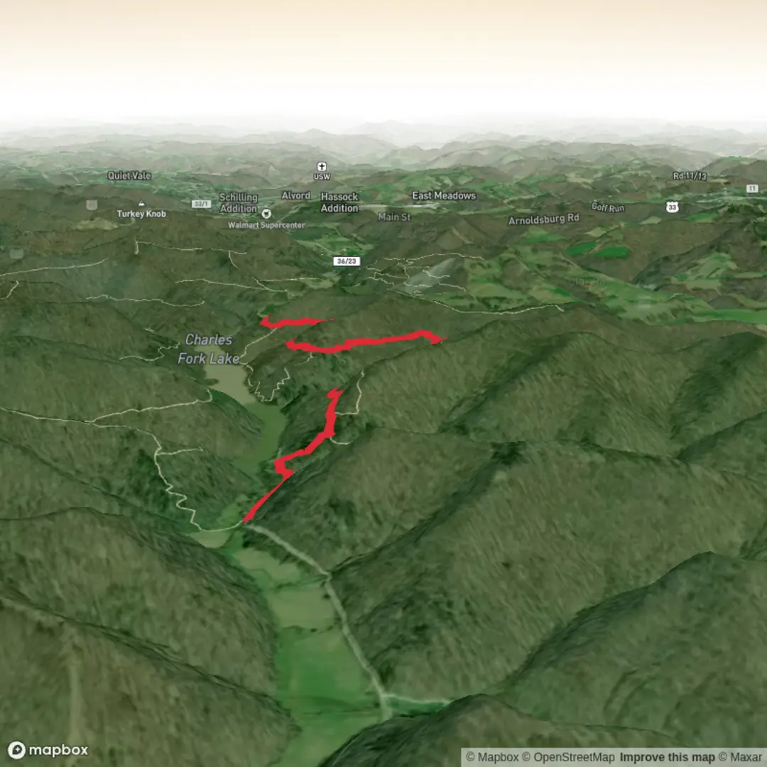
9.1 km
~1 hrs 56 min
73 m
Out and Back
“Help shape Trevor’s Trail into a planning-ready adventure—share the start point and nearby landmarks.”
I’m missing a few key pieces of information needed to describe this route accurately and convert the start location into a real-world landmark/address.
Please send either: 1) the start point coordinates (lat, lon) for the trailhead (and ideally the end point too if it’s point-to-point), or 2) a map screenshot, or 3) a HiiKER link to “Trevor’s Trail”.
Also, can you confirm these two fields? - Hike head (near): (it’s currently blank) — what town/park/state/country is it near? - Hike type: loop / out-and-back / point-to-point?
Once I have that, I’ll write a full planning-ready description for a ~9 km (5.6 mi) hike with ~100 m (328 ft) gain, including: - how to get to the trailhead by car and public transport - the nearest known address or notable landmark to the coordinates - what the terrain is like, what to watch for, seasonal considerations, and likely wildlife - notable landmarks and any historical context for the area - navigation notes using HiiKER only

Comments and Reviews
User comments, reviews and discussions about the Trevor's Trail, West Virginia.
average rating out of 5
0 rating(s)