Download
3D Flyover
Add to list
More
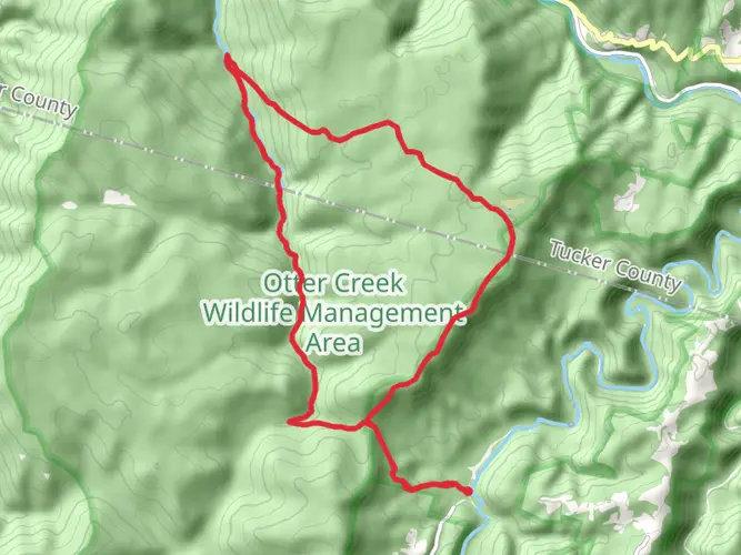
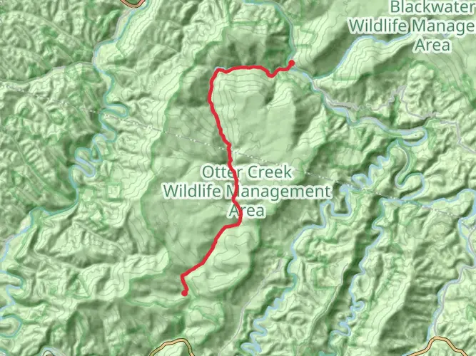
25.0 km
~6 hrs 23 min
838 m
Multi-Day
“Embark on the Otter Creek Loop, an Appalachian treasure weaving through history, wildlife, and serene wilderness.”
Nestled in the scenic heart of Randolph County, West Virginia, the Otter Creek Loop offers an immersive experience into the Appalachian wilderness. Spanning approximately 25 kilometers (about 15.5 miles) with an elevation gain of roughly 800 meters (around 2625 feet), this loop trail is a medium-difficulty adventure suitable for hikers with some experience.
Getting to the Trailhead
To reach the starting point of the Otter Creek Loop, hikers can drive to the vicinity of the Otter Creek Wilderness, which is accessible via Forest Road 91, also known as Otter Creek Road. The trailhead is located near the convergence of Otter Creek and the Dry Fork of the Cheat River. For those relying on public transportation, options are limited, and a car rental from the nearest major town may be necessary.
Navigating the Trail
Hikers can utilize HiiKER to navigate the trail, ensuring they stay on the correct path throughout their journey. The loop can be tackled in either direction, but many choose to go counterclockwise to gradually ascend the steeper sections and enjoy a more gentle descent towards the end.
Landmarks and Natural Features
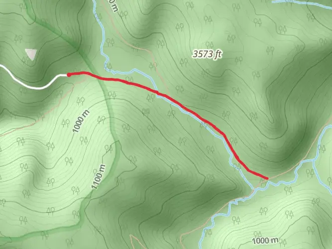
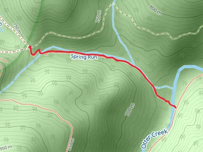
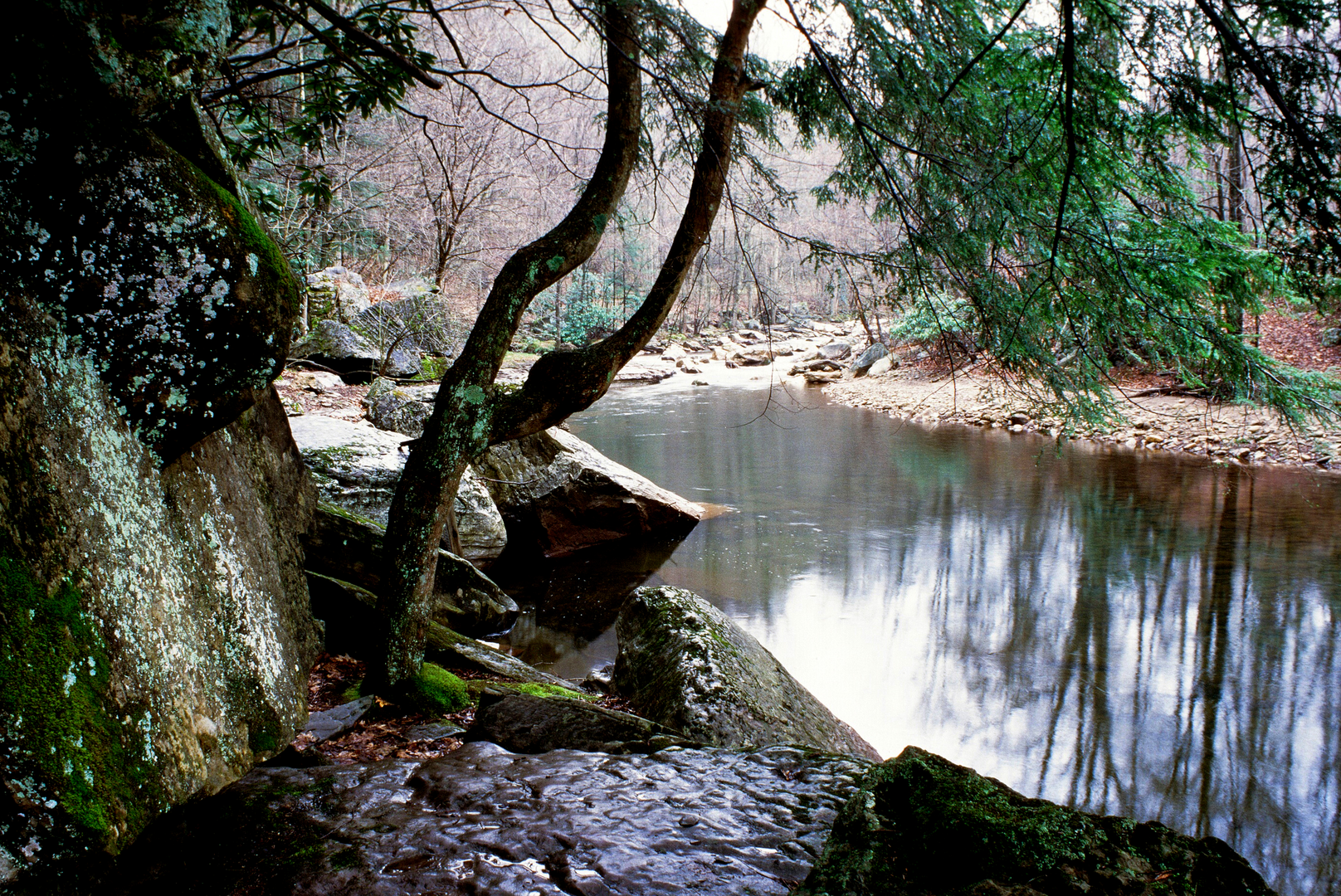
As you embark on the Otter Creek Loop, you'll be greeted by a canopy of mixed hardwoods, with occasional conifers adding to the diversity. The trail meanders alongside Otter Creek for a portion of the hike, where the soothing sounds of flowing water accompany your steps. Approximately 5 kilometers (3.1 miles) in, you'll encounter the first of several creek crossings. Be prepared with water-resistant footwear, especially during the wetter seasons when the creek can swell.
Wildlife and Flora
The Otter Creek Wilderness is home to a rich array of wildlife. Keep an eye out for white-tailed deer, black bears, and a variety of bird species, including the pileated woodpecker and the occasional sighting of a bald eagle. The undergrowth is lush with ferns, rhododendrons, and in the spring, a colorful display of wildflowers.
Historical Significance
The region holds historical significance, with remnants of old logging camps and railroads scattered throughout the area. These relics are a testament to the logging boom of the early 20th century, which played a pivotal role in West Virginia's development. As you hike, you may come across old railroad grades, now reclaimed by nature, that once transported timber out of these dense forests.
Elevation and Terrain
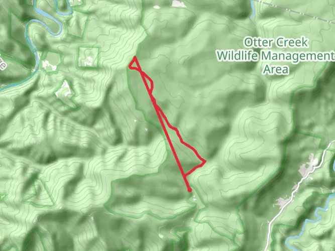
The trail's elevation gain is gradual but noticeable, with the highest point reaching around 800 meters (2625 feet). The terrain varies from soft forest floor to rocky outcrops, with some sections requiring careful footing. Around the halfway mark, the trail ascends to a ridge offering panoramic views of the surrounding wilderness before descending back towards Otter Creek.
Preparation and Safety
Before setting out, ensure you have adequate supplies, including water, food, and a first-aid kit. Weather in the Appalachians can change rapidly, so pack layers and be prepared for varying conditions. It's also wise to inform someone of your hiking plans and expected return time.
Conclusion
The Otter Creek Loop is a rewarding trail that offers a blend of natural beauty, wildlife encounters, and a glimpse into the region's past. With proper preparation and respect for the wilderness, hikers will find this loop to be a memorable adventure in the heart of West Virginia's rugged landscape.

What to expect?
Activity types
Frequently asked questions
How long does the Otter Creek Loop take to hike in Randolph County, West Virginia?
The Otter Creek Loop is 24.98 km, or about 15.5 miles, with 838 m of elevation gain, so most hikers treat it as a full-day hike or an overnight backpacking loop. Strong hikers can finish it in a long day, but the combination of distance, climbing, wet footing, and stream crossings often makes a 2-day trip more realistic.
Where is the trailhead for the Otter Creek Loop and where can you park?
The Otter Creek Loop is accessed from the Otter Creek Wilderness in Randolph County, with approach roads tied to Forest Road 91, also called Stuart Memorial Drive or Otter Creek Road, on the Cheat-Potomac Ranger District of Monongahela National Forest. Parking is typically at roadside trail access points and designated parking areas along Forest Road 91, rather than at a large developed trailhead.
Is the Otter Creek Loop hard, and how much elevation gain does the Otter Creek Loop have?
The Otter Creek Loop is generally a medium-difficulty route, but it is still a serious backcountry hike. The loop covers 24.98 km and gains 838 m, which is roughly 2,750 feet, so the challenge comes from both the mileage and the sustained climbing, especially when trails are muddy or slick.
Can you camp on the Otter Creek Loop in the Otter Creek Wilderness?
Yes. The Otter Creek Loop sits in a federally designated wilderness where backpacking and dispersed camping are allowed, but camps should be set at least 200 feet from roads, streams, and trails. Fires must be kept small using dead and down wood, and lightweight stoves are encouraged. Groups larger than 10 are prohibited in the wilderness.
Are dogs allowed on the Otter Creek Loop?
Dogs are allowed in the Otter Creek Wilderness, so they can go on the Otter Creek Loop, but pets must be kept under control at all times. Because this is a rugged wilderness route with muddy tread, deadfall, and creek crossings, it is best suited to trail-savvy dogs that can handle uneven terrain and water.
Are there creek crossings or muddy sections on the Otter Creek Loop?
Yes. Trails in the Otter Creek Wilderness are known for wet footing, mud, and limited bridging, and the Forest Service notes that some stream crossings can be difficult during high water. On the Otter Creek Loop, that means conditions can change quickly after rain, and hikers should expect to get their feet wet in places.
What is the best time of year to hike the Otter Creek Loop?
Late spring through fall is usually the best window for the Otter Creek Loop, when Forest Road 91 is typically accessible and overnight conditions are milder. Even then, the route can stay muddy and creek levels can rise after storms, so summer and early fall often offer the most manageable footing compared with colder, high-water periods.
Comments and Reviews
User comments, reviews and discussions about the Otter Creek Loop, West Virginia.
4.42
average rating out of 5
19 rating(s)