Download
3D Flyover
Add to list
More
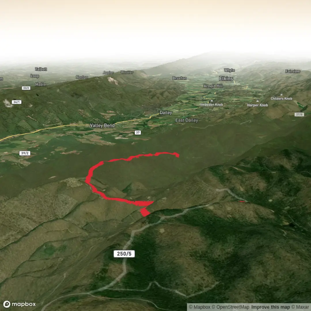
15.4 km
~3 hrs 43 min
383 m
Out and Back
“Climb to Chestnut Ridge’s breezy crest, weave through rocky forest rollers, and descend thoughtfully.”
I’m missing a few key specifics needed to make this accurate (there are multiple “Chestnut Ridge Trail” routes in the U.S., and the start point is currently blank). Share either (a) the start lon/lat, (b) a HiiKER link, or (c) the nearest town/park + state, and I’ll convert the coordinates to the nearest known address/landmark and tailor the route description, transit options, and local history.
In the meantime, here’s a planning-ready description that matches your stats (≈ 15 km / 9.3 mi, ≈ 400 m / 1,312 ft, Medium) and the kind of terrain typically associated with “Chestnut Ridge” routes in the eastern U.S. Once you provide the location, I’ll swap in the correct trailheads, landmarks, hazards, and historical notes for that exact ridge.
You’re looking at a ridge-walk style hike: steady climbing early, rolling ups-and-downs along the crest, then a longer descent back toward the finish. At 15 km (9.3 mi) with ~400 m (1,312 ft) of gain, most hikers take 4–6 hours depending on stops and how rocky the tread is.
Expect a mix of: - Hard-packed forest trail in sheltered sections - Rocky, rooty singletrack on the ridge spine - Occasional short, steeper pitches where the trail gains the ridge quickly - Potentially muddy pockets in saddles and drainages after rain
If you’re using navigation, download the route in HiiKER ahead of time and keep an eye on junction density—ridge systems often have side trails that drop off toward roads, creeks, or old access tracks.
Getting to the start (car + public transport)
By car: Most Chestnut Ridge trailheads are reached via a small parking pull-off or a designated lot at a park entrance/road crossing. Plan to arrive early on weekends—ridge hikes are popular because they stay cooler and offer viewpoints. If the route is a point-to-point, you’ll want a car shuttle or a rideshare plan; if it’s a loop, confirm the lot you’re using matches the loop’s “true” start.
By public transport: Ridge trailheads are often not directly served by transit. The usual approach is:
1) Take regional rail/bus to the nearest town center, then
2) Use a local taxi/rideshare to the trailhead road crossing/park entrance.
Once you tell me the state/park or provide coordinates, I’ll name the exact station/stop and the closest practical drop-off landmark.
What the climb feels like (and where the effort is)
Most of the elevation gain on hikes like this comes in two patterns: - Front-loaded climb: You gain the ridge in the first 2–4 km (1.2–2.5 mi), often picking up 200–300 m (650–980 ft) quickly. This is where pacing matters—start slower than you think you need to. - Ridge rollers: The remaining gain is “hidden” in short rises—small knobs, rocky steps, and re-climbs after shallow saddles. These add up, especially late in the day.
If your route is a loop, the descent usually comes in the final 3–5 km (1.9–3.1 mi). Descents on ridge trails can be deceptively tiring because of loose rock, leaf-covered roots, and steeper fall-line segments.
On-trail landmarks and terrain cues
On a Chestnut Ridge-style route, the most notable “landmarks” are often natural rather than built:
- Ridge crest viewpoints: Look for short spur paths or open rock ledges. These are common places to stop, but they can be exposed to wind and lightning risk.
- Saddles and drainages: Low points between bumps on the ridge often hold moisture—expect mud, slick leaves, and in cooler months, lingering ice in shaded pockets.
- Old woods roads / access tracks: Many ridges have remnants of historic logging or land management roads. They can look invitingly smooth but may lead away from the intended line—watch your position in HiiKER at these intersections.
If you share the exact location, I’ll call out the specific named overlooks, rock formations, creek crossings, and any historic structures (foundations, old rail grades, CCC-era features, etc.) that are actually on your route.
Nature, seasons, and wildlife to expect
“Chestnut Ridge” names often reflect the region’s hardwood history. In much of the eastern U.S., American chestnut was once a dominant tree before chestnut blight in the early 1900s. Many ridges still have chestnut oak and occasional American chestnut sprouts (they often resprout from old root systems but rarely mature). Depending on your exact state/park, you’ll likely see a classic ridge mix: - Oak–hickory forest on drier slopes and the crest - Maple, beech, tulip poplar in more sheltered hollows - Mountain laurel / rhododendron thickets in places (can narrow the corridor)
Wildlife commonly encountered (varies by region, but typical for these habitats): - White-tailed deer (most active dawn/dusk) - Wild turkey - Songbirds and raptors riding ridge thermals - Black bear in some regions—usually shy; store food securely and

Comments and Reviews
User comments, reviews and discussions about the Chestnut Ridge Trail, West Virginia.
average rating out of 5
0 rating(s)