Download
3D Flyover
Add to list
More
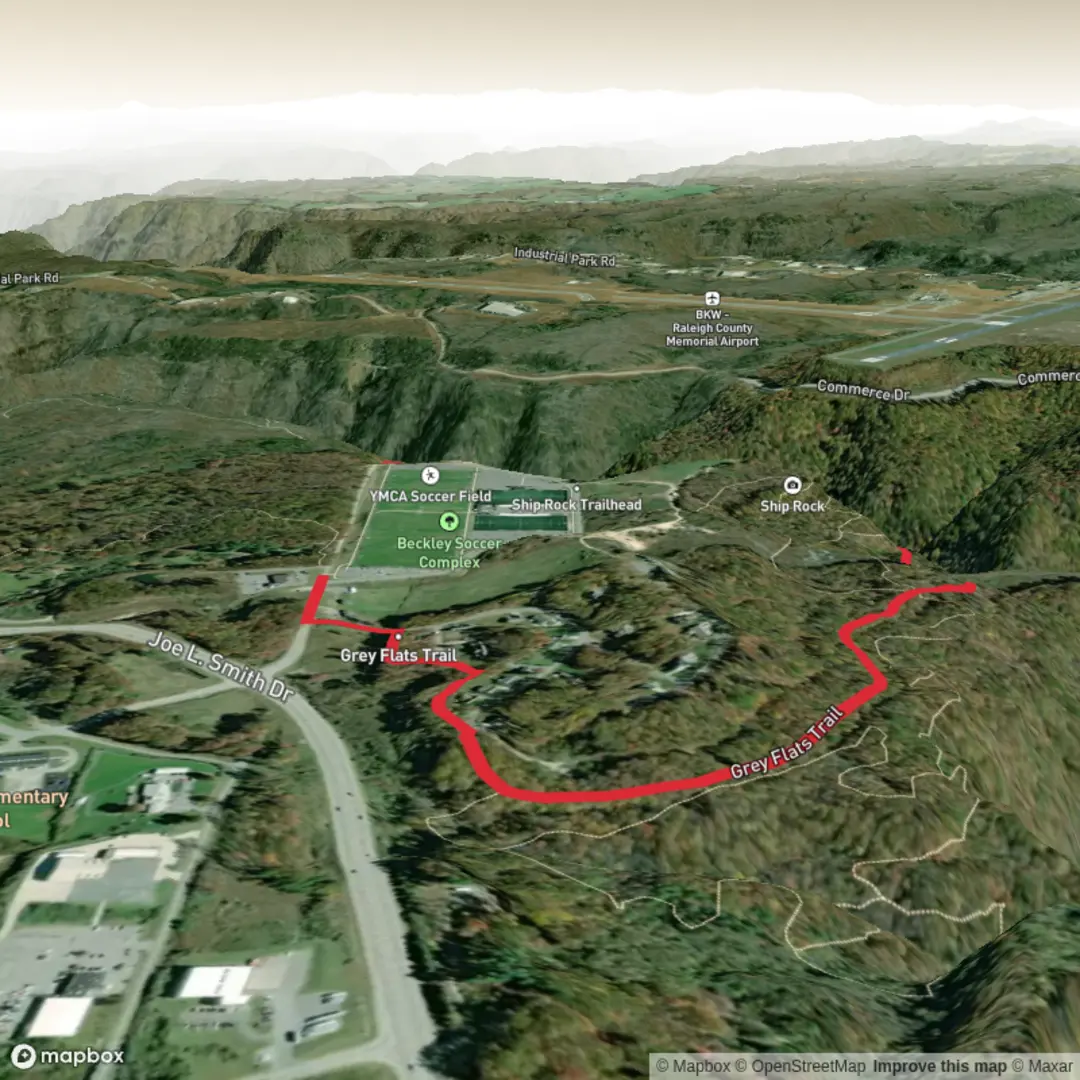
2.9 km
~37 min
27 m
Point-to-Point
“Wander Grey Flats’ leafy Piney Creek corridors—an unhurried woods ramble with gentle footing.”
From the moment you step onto this route, expect a relaxed, low-effort walk on a broad, mostly level corridor that feels more like a “woods ramble” than a workout. At roughly 3 km (1.9 mi) with about 0 m (0 ft) of climbing, Grey Flats is well-suited to first-timers, families, and anyone looking for an easy leg-stretcher in the Piney Creek watershed area near Beckley.
Getting to the start (car + public transport)
By car: The most reliable “nearest known address” to aim for is Grey Flats Road, Beckley, WV 25801—notably 250 Grey Flats Rd, Beckley, WV 25801 is a commonly mapped reference point in the immediate area. (mapquest.com)
As you approach the trail access points around Grey Flats Road, you’ll typically find small parking areas used by local trail users. Because this is a popular local system, arrive earlier on pleasant weekends if you want the easiest parking.
By public transport: Beckley’s public transit coverage is limited compared with larger cities, so the practical approach is usually: - Bus into Beckley, then - Rideshare/taxi to Grey Flats Road / the Grey Flats trail access. If you’re coming from out of town, plan your last-mile logistics in advance so you’re not stranded at the end of the hike.
What the walk feels like underfoot
Grey Flats sits within a larger network of trails in the Piney Creek area near Beckley. (beckleyareatrails.org) On an easy 3 km (1.9 mi) outing here, you can generally expect: - Gentle grades (true “easy” effort), with the trail contouring rather than climbing. - Packed dirt and leaf litter with occasional roots and small rocks. - Seasonal mud in low spots after rain—this watershed terrain can hold water, so shoes with decent tread help even on an “easy” day.
For navigation, it’s worth loading the route on HiiKER before you arrive, especially because the Grey Flats area connects into multiple intersecting paths and it’s easy to wander onto a longer loop without meaning to.
Landmarks and natural highlights
This hike is less about a single marquee destination and more about the feel of the Piney Creek rim-and-hollow landscape—mixed Appalachian forest, pockets of denser shade, and occasional openings where the woods thin.
Because the Grey Flats trails are part of a broader Piney Creek system, you may notice: - Benches/signage near access points and junctions where different segments split (useful “reset points” to confirm you’re still on your intended 3 km / 1.9 mi plan). (mountainproject.com) - Subtle changes in vegetation as you move between slightly higher, drier ground and lower, wetter pockets typical of a watershed setting.
Wildlife and what to watch for
In this part of West Virginia, common sightings (or signs) can include: - White-tailed deer (often at dawn/dusk) - Songbirds and woodpeckers in the canopy - Small mammals (squirrels, chipmunks) - Ticks in warm months, especially along brushy edges—use repellent and do a post-hike check.
Also keep an eye out for slick leaves on hardpack in fall and thin ice in shaded stretches in winter/early spring—both can make an otherwise easy, flat trail surprisingly slippery.
Historical context of the area
The Grey Flats trails sit in and around a landscape shaped by Appalachian resource and land-use history, and parts of the southern Grey Flats area have been associated with older local access routes and former land uses that trail builders and local groups have discussed and researched. (wvexplorer.com) More broadly, the Piney Creek area has active stewardship and trail development tied to watershed-focused organizations and partners, reflecting an ongoing effort to balance recreation with water-quality and habitat concerns. (pineycreekwatershed.org)

Surfaces
Dirt
Unknown
Paved
Comments and Reviews
User comments, reviews and discussions about the Grey Flats Trail, West Virginia.
average rating out of 5
0 rating(s)