Download
3D Flyover
Add to list
More
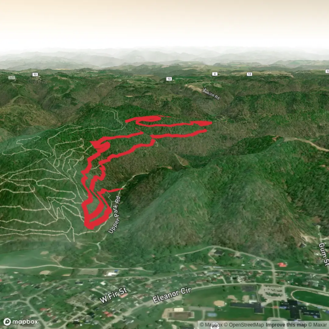
8.1 km
~1 hrs 48 min
107 m
Loop
“A trail story on pause—share the starting point, and this loop’s character can finally shine.”
I can write this up, but a few key details are missing—especially the start location. Right now “Hike head: near” is blank, and without coordinates or a nearby place name I can’t reliably convert the lon/lat to a nearest address/landmark or give accurate access, landmarks, hazards, and local history for this specific Face Plant Trail / Gun Range Trail loop.
Send any one of the following and I’ll produce the full hike description exactly in the style you requested:
- Start point coordinates (preferred):
lat, lonfor the trailhead/parking area - A HiiKER link to the route (or GPX/KML)
- Nearest town/park/landmark where the hike begins (even approximate), plus the state
- If you have them: waypoints (trailhead, junctions, viewpoints, water, parking)
Also confirm these two items so I match your intent: - Hike type: loop, out-and-back, or point-to-point? - “Gun Range Trail”: is there an active shooting range nearby (so I should include specific safety guidance), or is it just a historical name?
Once you share the start location, I’ll include: - Turn-by-turn style narrative with approx. distances in km + miles and elevation gain in m + ft (8 km / ~5.0 mi; 100 m / ~330 ft overall, unless the route data shows otherwise) - What to expect under at least one sub-heading mid-way (terrain, footing, seasonal conditions, wildlife, key junctions) - How to get there by car and public transport (based on the actual trailhead) - Nearest known address or significant landmark for the trailhead (from your lon/lat) - Any historical context tied to the specific area the trails are in - Navigation notes referencing HiiKER exclusively

Comments and Reviews
User comments, reviews and discussions about the Face Plant Trail and Gun Range Trail, West Virginia.
average rating out of 5
0 rating(s)