Download
3D Flyover
Add to list
More
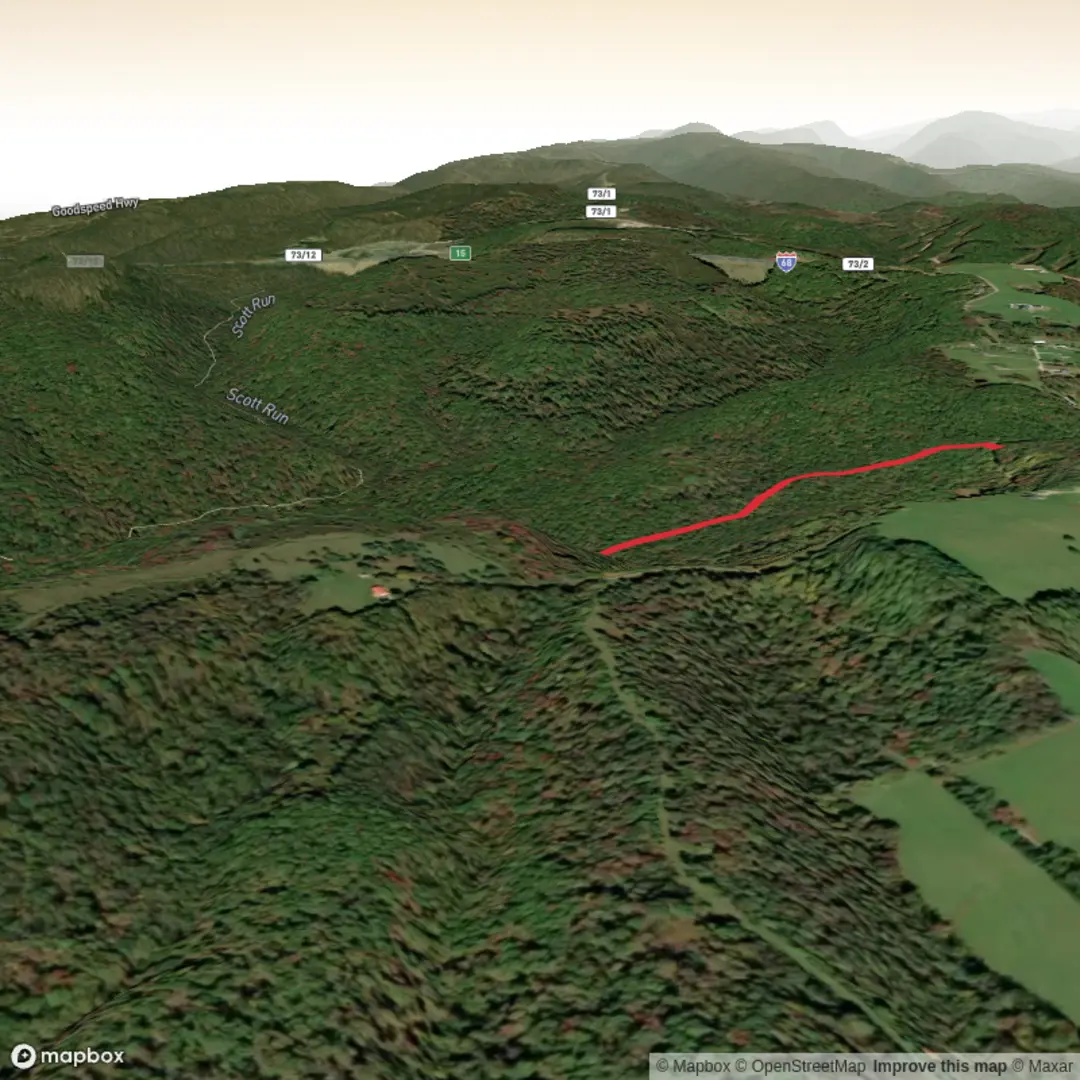
3.1 km
~44 min
73 m
Out and Back
“A creekside wander rising to drier woods, with a few punchy pitches—best savoured when it’s not slick.”
A compact, punchy out-and-back (or short loop, depending on how you connect the spurs) that packs a lot into roughly 3 km / 1.9 mi with about 100 m / 330 ft of climbing. Expect a wooded creek-valley feel at the low points, a steady rise onto higher ground, and a few short, sharper pitches that justify the Medium effort rating—especially if the tread is damp.
Getting to the trailhead (car + public transport)
Because the start location is listed only as “near” (with no coordinates or town/park name), the best I can do is describe how to plan your approach once you confirm the exact pin:
- By car: Use HiiKER to open the route and tap the trailhead marker, then navigate to the nearest signed parking area. For trails with names like Scott Run and Pisgah Spur, the start is often close to a small pull-off, a park access lot, or a neighborhood edge where a footpath slips into the woods. Arrive early on weekends—small lots fill quickly.
- By public transport: If you’re near a metro area, the usual pattern is bus to the nearest main road stop, then a short rideshare or walk to the trailhead. On HiiKER, check the trailhead’s nearest road name and look for bus stops along that corridor.
If you share the lon/lat (or a HiiKER link), I can convert it to the nearest known address or landmark and tailor the directions precisely.
What the hike feels like underfoot
For a 3 km / 1.9 mi hike with ~100 m / 330 ft gain, the elevation is typically gained in one of two ways:
- A steady, continuous climb for the first half, then a gentler return, or
- Rolling spur terrain—short climbs and dips that add up.
Plan for 45–90 minutes moving time depending on pace, stops, and trail conditions.
- Surface: Usually a mix of packed dirt, leaf litter, and embedded roots/rocks. After rain, shaded sections can stay slick—especially on sidehill traverses.
- Grade: Mostly moderate, with a couple of brief steeper ramps where the spur “kicks up” to gain the ridge/bench quickly.
- Footwear: Light hikers or trail runners work in dry conditions; choose shoes with reliable tread if it’s been wet.
Landmarks and natural highlights
Even on a short route, spur trails often exist to connect you to a specific feature—an overlook, a ridge, a creek crossing, or a junction that opens up longer options.
- Creek/Run corridor: If the “Run” in Scott Run reflects local naming (common in the eastern U.S.), you’ll likely be near a small stream at some point. These areas are cooler, greener, and can be buggy in warm months.
- Forest transition: Watch for subtle changes as you climb—more open understory on higher ground, different tree mix, and drier footing.
- Junctions: Spur trails frequently meet a mainline trail. Pay attention at intersections; short hikes can become longer quickly if you take the wrong connector.
If you want to identify the “must-see” point (overlook, creek bend, old structure, etc.), open the route in HiiKER and check for mapped waypoints or nearby named features.
Navigation and staying on route
This is the kind of hike where people most often go wrong at unsigned forks or where the tread fades briefly over rock or leaf cover.
- Keep HiiKER open and check your position at every junction.
- If the trail parallels a creek, don’t assume “following the water” keeps you on-route—side paths to the bank can look deceptively official.
- In leaf-off seasons, faint paths can appear everywhere; in leaf-on seasons, the correct turn can be hidden by vegetation.
Wildlife, plants, and seasonal conditions
What you’re likely to encounter depends on region, but for a wooded spur trail in the U.S., these are common planning considerations:
- Wildlife: Deer and small mammals are common; birds are active at dawn. In warmer months, expect ticks in brushy edges and mosquitoes near water.
- Snakes: In rocky, sunny openings, you may see snakes basking—give them space and watch where you place hands/feet on ledges.
- Poison ivy: Often lines trail edges and sunny clearings; long socks help if the corridor is narrow.
- After rain: Short trails can concentrate mud at low points. Step on durable surfaces (rock, firm soil) to avoid widening the trail.
Hazards to look out for (why “Medium” can feel harder)
- Slippery roots and off-camber tread on the climb/descent—most slips happen on the way back when legs are tired.
- Short steep pitches that spike heart rate quickly.
- Creek-adjacent footing (if present): wet rocks and undercut banks.
Historical context to watch for
Names like “Pisgah” are widespread in the U.S. and often reflect biblical/place-name traditions used by early settlers and churches (many “Mount Pisgah” names appear across Appalachia and beyond). In many regions, spur trails also pass through landscapes shaped by: - 19th–early 20th century logging, which can leave old grades, cut stumps, or unusually straight bench-like paths. - Older farm or homestead remnants near trail edges—stone piles, old fence lines, or terraced ground.

Surfaces
Dirt
Unknown
Comments and Reviews
User comments, reviews and discussions about the Scott Run Pisgah Spur Trail, West Virginia.
average rating out of 5
0 rating(s)