
Download
3D Flyover
Add to list
More
5.0 km
~1 hrs 22 min
229 m
Loop
“A compact forest-to-ridge loop with a punchy climb, airy views, and weather that keeps you humble.”
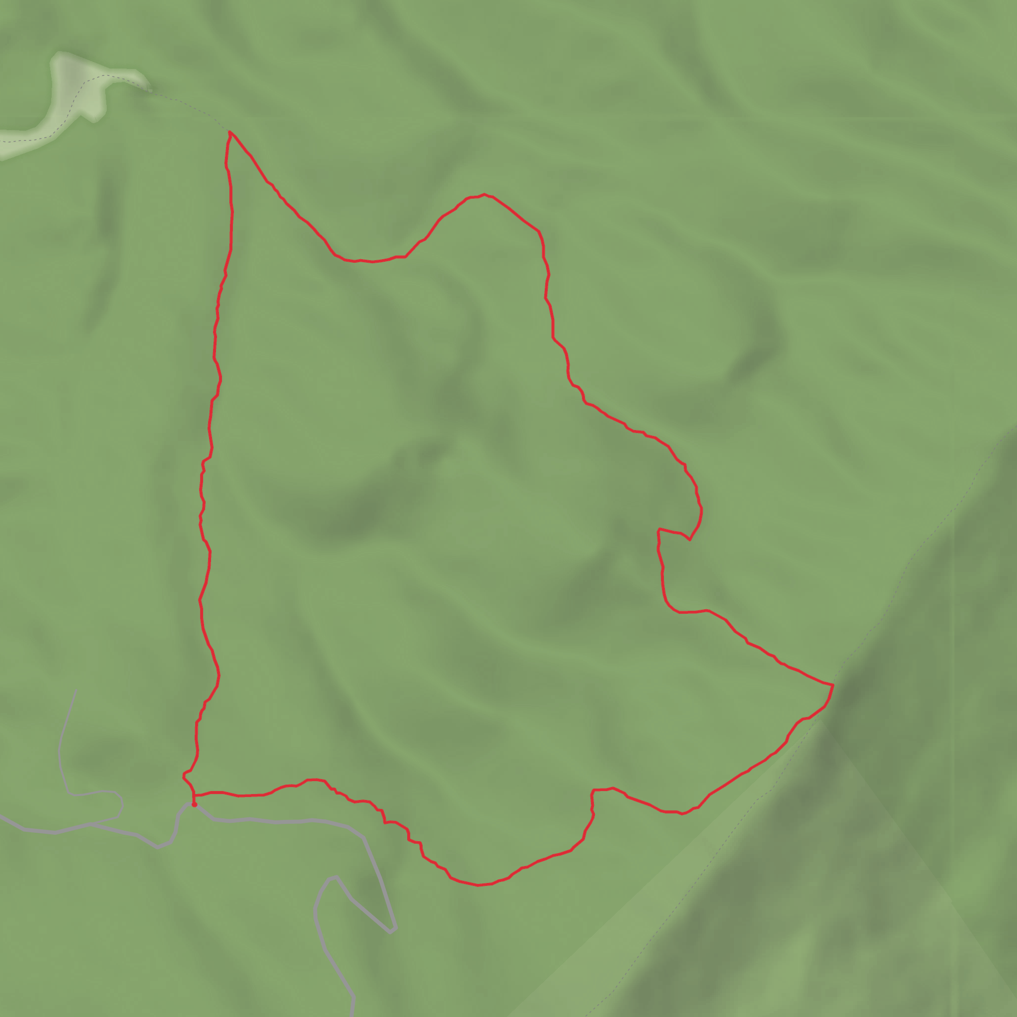
A compact loop with a steady climb to a broad, open ridge, this hike packs a lot into roughly 5 km (3.1 mi)—expect a mix of forest walking, a sustained ascent, and a more exposed section where weather can change the feel of the trail quickly. With about 200 m (656 ft) of total elevation gain, it’s a solid medium outing: short enough for a half-day, but steep enough in places to feel earned.
Getting to the trailhead (car + public transport)
You noted the hike starts “near” but didn’t include a location or coordinates. If you share a pin (lat/long) or even the nearest town/park name, I can convert it to the nearest recognizable address/landmark and give precise approach directions and parking notes.
For now, here’s the practical approach most hikers use for rural loop trailheads like this:
- By car: Plan for a small pull-off or informal parking area rather than a large lot. Arrive early on weekends. Bring offline access to the route in HiiKER because cell service can be patchy in upland forest/ridge terrain.
- By public transport: Many trailheads of this type are not directly served. The usual strategy is:
1) take regional transit to the nearest town, then
2) use a rideshare/taxi for the last few miles/km, or arrange a drop-off.
If you tell me the nearest town or coordinates, I’ll map the most realistic transit chain.
What the hike is like, step by step
0.0–1.2 km (0.0–0.75 mi): gentle warm-up through lower woods
The loop typically begins with an easy-to-moderate grade on a packed path or old track. This is where you’ll want to settle your pacing—because the climb usually arrives soon after. In damp seasons, watch for slick leaves on hardpack and shallow mud in low spots.
1.2–2.6 km (0.75–1.6 mi): the main climb (most of the 200 m / 656 ft gain)
This is the “work” section: a sustained ascent that can feel punchy despite the short overall distance. Expect:
- Short, steeper pitches where footing can loosen (small gravel, roots, or eroded tread)
- A noticeable temperature shift as you gain elevation—often cooler and breezier near the top
- More frequent blowdowns after storms in forested uplands
Pacing tip: if you’re breathing hard early, slow down—this climb is usually more enjoyable at a steady, conversational effort.
2.6–3.6 km (1.6–2.2 mi): ridge/opener terrain and the best sense of place
Near the high point, the trail often transitions to more open woods or ridge walking. Even without big “summit” drama, this is where you’ll feel the landscape open up—more light, more wind, and often longer sightlines through the trees. If there are any rock outcrops, ledges, or clearings on this loop, they’re commonly found around this segment.
Weather note: exposed or semi-exposed ridge sections can be significantly windier. A calm trailhead can turn into a chilly top—pack a light layer even on mild days.
3.6–5.0 km (2.2–3.1 mi): descent and return
The return leg usually trends downhill with a few rolling bumps. Descents are where most slips happen:
- Step carefully on roots and angled rock
- In wet conditions, treat wooden bridges/boardwalks (if present) as slippery
- Keep an eye out for trail junctions—loops sometimes have one or two intersections where it’s easy to take the wrong spur
Using HiiKER to confirm you’re staying on the loop at junctions is especially helpful here.
Landmarks, nature, and wildlife to look for
Because I don’t yet have the exact region for “Rich Patch Loop Trail,” I can’t responsibly name specific species unique to the area without risking misinformation. If you provide the state/park or coordinates, I’ll tailor this to the local ecology and call out the most likely wildlife and seasonal highlights.
That said, on a medium, ridge-oriented 5 km loop with ~200 m gain, hikers commonly encounter:
- Mixed woodland transitions: lower slopes often support denser, moisture-loving understory; higher ground tends to be drier with more open spacing between trees.
- Spring–early summer: wildflowers and fresh leaf-out; ticks become a bigger concern as vegetation thickens.
- Late summer: warmer, more humid climbs; insects can be active in sheltered sections.
- Autumn: excellent visibility through thinning leaves; leaf litter can hide rocks/roots.
- Winter/shoulder seasons: icy patches linger on shaded descents; traction can be useful even when the trailhead looks clear.
Wildlife awareness basics: - Give any animals space; never approach young wildlife. - Store snacks securely—small mammals learn quickly around popular trails. - Do a tick check after the hike, especially if the trail brushes through tall grass or dense understory.
Hazards and what to prepare for (medium difficulty done right)
- Footing: Trail erosion on the steeper climb and slick roots on the descent are the two most common issues.
- Navigation: Loops can be deceptively confusing at junctions—carry the route in HiiKER and confirm turns rather than assuming.
- Water: On short ridge loops, reliable water sources are often limited or seasonal. Carry what you need from the start (most hikers are comfortable with at least 1 liter
Surfaces
Ground
Unknown
Unpaved
Comments and Reviews
User comments, reviews and discussions about the Rich Patch Loop Trail, West Virginia.
average rating out of 5
0 rating(s)
