
Download
3D Flyover
Add to list
More
9.8 km
~1 hrs 57 min
7 m
Out and Back
“Wander Watoga’s hushed hardwood cathedral, where gentle paths, ferns, and clear streams invite an unhurried day.”
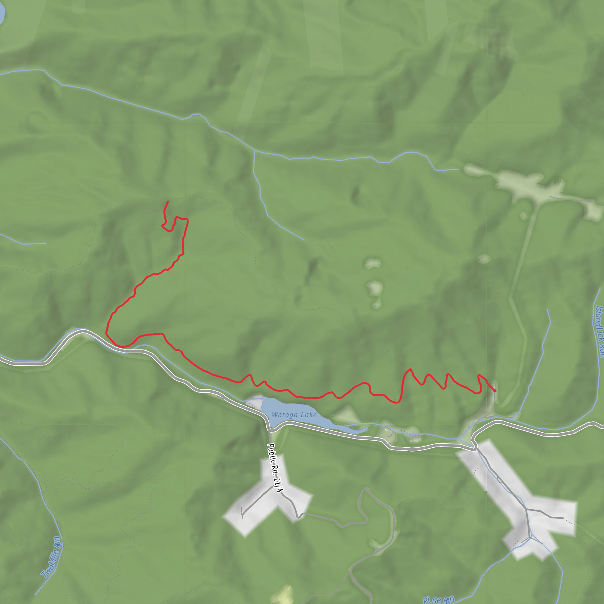
This easy, mostly level out-and-back (or short loop, if you choose to link trails) wanders through the heart of Watoga State Park in Pocahontas County, West Virginia—an area known for big hardwood forests, clear-running streams, and quiet, shaded walking that stays friendly for beginners. Expect a relaxed pace hike of about 10 km / 6.2 miles with minimal elevation change (around 0 m / 0 ft overall), ideal for families, casual walkers, and anyone looking for a low-stress day in the woods.
Getting to the start (car + public transport reality check)
Nearest significant landmark / address for the park: Watoga State Park, 4800 Watoga Park Rd, Marlinton, WV 24954. (wvstateparks.com)
From there, Bearpen Trail access is typically reached via internal park roads and signed trailheads shown on the official park map (look for “Bear Pen Trail” near the main developed areas around Watoga Lake and cabin/campground zones). (wvstateparks.com)
- By car: Most visitors approach from the Marlinton/Hillsboro area and enter the park via one of the signed entrances, then follow park signage toward Watoga Lake/cabin areas and the trailhead parking shown on the park map. (wvstateparks.com)
- By public transport: There isn’t practical, frequent public transit directly into Watoga State Park. Plan on driving, carpooling, or arranging a ride/taxi from Marlinton, WV (the park’s listed location city). (wvstateparks.com)
For on-trail navigation, download the route in HiiKER before you arrive so you can confirm which park trailhead you’re using and whether you’re doing a pure out-and-back or linking connectors for a longer walk.
What the walk feels like underfoot
Because this route is commonly treated as an easy woodland ramble, the tread is generally forgiving: packed dirt, leaf litter, and occasional rooty or slightly rocky patches typical of Allegheny Highlands forest trails. After rain, expect slick leaves, shallow mud, and wet boardwalk/bridge surfaces where the trail crosses drainages.
Even with “easy” grades, keep an eye out for: - Short, steeper nubs where the trail rolls over low ridges - Wet spots in shaded hollows that can stay muddy long after storms - Trail junctions where it’s easy to drift onto a connector (use HiiKER to confirm you’re staying on Bearpen)
Landmarks and natural highlights (with planning distances)
On a ~10 km / 6.2 mi plan, a simple way to think about the day is:
- 0.0–1.5 km (0.0–0.9 mi): Settling into the forest—quiet, shaded walking with the “park woods” feel: mixed hardwoods, filtered light, and the sound of small drainages depending on season.
- 1.5–5.0 km (0.9–3.1 mi): The most “in the woods” portion—expect longer uninterrupted stretches where you’ll see fewer buildings and more classic Appalachian understory (ferns, saplings, mossy logs). This is where you’re most likely to spot wildlife sign.
- Turnaround around 5.0 km (3.1 mi): Choose a natural stopping point (junction, stream crossing, or a comfortable flat) and return the same way for the cleanest logistics.
If you’d rather make it feel more like a tour than an out-and-back, Watoga’s trail system allows you to build a loop by incorporating Buck & Doe Trail and North Boundary Trail (the park specifically notes a loop option using these). (wvstateparks.com)
That loop is described by the park as roughly 4.75 miles (~7.6 km), so to reach ~10 km you’d typically add a short spur or an extra out-and-back segment from a junction. (wvstateparks.com
Comments and Reviews
User comments, reviews and discussions about the Bearpen Trail, West Virginia.
average rating out of 5
0 rating(s)
