Download
3D Flyover
Add to list
More
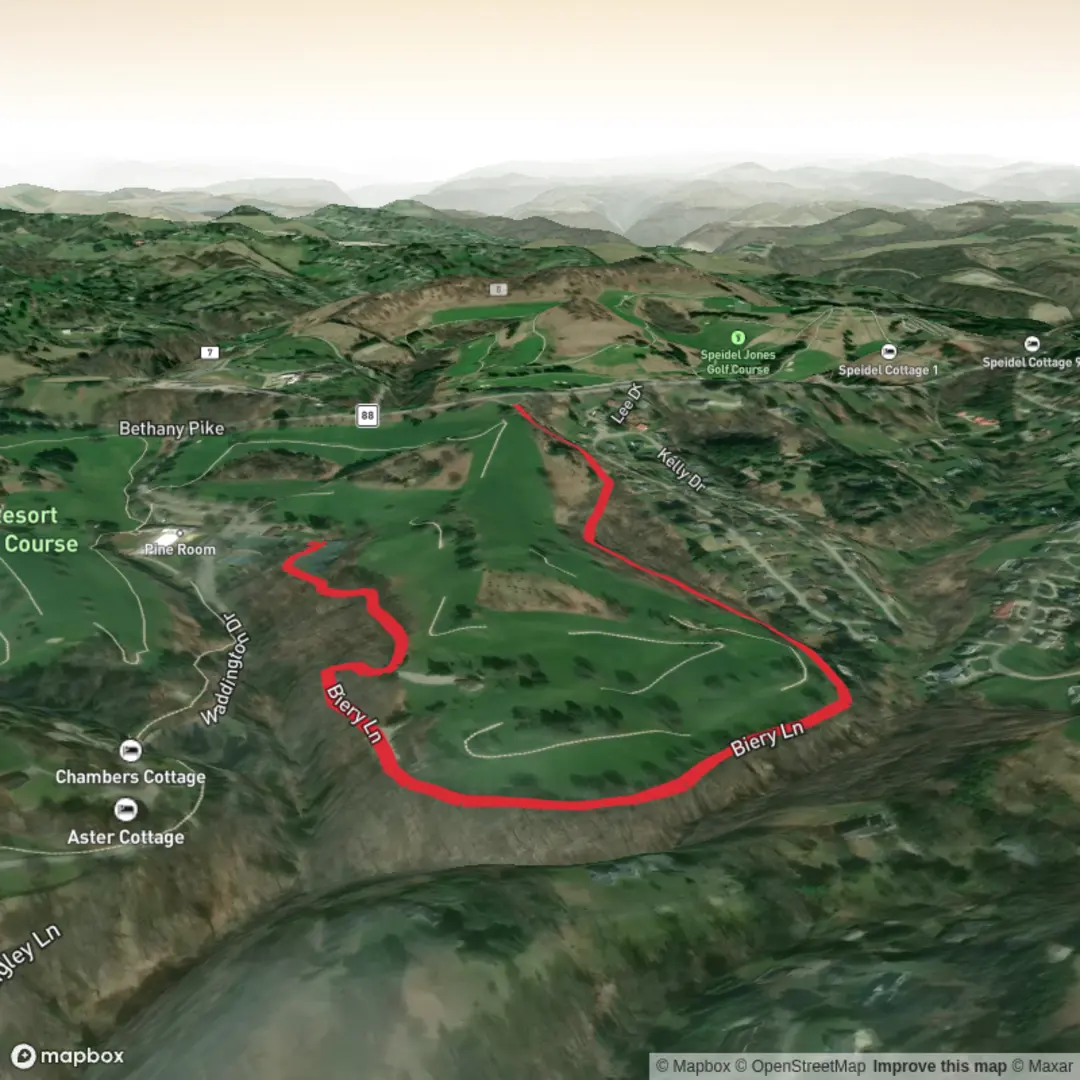
4.0 km
~47 min
0 m
Out and Back
“A gentle, mostly flat Roosevelt ramble—awaiting your map details to paint the landmarks.”
I’m missing a few key specifics needed to make this accurate (especially the trailhead location and what “near” refers to). Share either of the following and I’ll turn it into a complete, ready-to-hike description with landmarks, access, and planning details:
- A HiiKER link to “Roosevelt Trail – Purple Trail”, or
- The trailhead coordinates (lat, lon) (and, if you have them, the end point/parking coordinates), or
- A static map image of the route.
Also tell me: - State/park/city (there are multiple “Roosevelt Trail” routes in the U.S.). - Hike type: loop, out-and-back, or point-to-point (if you know).
Once I have that, I’ll: - Convert the lat/lon to the nearest known address or landmark (e.g., a named trailhead, park entrance, visitor center, or parking lot), - Give car + public transit approaches to the start, - Describe what to expect over ~4 km / 2.5 mi with ~0 m / 0 ft gain (easy, mostly flat), - Call out notable landmarks, typical flora/fauna, seasonal considerations, and any historical context tied to the specific Roosevelt site/region, - Include navigation guidance referencing HiiKER only.

Comments and Reviews
User comments, reviews and discussions about the Roosevelt Trail - Purple Trail, West Virginia.
average rating out of 5
0 rating(s)