Download
3D Flyover
Add to list
More
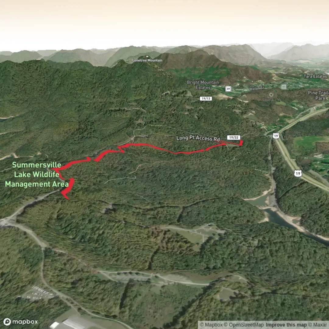
5.8 km
~1 hrs 15 min
59 m
Out and Back
“A trail tale waiting for its true starting point—share the coordinates, and the landscape comes alive.”
I’m missing a few key pieces of information needed to write an accurate, plan-ready description of this hike—especially because “Carpetpine Trail” isn’t unique and the start point is currently blank (“near …”). If you paste the trail’s start coordinates (lat, lon) (or a HiiKER link), I’ll convert them to the nearest known address/landmark and build the full description with distances, elevation, wildlife, landmarks, and any local history.
Please send any of the following (whatever you have):
- Start point: latitude/longitude (preferred)
- End point (if different): latitude/longitude
- Region/park/state/country (even a rough area helps)
- Hike type: loop / out-and-back / point-to-point
- Any map screenshot (optional)
Once I have the start location, I’ll include: - How to get there by car (parking, access roads) and public transport (nearest stop + walking connection) - A step-by-step route breakdown for ~6 km / 3.7 mi and ~100 m / 328 ft gain - What to watch for (trail surface, mud, crossings, exposure, seasonal issues) - Notable nature/wildlife and any historical context specific to that area

Comments and Reviews
User comments, reviews and discussions about the Carpetpine Trail, West Virginia.
average rating out of 5
0 rating(s)