Download
3D Flyover
Add to list
More
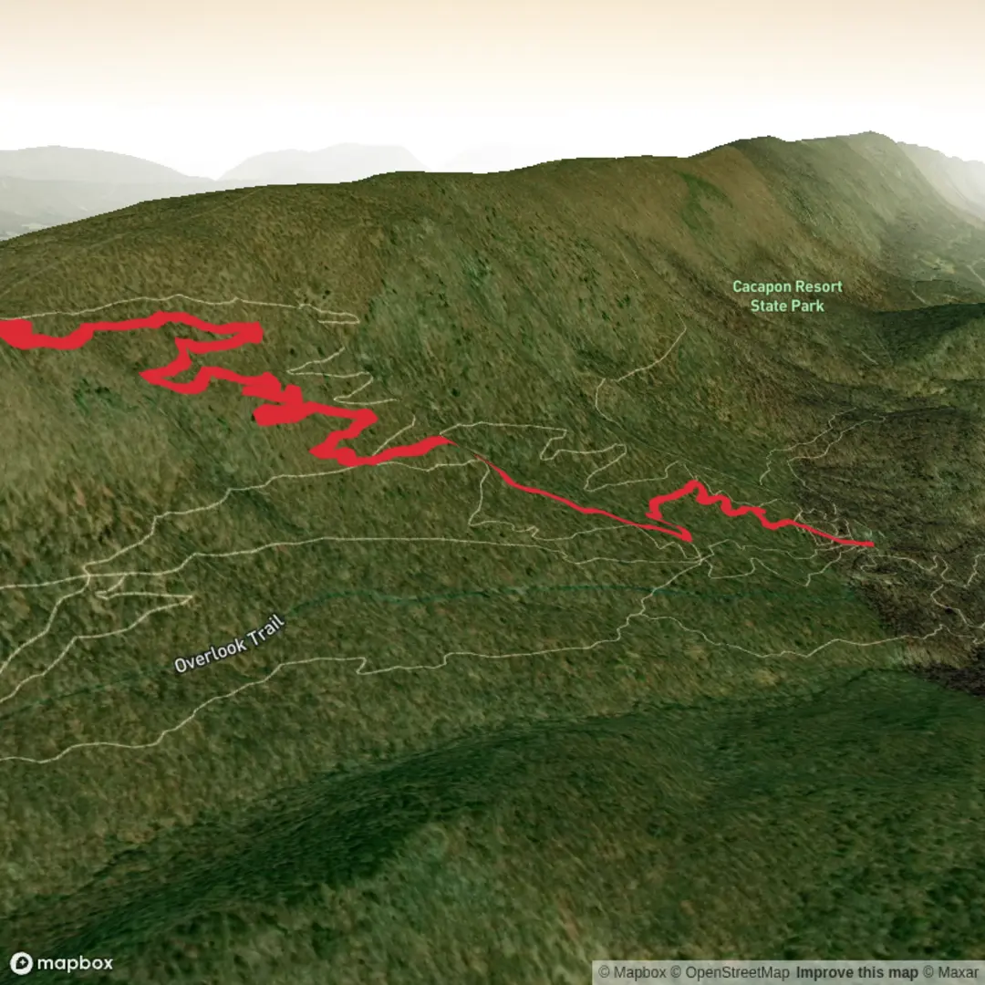
8.0 km
~2 hrs
246 m
Out and Back
“A vivid trail tale awaits—share the missing start point and route details to bring it to life.”
I’m missing a few key pieces needed to write this accurately (especially the start location). Please paste either a HiiKER link/GPX or the trailhead coordinates (lat/long). Right now “Hike head: near” is blank, and “Hike type” is blank—without at least a trailhead location I can’t convert coordinates to a nearby address/landmark, describe the correct terrain, or give reliable transport directions.
Send any one of these and I’ll write the full hike description in the format you asked for:
- Trailhead coordinates (and, if you have them, the end point too), e.g. 34.1234, -118.1234
- A HiiKER route link
- A GPX/KML snippet (or upload the file)
- A static map image of the route (I’ll use it for context)
Also tell me: - Hike type: loop / out-and-back / point-to-point (or I can infer it from the route) - The state/country (if you’re not sure, coordinates solve this)
Once you share that, I’ll include: - Segment-by-segment expectations with approx. distances and elevation in km + miles and m + feet - Key landmarks, typical conditions, hazards, and what to watch for - Likely flora/fauna for the exact area - Any relevant historical context tied to the region - How to get to the trailhead by car and public transport - Nearest known address or significant landmark to the provided coordinates

Surfaces
Dirt
Ground
Unknown
Comments and Reviews
User comments, reviews and discussions about the Middle Boy Scout and Party On, West Virginia.
average rating out of 5
0 rating(s)