
Download
3D Flyover
Add to list
More
2.5 km
~33 min
40 m
Loop
“A breezy, mostly level loop for a mindful wander—birds, plants, and quick turns stealing the show.”
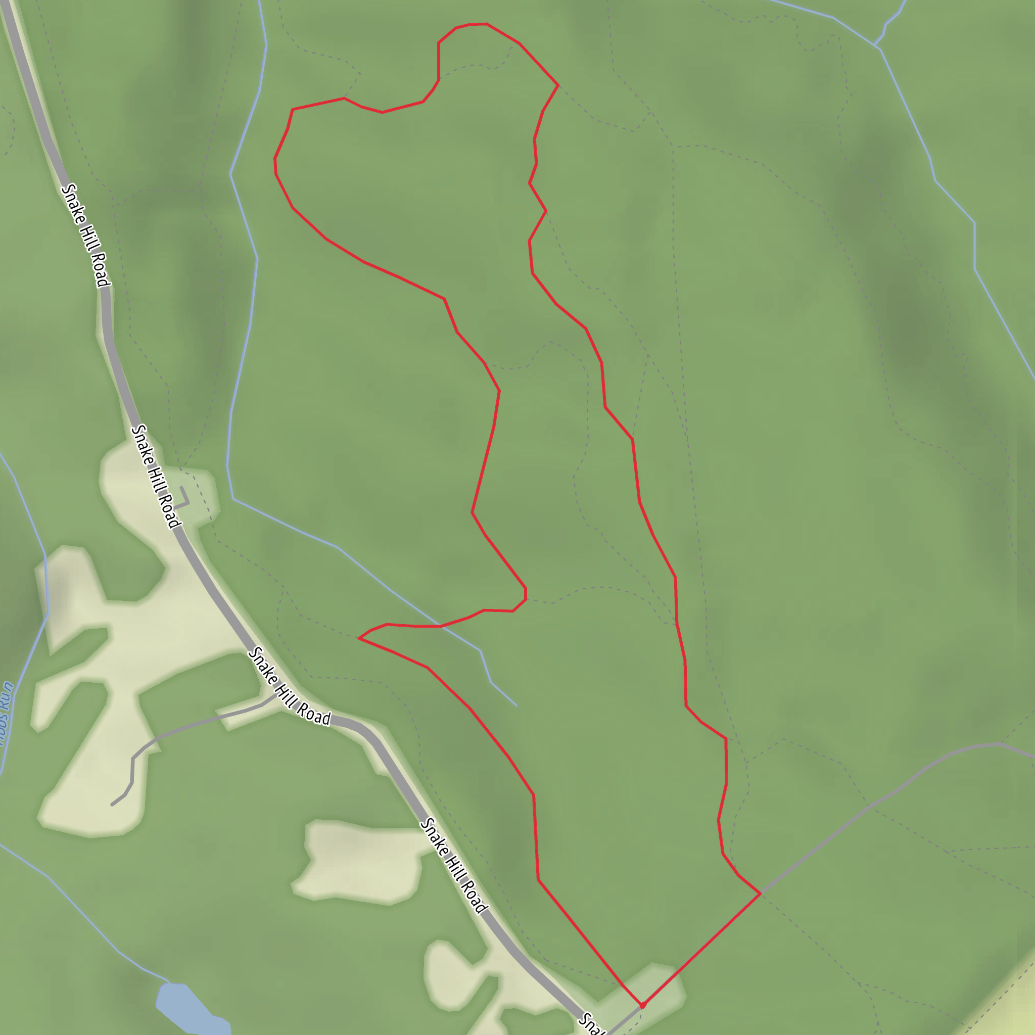
This is a short, flat loop (about 2 km / 1.2 mi with roughly 0 m / 0 ft of climbing) that’s ideal for a quick leg-stretcher, a family walk, or an easy nature loop where you can focus more on plants, birds, and trail features than on elevation or endurance. Expect a mostly level path with frequent small turns typical of “loop” systems—easy to follow, but it’s still worth having HiiKER open so you don’t accidentally take a connector and shorten (or lengthen) the walk.
Getting to the trailhead (car + public transport)
You noted the hike starts “near” something, but the location is missing. If you share either:
- a latitude/longitude,
- a HiiKER link,
- the park/trailhead name, or
- the nearest town/city,
I can convert the coordinates to the nearest known address or significant landmark and give precise, realistic directions.
Until then, here’s the practical approach that works for most Sidewinder-style loop trailheads (often in parks, preserves, or desert recreation areas):
- By car: Aim for the signed trailhead/parking area associated with the loop system. Arrive early on weekends—small lots fill quickly even for short trails. Bring a small amount of cash or a card in case there’s a day-use fee kiosk.
- By public transport: If the trail is in/near a city park system, the best strategy is usually to take transit to the closest major stop (park entrance, visitor center, or main road) and then walk the last 0.5–2.0 km (0.3–1.2 mi) on sidewalks/park roads to the trailhead. If it’s in a more remote recreation area, public transport may not be viable; rideshare to the nearest signed entrance is sometimes possible, but return service can be unreliable.
What the walk is like underfoot
Because the elevation gain is essentially negligible, the main “difficulty” factors are surface and exposure rather than steepness:
- Surface: Typically hard-packed dirt, decomposed granite, sand, or fine gravel. After rain, low spots can hold water or turn slick; in dry periods, sandy patches can feel softer and slightly slower.
- Width & obstacles: Expect a narrow-to-moderate singletrack with occasional pinch points, small roots/rocks, and short spur connections. Nothing sustained, but watch footing if you’re moving quickly.
- Wayfinding: Loop networks often have multiple junctions close together. Keep an eye out for trail markers and confirm junction choices with HiiKER so you stay on the intended “Sidewinder + Sidewinder North” loop rather than taking a shortcut.
Landmarks and points of interest
On a 2 km (1.2 mi) loop, landmarks tend to be subtle and close together. Common features to look for:
- Junction clusters: Early in the hike you’ll likely encounter one or two decision points where Sidewinder and Sidewinder North split or reconnect. These are the spots where people most often drift onto the wrong connector.
- Open viewpoints (micro-vistas): Even flat loops often pass small clearings—great places to pause for a quick scan of the surrounding terrain and to re-check your position on HiiKER.
- Vegetation transitions: Short loops frequently cross slightly different micro-habitats (a more shaded stretch vs. open scrub), which can change bird activity and the kinds of wildflowers you’ll see seasonally.
Nature and wildlife to watch for
Without the exact region, the safest planning guidance is to assume a typical park/preserve environment where wildlife is present but usually avoids people:
- Birdlife: Expect small songbirds and ground-foragers near brush edges; early morning is best for activity.
- Mammals: Rabbits/squirrels are common in many regions; larger mammals are usually crepuscular (dawn/dusk).
- Reptiles/insects (warm seasons): Stay alert for snakes on warm days, especially where the trail crosses sunny, open ground or edges of brush. Ticks and mosquitoes depend heavily on region and recent weather—long socks and a quick post-hike check are smart.
- Plants: If you’re in a desert or scrub environment, watch for spines/thorns encroaching on narrow tread. In greener parklands, poison ivy/oak can be the main concern—avoid brushing against unknown plants.
Safety and preparation (easy doesn’t mean “no planning”)
For a 2 km / 1.2 mi easy loop, you can keep it simple, but a few basics make the walk smoother:
- Water: At least 0.5 L (16–17 oz) per person in mild weather; more if it’s hot, sunny, or humid.
- Sun & heat: Hat + sunscreen; flat trails can still be fully exposed.
- Footwear: Comfortable walking shoes are fine; choose something with decent grip if the surface is sandy or gravelly.
- Navigation: Keep HiiKER handy for junctions and to confirm you’re completing the full loop.
- Timing: Most hikers will finish in 25–45 minutes, depending on stops and surface.
Historical significance (what to expect)
The name “Sidewinder” is commonly used in regions where sidewinder rattlesnakes are part of the local ecology, and it’s also a popular trail-naming convention in desert parks and preserves. The specific historical context—Indigenous history, settlement patterns, land-use (ranching, mining, rail, or conservation)—depends entirely on the
Surfaces
Unknown
Unpaved
Comments and Reviews
User comments, reviews and discussions about the Sidewider and Sidewinder North Loop Trail, West Virginia.
average rating out of 5
0 rating(s)
