Download
3D Preview
Add to list
More
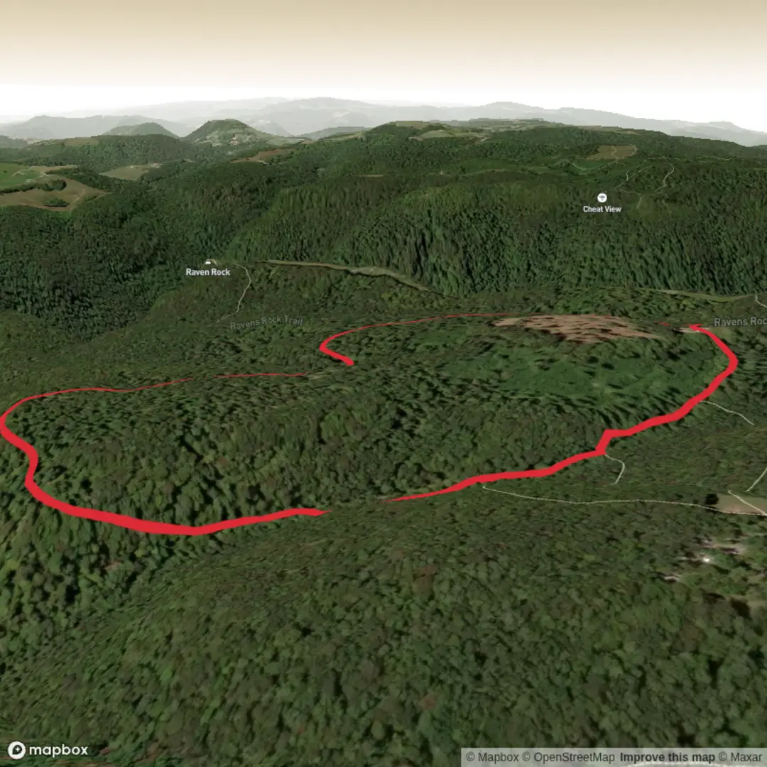
2.6 km
~36 min
55 m
Loop
“A trail’s story begins at the trailhead—share the start pin to unlock landmarks, wildlife, and history.”
I’m missing the key piece that determines everything else (access, landmarks, wildlife, history, and the “nearest known address/landmark” conversion): the start location.
Send either: - the longitude/latitude for the trailhead (preferred), or - a Google Maps pin/link, or - the park/trailhead name + town/state.
Also confirm these two fields (they’re blank in your details): - Hike head: near (what should this be near?) - Hike type: loop / out-and-back / point-to-point (you called it “Nature Loop Trail,” so I can assume loop unless you tell me otherwise)
Once I have the trailhead location, I’ll: - convert the lon/lat to the nearest known address or significant landmark - give a planning-ready description for a ~3 km / ~1.9 mi loop with ~100 m / ~328 ft gain (Medium), including approximate distance markers, what to watch for, notable features, likely wildlife/plant life, and any local historical context - include car + public transport options to the start - reference navigation using HiiKER only.

Comments and Reviews
User comments, reviews and discussions about the Nature Loop Trail, West Virginia.
average rating out of 5
0 rating(s)