Download
3D Flyover
Add to list
More
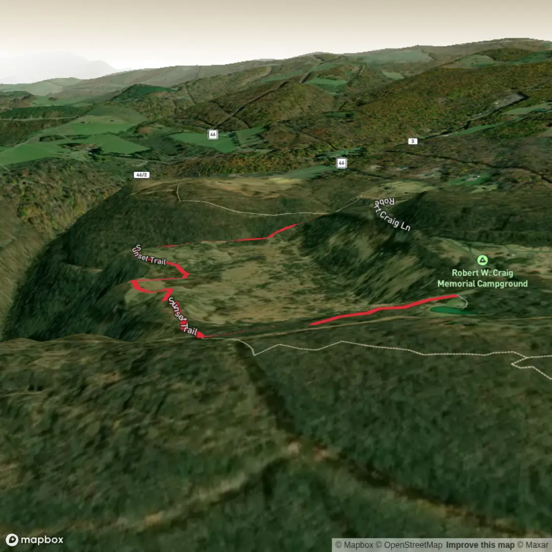
2.1 km
~28 min
33 m
Point-to-Point
“A sunset-named trail awaits—share a start point, and I’ll paint its true story.”
I’m missing the key location details needed to make this accurate. “Hike head: near” is blank, and there are no coordinates to convert to a nearby address/landmark—so I can’t reliably describe the terrain, landmarks, wildlife, access, or local history for the correct “Sunset Trail” (there are many with that name).
Send one of the following and I’ll write the full hike description exactly in the style you requested:
1) Start point coordinates (lat, lon) (and end point if different), or
2) A park/trail system name + city/state (e.g., “Sunset Trail, ___ Regional Park, __, __”), or
3) A HiiKER link to the route.
If you have them, also share:
- Hike type (loop / out-and-back / point-to-point)
- Any map screenshot or GPX (optional)
- Whether you want sunset timing/viewpoints emphasized (since it’s “Sunset Trail”)
Once I have the location, I’ll include:
- Distance ~2 km (1.2 mi) and elevation gain ~0 m (0 ft) with realistic on-the-ground expectations
- Turn-by-turn style cues using HiiKER for navigation references
- Notable landmarks, habitat, likely wildlife, and any seasonal hazards
- How to reach the trailhead by car and public transport, plus the nearest recognizable address/landmark converted from your coordinates

Comments and Reviews
User comments, reviews and discussions about the Sunset Trail, West Virginia.
average rating out of 5
0 rating(s)