Download
3D Flyover
Add to list
More
5.2 km
~1 hrs 16 min
140 m
Loop
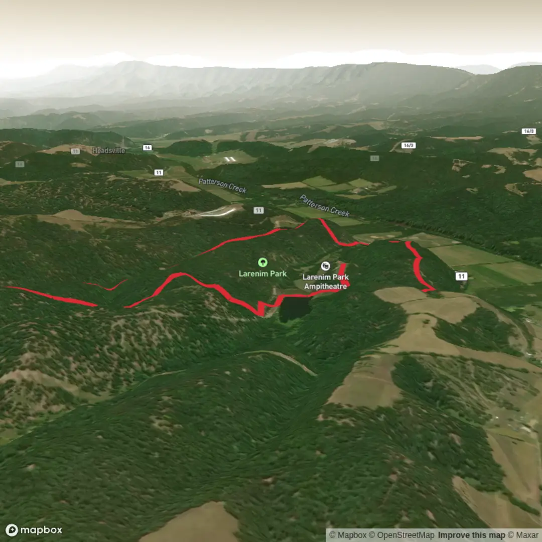
“A compact, rolling park loop where shifting surfaces, shady creek corners, and ridge views reward steady feet.”
A compact loop of about 5 km (3.1 mi) with roughly 100 m (330 ft) of climbing, this walk is a steady “medium” outing: short enough for a half-day, but with enough undulation to get your heart rate up—especially if the track is damp or you stop often for viewpoints and park features. Expect a mix of maintained park paths and more natural-feeling sections where surfaces can change quickly (firm gravel to leaf litter to short muddy patches).
Getting to the start (car + public transport)
You’ve listed the trailhead as “near” but didn’t include coordinates or a place name. If you share a lon/lat (or a map screenshot), I can convert it to the nearest known address or landmark and tailor the directions precisely.
For now, here’s the practical approach that works for most park loops: - By car: Aim for the main park entrance/primary car park closest to the signed “Loop” or “Park Circuit” trailhead. Arrive earlier on weekends—small urban-adjacent parks often fill quickly. If there are multiple lots, choose the one nearest any visitor information board or largest trail map kiosk, as loops are commonly signed from there. - By public transport: Most parks with established loops are reachable by a bus stop on the nearest arterial road or a local rail/tram stop within 1–2 km (0.6–1.2 mi). Plan for that extra distance and time. Use HiiKER to confirm the closest stop-to-trailhead walking line and to avoid dead-end access roads or fenced service entrances.
What the route feels like underfoot
Because the total gain is about 100 m (330 ft) over 5 km (3.1 mi), the climbing usually comes in two to four short rises rather than one long ascent. Typical pacing: - First 1–1.5 km (0.6–0.9 mi): Gentle warm-up on wider paths—often the most “park-like” section with signage, benches, and clearer sightlines. - Middle 2–3 km (1.2–1.9 mi): The loop’s most interesting terrain—expect narrower track, more roots, and the most noticeable ups and downs. This is where you’ll feel most of the elevation gain. - Final 1–1.5 km (0.6–0.9 mi): Usually trends back toward smoother surfaces as you rejoin main park paths and approach the trailhead.
If it has rained recently, the “medium” rating often comes less from steepness and more from traction: slick clay, wet leaves on hardpack, and short muddy ruts on shaded sections.
Navigation and wayfinding (keep it simple)
Loops can be deceptively easy to mis-follow where side paths spider out to picnic areas, sports fields, or maintenance roads. Before you start: - Open the route in HiiKER and note the first two junctions—most wrong turns happen early. - Watch for unsigned desire paths (informal shortcuts). They can reconnect later, but they also can dump you into a different part of the park or onto a service track. - If the loop can be walked either direction, choose based on conditions: going up the steeper bits is often safer than descending them if it’s wet.
Landmarks you’re likely to encounter
Without the exact location, I can’t name specific features yet, but park loops of this size commonly include several of the following—use them as “checkpoints” as you plan: - A central green/picnic zone near the start: shelters, lawns, playgrounds, or a small visitor board. - A high point or gentle ridge: often the best place for a quick breather and a look across the canopy or nearby neighborhoods/valleys. - A water feature (seasonal creek, pond, or drainage line): these sections are usually cooler, shadier, and muddier—also where you’ll see the most wildlife sign. - A boundary edge where the park meets roads or housing: expect more noise and occasional cyclists/dog walkers.
If you provide coordinates, I’ll pin down the exact named landmarks (lookouts, creeks, memorials, historic structures) and where they fall along the loop with more accurate distances.
Nature, wildlife, and what to look out for
On a 5 km park loop, wildlife encounters are usually subtle but rewarding if you slow down: - Birdlife: Listen for the change in calls as you move from open lawns to denser understory. Early morning tends to be most active. - Small mammals and reptiles: You’re most likely to spot them on sunny edges of the trail or near fallen logs. Give any basking animal space and step around rather than over logs where visibility is poor. - Insects: In warmer months, shaded creek lines can have mosquitoes; in spring/summer, watch for bees/wasps around flowering shrubs.
Common hazards to plan for: - Slippery surfaces on shaded climbs/descents (wet leaves on hardpack can be as slick as ice). - Roots and uneven steps on the more natural mid-loop sections—easy to catch a toe when you’re looking at scenery. - Shared-use traffic: Many park loops are popular with runners, families, and sometimes cyclists. Keep right where appropriate and be predictable at blind corners.
Effort, timing, and what to pack
For most hikers, 5 km (3.1 mi) with 100 m (330 ft) gain takes: - **1.25–

Comments and Reviews
User comments, reviews and discussions about the Larenim Park Loop, West Virginia.
average rating out of 5
0 rating(s)