Download
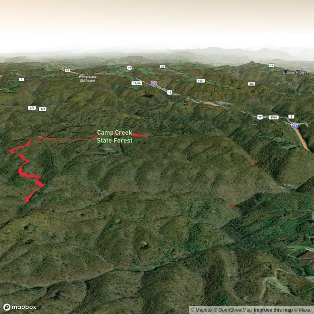
3D Flyover
Add to list
More
11.3 km
~2 hrs 35 min
201 m
Loop
“Wander shaded Appalachian forest from thundering falls to lively fords—more adventurous when creeks run high.”
Expect a relaxed, waterfall-and-creek kind of day with lots of shade, soft forest footing, and frequent water crossings. At roughly 11 km (6.8 mi) with about 200 m (656 ft) of total climbing, this route stays friendly for most fitness levels, but it can feel more “adventurous” than the numbers suggest when the creeks are up.
The hike begins at the Campbell Falls / Forest Access parking area in Camp Creek State Park & Forest. The nearest reliable “put-it-in-your-maps” destination is the park’s main address: Camp Creek State Park & Forest, 2390 Camp Creek Road, Camp Creek, WV 25820. From there, follow park signs toward Campbell Falls and the Forest Access parking. (wvstateparks.com)
Getting to the trailhead (car + public transport reality check)
By car: The park is close to I-77 (West Virginia Turnpike), Exit 20 (Camp Creek). From the exit area you’ll follow Camp Creek Road into the park; once inside, signage directs you to Campbell Falls and the Forest Access parking. (wvfalls.com)
By public transport: This is rural Mercer County—there typically isn’t a convenient bus/train option that drops you at the park entrance. The most workable approach is usually: get to Princeton, WV (regional bus service may be available depending on the day/operator), then use a taxi/rideshare for the last stretch to Camp Creek State Park. If you’re planning a car-free trip, confirm your last-mile ride in advance because cell coverage and driver availability can be limited.
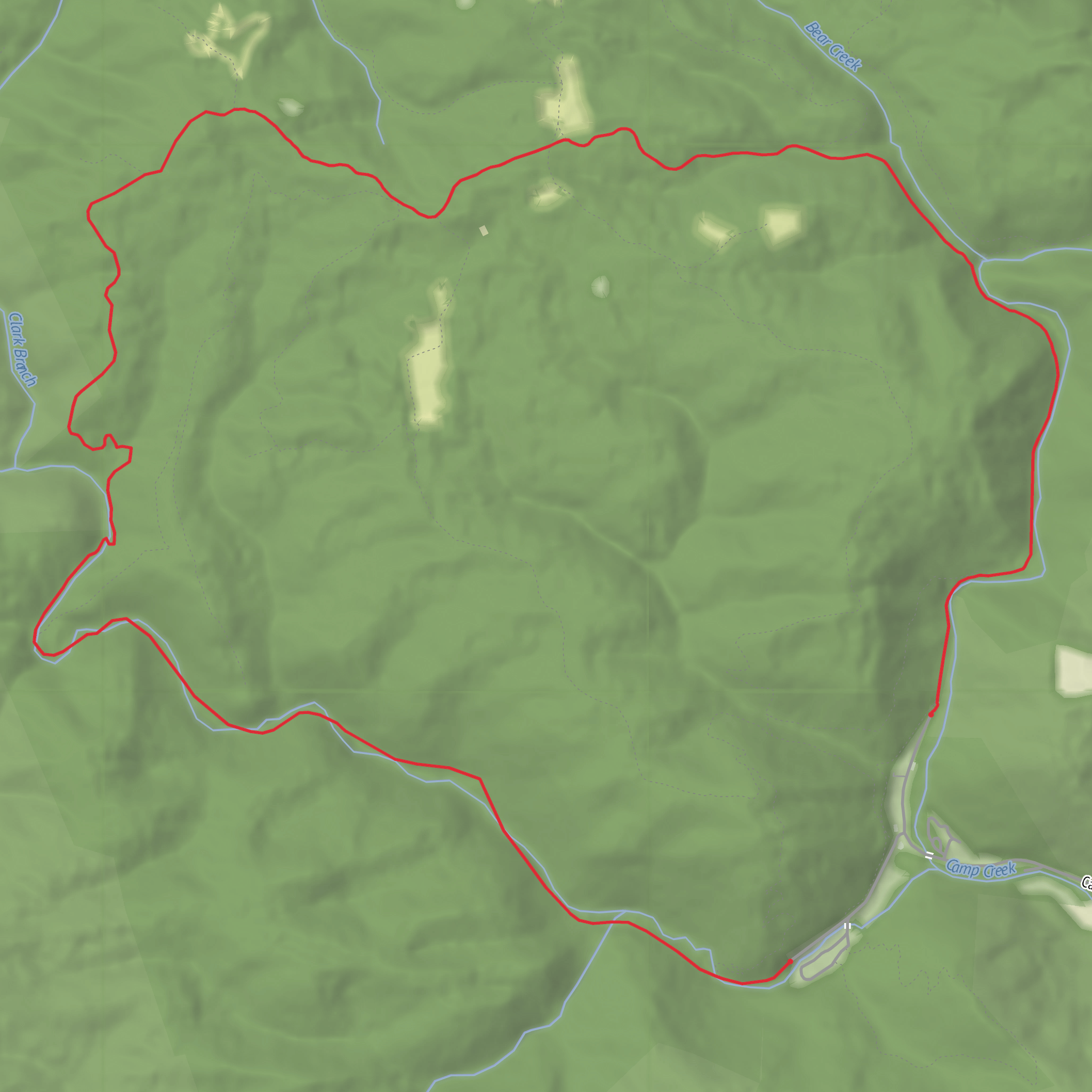
Once you’re parked, the route quickly commits to its theme: moving water. Early on, you’ll be on a gravel approach that passes Campbell Falls, a classic West Virginia cascade that’s often the first “wow” moment before you’ve even started counting miles. The trail system here is a mix of old road grades and narrower tread, so it’s easy to keep a steady pace.
From the falls area, the loop works its way toward Bear Creek and then climbs more assertively. The climb is short-lived but noticeable—think “wake up the legs” rather than “grind.” After that, the trail spends time along a ridgeline and then trends toward Mash Fork Creek, where the character changes again: you’ll encounter multiple creek crossings (the park’s own trail description notes nine crossings plus a tributary ford on this loop). (wvstateparks.com)
Creek crossings: what to look out for
These crossings are the main variable that can change an easy outing into a slow, careful one: - After rain, expect higher, faster water and slick rocks/logs. - Waterproof footwear helps, but traction matters more than “staying dry.” - Trekking poles can be useful for balance, but keep hands free if you need to brace. - If water is high enough that you’re unsure of footing, it’s smart to turn back—this loop’s difficulty is often dictated by water level, not elevation. (wvstateparks.com)
As you near Mash Fork Falls, you’ll get another highlight: a more tucked-away waterfall setting compared to Campbell Falls, with the sound of water guiding you in. The loop then uses gravel road/trail connectors to bring you back toward the developed park area. (wvstateparks.com)
Nature, wildlife, and seasonal conditions
This is Appalachian mixed forest—expect hardwoods, dense understory in places, and long stretches of shade. The area is known for wildlife viewing opportunities, and you may spot white-tailed deer, wild turkey, and a variety of songbirds and woodpeckers. In warmer months, watch for ticks in brushy edges and snakes near sunny openings and rockier creek margins (they’re usually avoidable if you step thoughtfully and don’t put hands where you can’t see).
Because the route follows creeks and
Comments and Reviews
User comments, reviews and discussions about the Turkey Loop Trail, West Virginia.
average rating out of 5
0 rating(s)
