Download
3D Flyover
Add to list
More
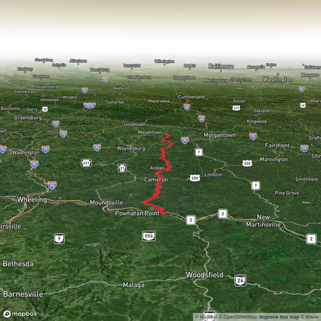
113.1 km
~5 days
2404 m
Multi-Day
“A vivid adventure awaits on Warrior Trail—share your start point so the story fits your path.”
I’m missing a few key pieces of location info to make this accurate and safe to plan from. “Warrior Trail” exists in multiple places, and your “Hike head: near” line is incomplete—without a start point (or a GPX / coordinates), I can’t reliably convert lon/lat to a nearby address/landmark, describe the correct terrain, or give realistic transport directions.
Send any one of the following and I’ll write the full, detailed hike description exactly in the style you requested:
- Start point coordinates (lon/lat) and, if possible, end point (or confirm it’s a loop)
- A HiiKER link to the route
- A GPX file (paste the text or upload)
- The country/state/region + the nearest town/park/trailhead name
Also confirm these (quick checkboxes is fine):
1) Hike type: point-to-point or loop?
2) Surface: mostly trail, forest road, beach, mixed? (if you know)
3) Season you’re planning (month) and whether you’ll camp or do it as a multi-day with lodging.
Once I have the start location, I’ll include:
- Segment-by-segment expectations across ~113 km / 70 mi and ~2,500 m / 8,200 ft gain
- Water/food resupply logic, typical hazards, and what to watch for
- Notable landmarks + ecology/wildlife typical to that exact region
- Any relevant historical/cultural context tied to the places you’ll pass
- How to reach the trailhead by car and public transport, with the nearest recognizable address/landmark derived from your coordinates
- Navigation guidance referencing HiiKER only

Surfaces
Unknown
Asphalt
Unpaved
Gravel
Paved
Comments and Reviews
User comments, reviews and discussions about the Warrior Trail, West Virginia.
average rating out of 5
0 rating(s)