Download
3D Flyover
Add to list
More
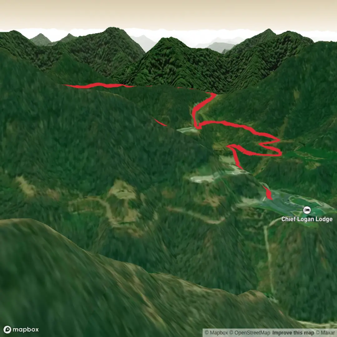
4.4 km
~1 hrs 2 min
91 m
Loop
“A short, punchy woodland loop with rolling climbs, rooty footing, and quick-spark moments of view and wildlife.”
I’m missing a few key specifics needed to make this accurate (especially the start location). If you paste the trail link (HiiKER) or the trailhead coordinates (lat/long), I’ll convert them to the nearest known address/landmark and tailor everything—parking, transit, landmarks, and what to watch for—exactly to the right place.
For now, here’s a planning-ready description based on what you provided (a ~4 km / ~2.5 mi loop or lollipop with ~100 m / ~328 ft gain, medium effort), written so you can swap in the exact trailhead once you share it.
You’ll be covering a short but punchy route—about 4 km (2.5 mi) with roughly 100 m (328 ft) of climbing—so expect a steady “up-and-down” feel rather than a long grind. Most hikers finish in 1–2 hours depending on stops and trail conditions. Because it’s rated Medium, plan for uneven footing, a couple of short climbs, and at least one section where you’ll want to slow down for roots/rocks or a narrow tread.
Getting to the start (car + public transport)
By car: Aim to arrive with enough time to find legal parking without rushing—many short, popular trails fill up quickly on weekends. If the trailhead is at a park or conservation area, look for a signed main lot rather than roadside pull-offs (which are often posted or soft-shouldered). Once you share the trailhead coordinates or HiiKER link, I’ll identify the nearest signed lot and the closest “pin-able” landmark (visitor center, gate, picnic area, etc.).
By public transport: For most trailheads, the workable strategy is:
1) take transit to the nearest town center or major stop, then
2) use a short rideshare/taxi to the trailhead, or walk if it’s within a couple miles.
Send the nearest city/state (or coordinates) and I’ll outline the most realistic transit approach and the closest stop.
What the hike feels like underfoot
With ~100 m (328 ft) of gain packed into ~4 km (2.5 mi), the climbing is noticeable but not relentless. Expect: - A warm-up section (first ~0.5–1.0 km / 0.3–0.6 mi): usually gentle grade where you can settle into pace and check gear. - A main climb or rolling rise (~1.0–2.5 km / 0.6–1.6 mi): where most of the elevation is gained. This is where footing often gets more textured—embedded rocks, roots, or short steeper pitches. - A return leg (~last 1–1.5 km / 0.6–0.9 mi): typically easier, but watch for downhill slip hazards if the surface is dusty, leaf-covered, or muddy.
If the route combines Wild Turkey Trail and Wilderness Trail, it often means you’ll have at least one junction where it’s easy to take the wrong spur. Use HiiKER to confirm you’re on the intended track at every signed intersection, especially if multiple loops share the same corridor.
Landmarks and points of interest (what to look for)
On a hike this length, the “highlights” tend to come in quick succession rather than being one big destination. Common features on paired loop systems like this include: - A small high point or overlook: even modest elevation can open up a view through the canopy, especially in leaf-off seasons. - Edge habitat transitions: where forest meets meadow/brush or a wetter drainage—these are often the best wildlife-viewing zones. - Interpretive signs or boundary markers: “Wilderness” naming sometimes indicates a protected parcel, older land-use history, or a management designation.
If you share the location, I’ll call out the specific landmarks (named overlooks, creek crossings, old foundations, memorials, etc.) with approximate distances.
Nature and wildlife (and what to watch for)
The trail names strongly suggest you’re in habitat that supports ground-foraging birds and mixed woodland.
Wild turkey: You’re most likely to spot them early or late in the day along quieter stretches. Give them space—especially in spring when behavior can be more assertive. If you encounter a group on-trail, pause and let them move off rather than pushing through.
Other common wildlife considerations (U.S. context): - Ticks: If you’re hiking in brushy edges or leaf litter, do a tick check afterward and consider long socks/repellent. - Snakes: In warmer months, watch sunny rock edges and the sides of the tread. - Deer and small mammals: Often seen near dawn/dusk; they can startle and bolt across trail.
Plants: Expect seasonal changes—spring wildflowers, summer dense understory, fall leaf cover that can hide rocks/roots. Leaf-covered tread is one of the biggest “medium hike” injury multipliers because it disguises ankle-twisting terrain.
Navigation and trail etiquette
Even on a 4 km (2.5 mi) outing, junction density can make navigation the main challenge. - Keep HiiKER open and confirm your position at every trail name sign. - If the system uses blazes, don’t assume blaze color alone is enough—some parks reuse colors on different loops. - Yield to uphill hikers on steeper pitches, and expect faster users (trail runners) on short loop networks.
Conditions, gear, and pacing
For a medium 4 km (2.5 mi) hike with modest gain: - Footwear: trail shoes with decent tread

Surfaces
Unknown
Ground
Paved
Comments and Reviews
User comments, reviews and discussions about the Wild Turkey Trail and Wilderness Trail, West Virginia.
average rating out of 5
0 rating(s)