Download
3D Flyover
Add to list
More
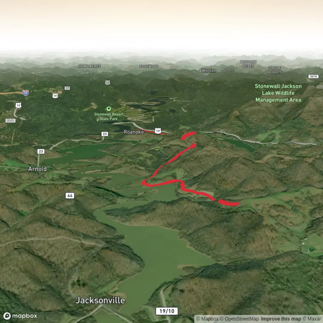
10.1 km
~2 hrs 19 min
191 m
Out and Back
“A vivid hike awaits—but it needs a precise trailhead to keep guidance safe and true.”
I’m missing a few key pieces needed to write this accurately (especially the start location). “Arnold Road Trail” exists in multiple places, and your “Hike head: near” field is blank—so I can’t convert coordinates to a nearby address/landmark or give correct transport directions and local history without risking sending you to the wrong trail.
Send any one of the following and I’ll produce the full 10 km (6.2 mi), ~200 m (656 ft) easy-hike description exactly in the style you requested:
1) A lon/lat pair for the trailhead (example: -122.1234, 47.1234), or
2) A Google Maps link / pin, or
3) The nearest town + state/province + country, plus where you plan to park (if known).
Also, if you know them, include:
- Hike type: loop / out-and-back / point-to-point
- Any must-hit waypoint names (lake, lookout, bridge, ruins), if you have them
Once you share the trailhead location, I’ll: - Convert it to the nearest known address or significant landmark - Explain what the terrain is like, where the ~200 m (656 ft) is gained, and what to watch for - Include landmarks, habitat, likely wildlife, and historical context for that specific region - Give car + public transport options to the start - Reference navigation using HiiKER only (no other tools)

Comments and Reviews
User comments, reviews and discussions about the Arnold Road Trail, West Virginia.
average rating out of 5
0 rating(s)