
Download
3D Flyover
Add to list
More
2.1 km
~24 min
0 m
Loop
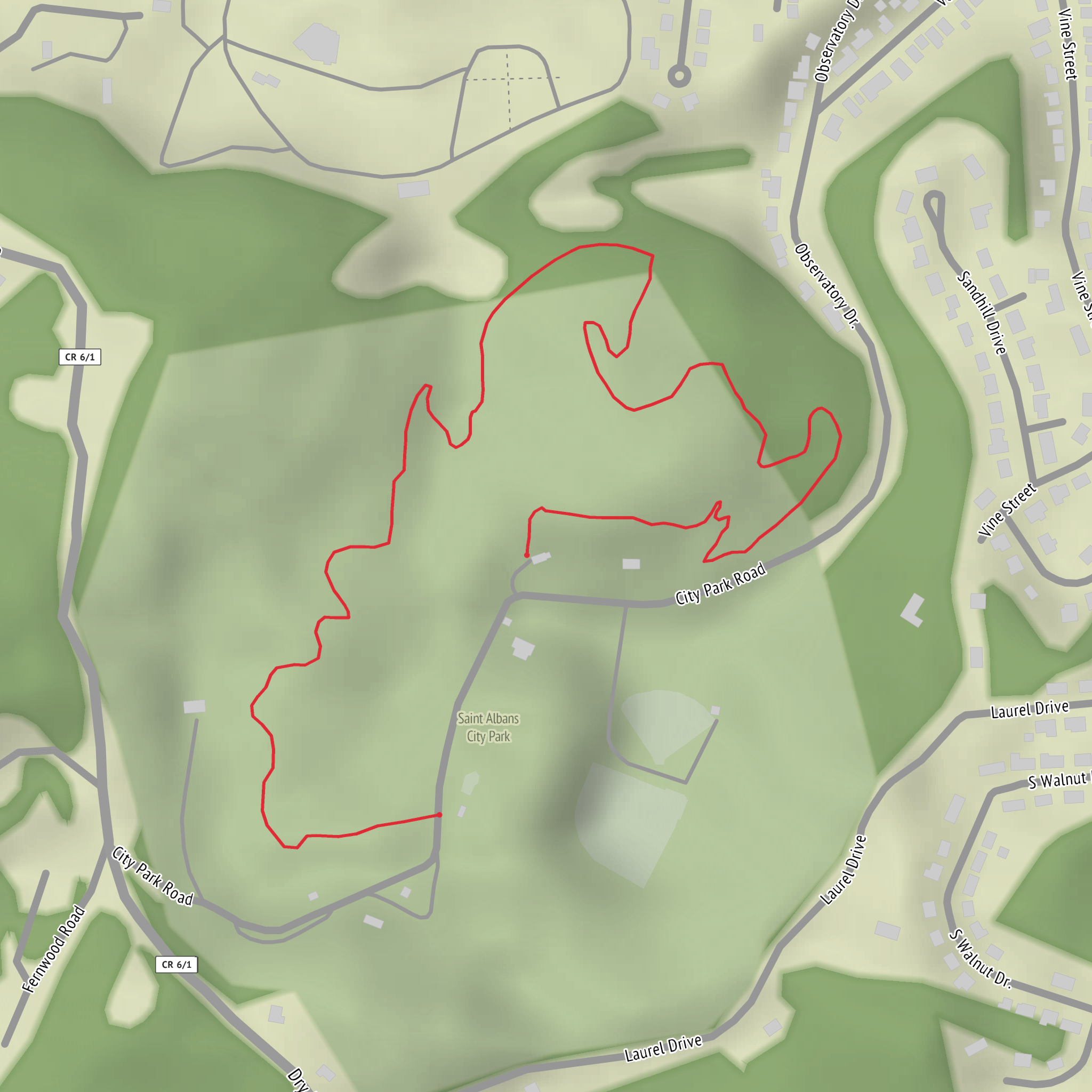
“A breezy, mostly level wander where shade, surfaces, and signage shape a gentle escape.”
This is a short, mostly level outing—about 2 km (1.2 mi) with roughly 0 m (0 ft) of climbing—well-suited to beginners, families, or anyone wanting a quick leg-stretcher. Because the elevation change is minimal, the main things that shape the experience are surface conditions (pavement vs. packed dirt), shade/exposure, and how well the route is signed.
Before I can convert coordinates to a nearby address/landmark and give you accurate, place-specific details (wildlife, notable features, history, and the best way to reach the trailhead), I need one missing piece:
- Trailhead location: please send the latitude/longitude (or a HiiKER link, or the nearest town/park name). Your “Hike head: near” field is blank.
In the meantime, here’s what you can expect and how to plan for a flat 2 km (1.2 mi) “easy” route like this, plus the exact info I’ll tailor once you share the trailhead location.
What the walk will feel like (pace, surfaces, accessibility)
- Time on feet: most hikers take 25–45 minutes for 2 km (1.2 mi), depending on stops and group size.
- Typical surfaces: easy, flat trails are often paved multi-use paths, gravel, or hard-packed dirt. After rain, even “flat” routes can develop puddles, slick mud, or thin algae on shaded pavement/boardwalk—the most common slip hazard on easy walks.
- Accessibility: with near-zero elevation gain, this may be suitable for strollers or mobility devices if the surface is paved or well-compacted and there are no pinch points (gates, steps, narrow bridges). I’ll confirm once I know the location.
Navigation (keep it simple, but don’t skip it)
Even short trails can have confusing junctions in parks or campuses. - Download the route in HiiKER before you go and save it offline if cell service is spotty. - Watch for short connector spurs that look “more trail-like” than the main route—easy trails often share corridors with service roads or wider paths that people mistakenly avoid.
Landmarks and points of interest (how I’ll map it once you share the start point)
On a 2 km (1.2 mi) route, you’ll usually have 1–3 standout features rather than a long sequence of sights. Depending on where Rotc Trail is, common highlights include: - A trailhead kiosk or interpretive sign (often where rules, hours, and a local map are posted) - A water feature (pond/creek/drainage) with birds and amphibians - A viewpoint or open lawn/field that’s good for a quick rest - A historic marker (especially if the trail is in a municipal park, near an older neighborhood, or on repurposed infrastructure)
If you provide coordinates, I’ll convert them to the nearest known address or significant landmark (for example, a park entrance, visitor center, major intersection, or named facility) and then lay out the route with approximate distances like: - 0.0 km / 0.0 mi: start at [nearest landmark/address] - 0.5 km / 0.3 mi: junction/bridge/interpretive sign - 1.0 km / 0.6 mi: turnaround or key feature - 2.0 km / 1.2 mi: finish/loop closure
Nature and wildlife to look out for (varies a lot by region)
With an easy, flat trail, wildlife viewing is often best at the edges—near water, brushy margins, and quiet corners away from playgrounds/roads. Once I know the region, I’ll be specific, but typical sightings on short park-style trails include: - Songbirds and woodpeckers in tree cover; waterfowl if there’s a pond/creek - Squirrels, rabbits, and occasionally deer in greener corridors - Ticks and mosquitoes in warm months—especially in tall grass or near standing water - Poison ivy/oak/sumac depending on the state/region (I’ll confirm what’s relevant where this trail is)
What to bring (light kit, but don’t under-pack)
For a 2 km (1.2 mi) easy walk: - Water: at least 250–500 ml per person (more in heat/humidity) - Footwear: sneakers are usually fine; choose something with decent tread if it’s dirt/gravel - Sun/wind layer: flat trails can be surprisingly exposed - Bug/tick protection: repellent and a quick post-hike check if the corridor is grassy/wooded
Getting to the start (car + public transport framework)
Once you share the trailhead location, I’ll give exact directions and the nearest transit stops. In general: - By car: look for the primary park entrance lot or the closest legal street parking near the signed trailhead. I’ll note any common issues like “lot fills by 10 a.m.” or “no parking on shoulders.” - By public transport: the best approach is usually bus/rail to the nearest major stop, then a 0.5–2.0 km (0.3–1.2 mi) walk to the trailhead. I’ll identify the closest stop and the safest walking approach (crosswalks, sidewalks, busy
Comments and Reviews
User comments, reviews and discussions about the Rotc Trail, West Virginia.
average rating out of 5
0 rating(s)
