Download
3D Flyover
Add to list
More
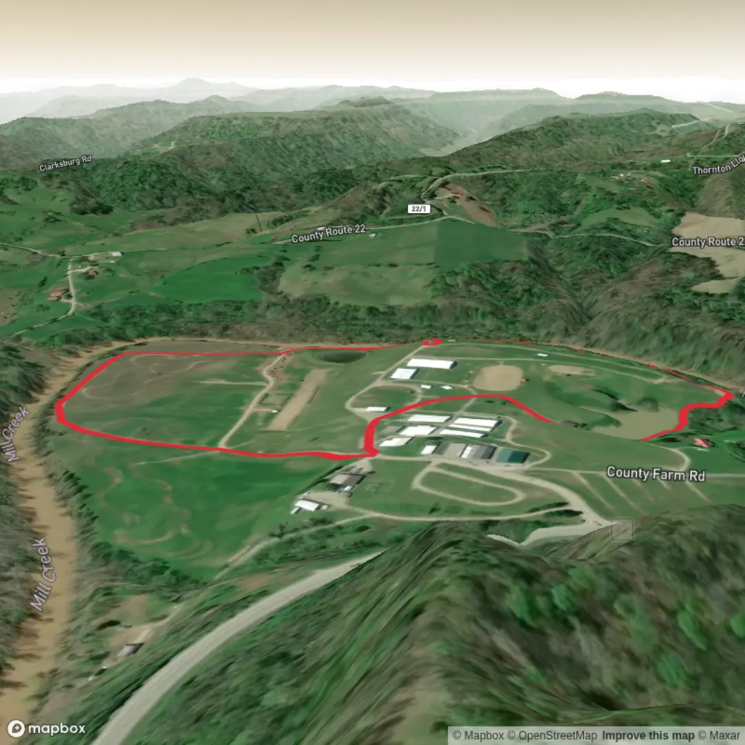
2.2 km
~25 min
0 m
Loop
“A trail tale still taking shape—share the trailhead, and the landscape comes into focus.”
I’m missing a few key pieces of location data to make this accurate and to convert the start point to a nearby address/landmark.
Send either of the following and I’ll write the full hike description exactly as you requested: - A lon/lat for the trailhead (or a map screenshot), or - The park/forest/town + state/country where “Derby Trail” and “Smoldering Trail” are located, plus the preferred start/parking area name if you know it.
Also, if you have them, paste any of this (optional but helpful): - Trailhead coordinates for both ends (if it’s point-to-point) - The intended route shape (loop vs out-and-back) since “Hike type” is blank - Any notes you already have (surface type, boardwalks, seasonal closures, etc.)
Once I have the trailhead location, I’ll include: - Turn-by-turn expectations with approximate distances in km + miles (2 km ≈ 1.2 mi) and elevation in m + ft (0 m ≈ 0 ft) - What to watch for (mud, roots, ticks, flooding, signage) - Landmarks, habitat, likely wildlife, and any local historical context - How to reach the start by car and public transport - Navigation guidance referencing HiiKER only - The trailhead described as the nearest known address or significant landmark (converted from lon/lat)

Comments and Reviews
User comments, reviews and discussions about the Derby Trail and Smoldering Trail, West Virginia.
average rating out of 5
0 rating(s)