Download
3D Flyover
Add to list
More
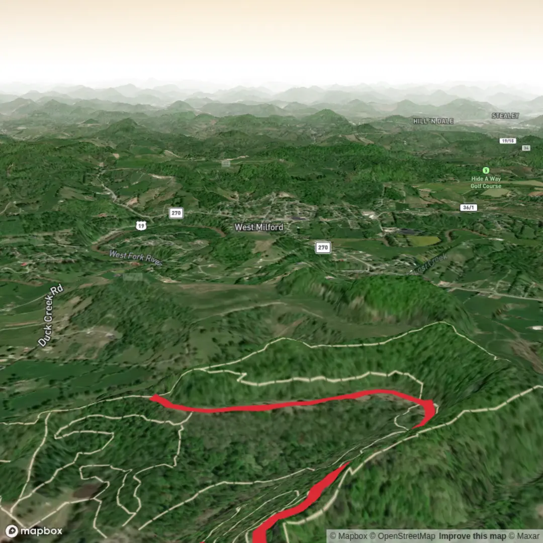
5.3 km
~1 hrs 9 min
65 m
Out and Back
“Share a start point or nearby landmark, and I’ll paint a gentle, well-signed walk—eyes open.”
I’m missing the key location details needed to describe and plan this hike accurately. “Rachel Hershey” could refer to multiple places/tracks, and your “Hike head: near” field is blank—so I can’t convert coordinates to a nearby address/landmark or give reliable transport directions yet.
Send one of the following and I’ll write the full hike description (≈5 km / 3.1 mi, ≈100 m / 330 ft gain, Easy) with landmarks, nature/wildlife, hazards, and any local history—using HiiKER for navigation references:
1) Start point coordinates (lat, lon) and (if you have it) end point or a GPX link
2) The nearest town/park/trailhead name + state/country (e.g., “near Hershey, PA” or “near [Park Name]”)
3) A HiiKER route link for “Rachel Hershey”
Also confirm these two items so I match your intent:
- Hike type: loop, out-and-back, or point-to-point?
- Surface/setting: forest track, coastal path, paved greenway, desert wash, etc. (if known)
Once you provide the location, I’ll include: - Driving approach + parking notes, and public transport options to the closest practical stop - Turn-by-turn style expectations by distance (km/mi) and climbing (m/ft) - What to watch for (mud, ticks, snakes, exposure, stream crossings, trail junctions) - Notable viewpoints/structures/ecology and any historical context tied to the specific area

Comments and Reviews
User comments, reviews and discussions about the Rachel Hershey, West Virginia.
average rating out of 5
0 rating(s)