Download
3D Flyover
Add to list
More
5.9 km
~1 hrs 32 min
215 m
Out and Back
“A compact woodland loop of roots, mud, and punchy climbs—quietly testing legs and focus.”
This is a compact, rolling loop-style outing of about 6 km (3.7 mi) with roughly 200 m (656 ft) of climbing—enough elevation change to feel like a workout, but broken into manageable rises and dips that suit a medium difficulty day. Expect a mix of well-trodden nature-trail tread and narrower woodland singletrack, with frequent roots and short, punchy grades rather than long sustained climbs.
Getting to the trailhead (car + public transport)
You didn’t include the actual “near …” location or any coordinates, so I can’t convert a lon/lat to a nearby address/landmark yet. If you share the town/park name or a pin/coordinates, I’ll translate it to the nearest recognizable trailhead/landmark and tailor directions precisely.
For now, here’s the practical approach most hikers use for trail systems that include a “Nature Trail” spur:
- By car: Aim for the main park entrance / nature center / primary day-use parking lot associated with the Youngs Nature Trail. These areas typically have the most reliable parking, signage, and a kiosk map. Arrive earlier on weekends—nature-trail lots fill quickly because they attract walkers and families as well as hikers.
- By public transport: If the area is served by buses, the most reliable strategy is to route to the closest stop on a main road bordering the park, then walk in via the signed access path to the nature trail. Use HiiKER to confirm which access point connects cleanly to the Youngs Nature Trail without forcing a road-walk on narrow shoulders.
What the hike feels like underfoot
Most of the elevation gain (~200 m / 656 ft) tends to come in short climbs—the kind where you’ll notice your breathing for a few minutes, then recover on flatter benches. Underfoot, plan for:
- Packed dirt and leaf litter in dry conditions
- Mud pockets in shaded low spots after rain (especially where the trail crosses seepage lines)
- Roots and small rocks on the steeper pitches—trekking poles can help with traction and knee comfort on the descents
- Occasional narrow sections where vegetation encroaches in summer
Because the total distance is modest, many hikers underestimate it; the “medium” rating usually comes from grade changes + footing, not mileage.
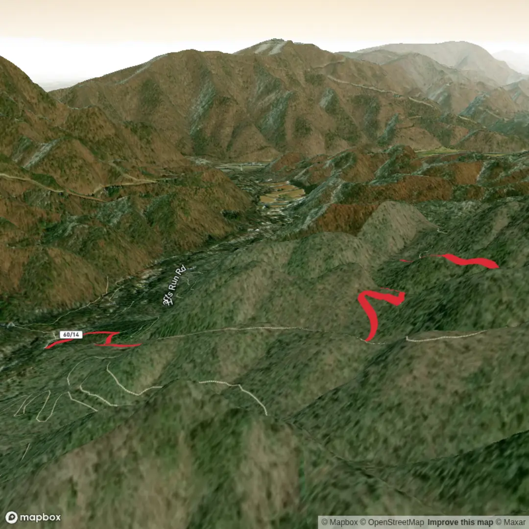
Route flow and key waypoints (approximate)
Without your exact start point, this is the typical, planning-friendly breakdown for a 6 km loop that links a nature trail with a “Black Bear” segment:
- 0.0–1.5 km (0.0–0.9 mi): Gentle warm-up on the Youngs Nature Trail. Expect interpretive-style trail design: smoother tread, more frequent junctions, and occasional boardwalk/bridging in wetter pockets. Elevation gain is usually modest here—think 30–60 m (100–200 ft) spread out.
- 1.5–3.5 km (0.9–2.2 mi): Transition onto the Black Bear Trail proper. This is often where the trail narrows and the grade steepens. Plan for the most sustained climbing in this middle section—roughly 100–140 m (330–460 ft) depending on how the loop is laid out. Look for a high point that may be marked by a subtle ridge, a change in forest type, or a more open understory.
- 3.5–6.0 km (2.2–3.7 mi): Rolling return with intermittent descents. The downhill can be deceptively slick if the surface is hard-packed with a thin layer of leaves. Expect short, steeper drops rather than a single long descent, with a final easy cruise back toward the nature-trail corridor.
Use HiiKER at junctions—nature-trail networks often have multiple short connectors that can accidentally shorten or lengthen your loop if you miss a turn.
Landmarks, nature, and what to watch for
Trails named “Black Bear” are often in regions where bears are part of the ecosystem (or where the name reflects local heritage). Either way, the landscape tends to be classic mixed woodland habitat:
- Forest and plants: Expect a canopy of mixed hardwoods and/or conifers depending on your region, with seasonal wildflowers in spring and dense green understory in summer. In fall, leaf cover can hide roots and rocks—slow down on descents.
- Water features: Many nature trails are routed near small creeks, seeps, or wetland edges. These areas are beautiful but can be buggy in warm months and muddy after rain.
- Wildlife: Deer and small mammals are common; birds are often a highlight in the quieter morning hours. If you’re in black bear country, hike smart:
- Make noise in low-visibility sections (dense brush, bends, near running water)
- Keep food sealed; don’t linger eating at blind corners
- Give any wildlife space and never approach cubs
- Ticks and insects: In much of the U.S., ticks are a real consideration in brushy edges and leaf litter. Wear long socks, consider permethrin-treated clothing, and do a full tick check after.
Safety, timing, and planning notes
- Time estimate: Most hikers will take 1.5–2.5 hours depending on stops, trail conditions, and how “punchy” the climbs are.
- Footwear: Light hikers or trail runners work in dry weather; after rain, choose shoes with solid lugs for mud and leaf-slick slopes.
- Water: For 6 km

Surfaces
Ground
Unknown
Comments and Reviews
User comments, reviews and discussions about the Black Bear Trail via Youngs Nature Trail, West Virginia.
average rating out of 5
0 rating(s)