Download
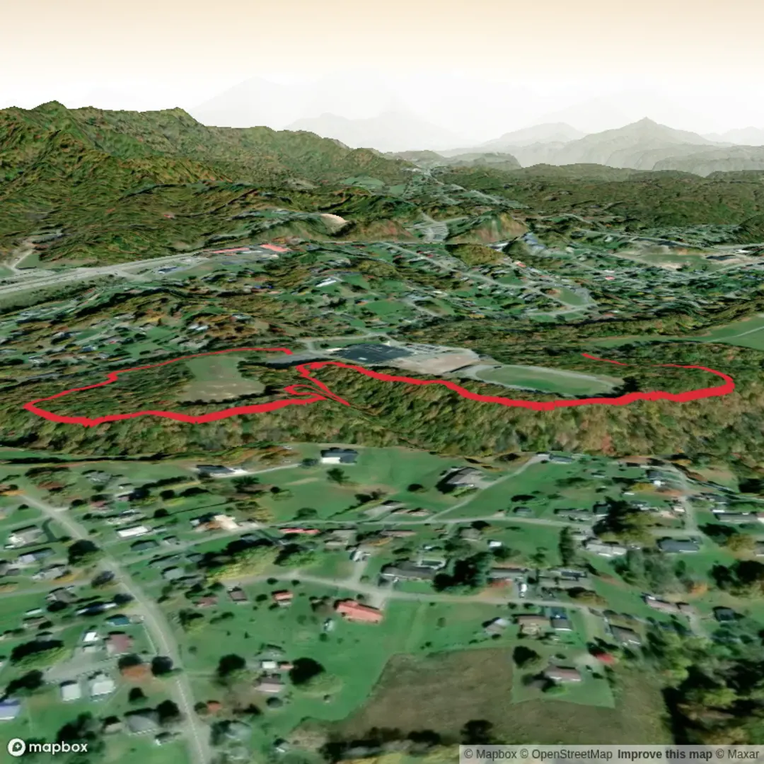
3D Flyover
Add to list
More
3.8 km
~45 min
0 m
Out and Back
“A breezy, mostly level campus loop of sidewalks and shade—best enjoyed outside school rush.”
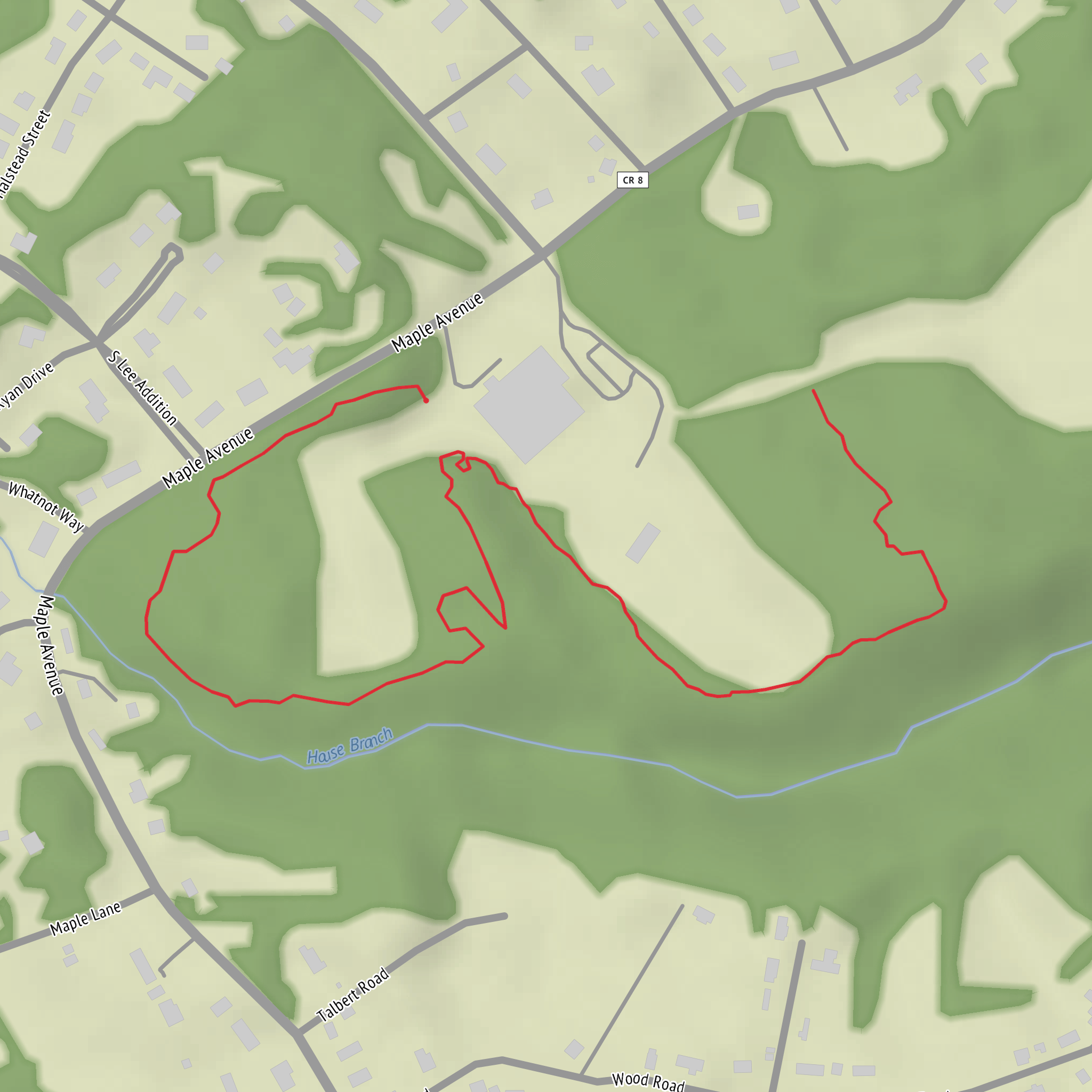
This is a short, flat, low-stress walk of about 4 km (2.5 miles) with essentially 0 m (0 ft) of climbing—ideal for a quick leg-stretcher, a jog/walk combo, or an easy outing with kids. Because it’s centered around a school campus and nearby neighborhood paths, expect paved sidewalks, campus walkways, and possibly a short section of packed gravel depending on how you link the loop.
Getting to the start (car + public transport)
- By car: The simplest approach is to navigate to Fayetteville High School and park in visitor/overflow lots if posted as available. Outside of school hours, parking is often easiest; during arrival/dismissal windows, traffic patterns and restricted areas can make access slower.
- By public transport: If Fayetteville has local bus service, the most reliable plan is to route to a stop closest to Fayetteville High School and walk the final few minutes. Use your transit app to time it around school bell schedules, since some routes run less frequently mid-day.
If you share the state (and any coordinates/lon-lat you have for “Hike head: near …”), I can pin the start to the nearest real-world address or landmark precisely—there are multiple “Fayetteville High School” locations in the U.S., and I don’t want to point you to the wrong one.
What the route feels like underfoot
Plan on a mostly level, hard-surface outing. Over 4 km (2.5 miles), most hikers will take 45–75 minutes at an easy pace, depending on stops and crossings.
- 0.0–1.0 km (0.0–0.6 mi): You’ll typically begin on campus-adjacent sidewalks or a perimeter path. Expect crosswalks, curb cuts, and occasional short ramps. This first stretch is usually the busiest: student drop-off lanes, staff parking entrances, and morning/afternoon traffic.
- 1.0–2.0 km (0.6–1.2 mi): The walk often settles into a quieter rhythm as you move along the outer edge of school grounds and into nearby residential streets or green buffers. If there’s a track, practice fields, or a stadium, you’ll likely pass them here—good visual anchors if you’re checking progress in HiiKER.
- 2.0–3.2 km (1.2–2.0 mi): This is commonly the most pleasant portion: tree-lined blocks, small lawn corridors, or a short connector path between streets. Shade can be intermittent; in warmer months, heat off pavement can be noticeable even on an “easy” walk.
- 3.2–4.0 km (2.0–2.5 mi): The final leg usually returns you toward the main campus frontage. Expect the most road crossings here as you rejoin busier access roads.
Navigation and safety (especially around a school)
Even though it’s easy and flat, this kind of route benefits from a quick check on HiiKER before you go: - Confirm the exact loop you intend to follow (campus paths can look “open” but be fenced or signed as staff-only). - Watch for one-way campus drives and no-pedestrian zones near loading areas. - Time your hike to avoid arrival/dismissal peaks if you want a calmer walk.
Key things to look out for: - Traffic pinch points: drop-off loops, bus lanes, and parking lot entrances. - Surface hazards: painted crosswalks can be slick when wet; leaf litter can hide uneven sidewalk edges. - Lighting: if you’re walking near dusk, some campus edges are well-lit while neighborhood connectors may be dim.
Landmarks you’re likely to pass
Because this is a school-centered loop, the “landmarks” are usually built features rather than remote natural ones: - Athletic facilities (track, football/soccer field, baseball/softball diamonds) - Auditorium/gym frontage and main entrance signage (useful for confirming you’re on the correct side of campus) - Neighborhood parks or small greenways if the loop ties into local recreation corridors
If you provide the start coordinates, I can call out the most prominent nearby landmark (e.g., a named park, stadium, or trailhead sign) and the nearest street address for parking and pickup.
Nature, wildlife, and what to expect seasonally
Even in a developed setting, you’ll usually get a surprising amount of everyday wildlife: - Birdlife: robins, sparrows, starlings, crows, and seasonal migrants; raptors sometimes circle over open fields. - Small mammals: squirrels are common; rabbits may appear near field edges at dawn/dusk. - Insects: in warm months, expect mosquitoes near any drainage swales or retention ponds; after rain, ants and beetles are active along curbs.
Vegetation is typically ornamental trees and maintained lawns, with occasional pockets of native shrubs if there’s a buffer strip or drainage corridor. After storms, watch for downed branches and muddy runoff at curb ramps.
Practical planning (what to bring for an easy 4 km / 2.5 mi)
- Footwear: comfortable walking shoes are fine; pavement-heavy routes can be harder on feet than dirt.
- Water: a small bottle is usually enough, but bring more in hot/humid weather—flat doesn’t mean cool.
- Sun/wind protection: open
Comments and Reviews
User comments, reviews and discussions about the Fayetteville High School Trail, West Virginia.
average rating out of 5
0 rating(s)
