Download
3D Flyover
Add to list
More
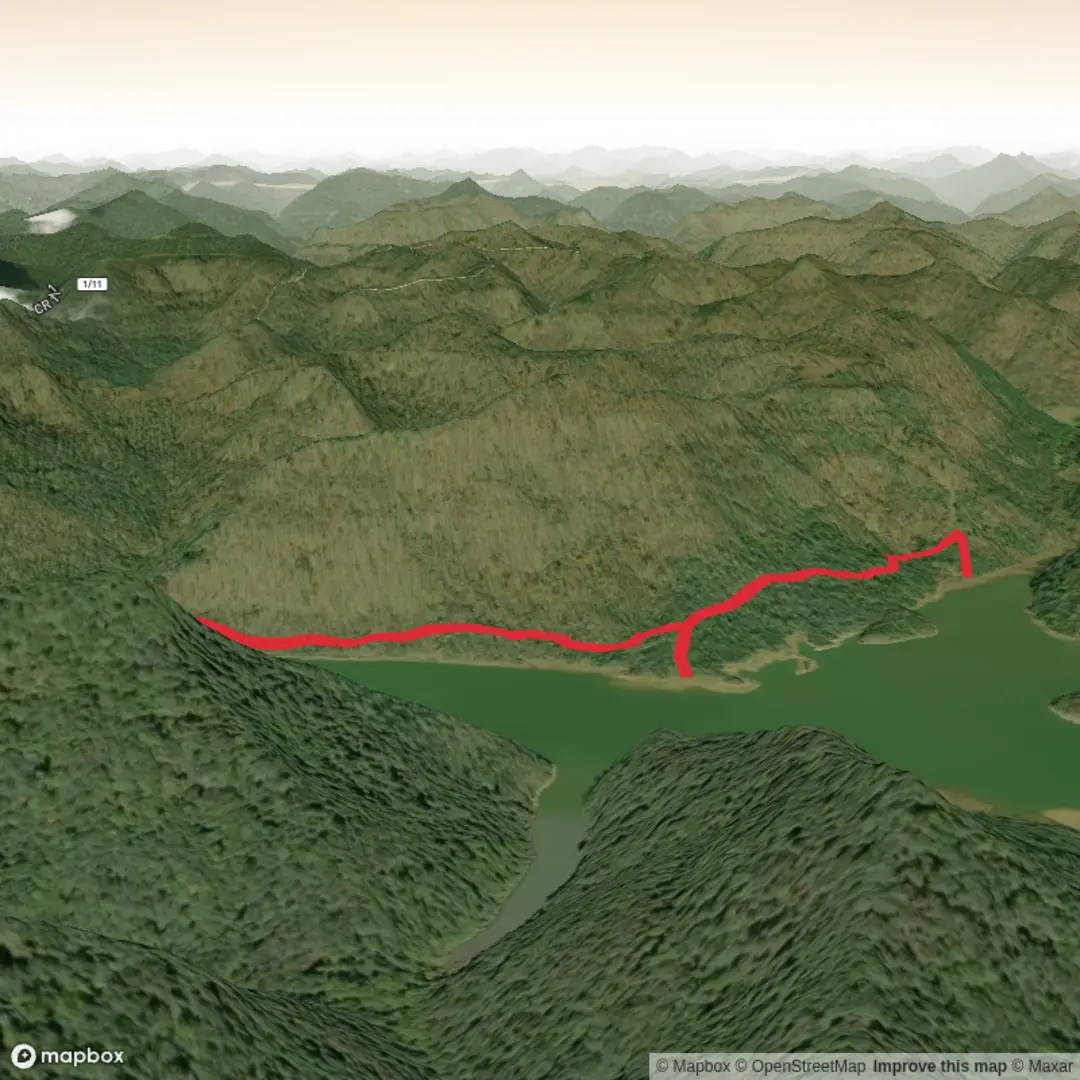
5.0 km
~1 hrs 5 min
53 m
Out and Back
“A trail’s story waits in the thicket—share a pin or map, and I’ll paint the journey.”
I’m missing a few key pieces of information needed to describe this specific “Thicket Trail” accurately (there are multiple trails with that name in different places), and you didn’t include coordinates or a map.
Send one of the following and I’ll write the full hike description exactly in the style you requested (with distances/elevation in km + miles and m + ft, landmarks, wildlife, hazards, history, and detailed logistics):
1) Start point coordinates (lat, lon) (or a GPX/AllTrails/HiiKER link), or
2) The park/forest name + nearest town/state, or
3) A static map image of the route.
Also, please fill in these blanks (even rough is fine):
- Hike head (trailhead) near: (town/landmark)
- Hike type: loop / out-and-back / point-to-point
- Any lon/lat locations you want converted to the nearest known address/landmark (paste them)
Once I have the location, I’ll: - Convert any coordinates to the nearest recognizable address or major landmark - Explain how to get to the trailhead by car and public transport - Describe what to expect along the route with approximate distance markers (e.g., 0.5 km / 0.3 mi, 2 km / 1.2 mi, etc.) - Note seasonal conditions, trail surface, mud/water crossings, ticks/poison ivy, and other common “easy-trail” gotchas - Reference navigation using HiiKER only

Comments and Reviews
User comments, reviews and discussions about the Thicket Trail, West Virginia.
average rating out of 5
0 rating(s)