Download
3D Flyover
Add to list
More
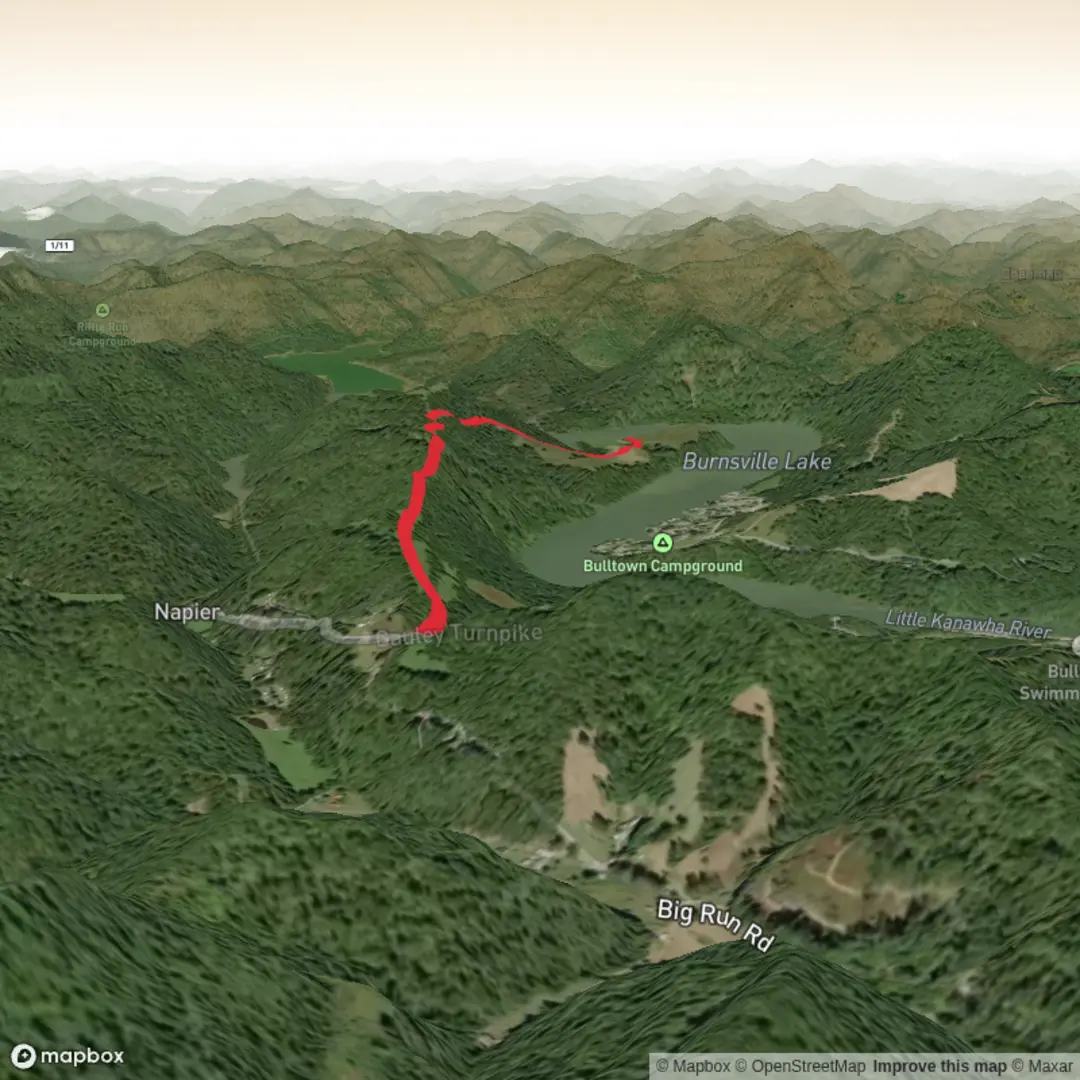
5.7 km
~1 hrs 19 min
105 m
Out and Back
“A gentle Indian Ridge ramble awaits—share a pin, and I’ll shape a mindful route.”
I’m missing a few key pieces of information to describe the right Indian Ridge Trail (there are multiple “Indian Ridge Trail” routes in the U.S. and elsewhere), and your hike details have a couple of blanks.
Send any one of the following and I’ll convert it to the nearest known address/landmark and build the full 6 km (3.7 mi), ~100 m (330 ft) easy hike plan from there:
1) Start point coordinates (lat, lon) (best), or
2) A HiiKER link, or
3) The park/forest/town + state (e.g., “near ___, Colorado”), or
4) A map screenshot of the route.
Also confirm these two fields (even a guess is fine):
- Hike head (near): (town/park/landmark)
- Hike type: out-and-back / loop / point-to-point
Once I have the location, I’ll include: - driving + public transport options to the trailhead, - turn-by-turn expectations with approximate distance markers in km and miles and elevation in m and ft, - notable landmarks, terrain, and seasonal conditions, - likely wildlife + what to watch for, - any relevant historical/cultural context for the specific region, - and navigation notes using HiiKER only.

Comments and Reviews
User comments, reviews and discussions about the Indian Ridge Trail, West Virginia.
average rating out of 5
0 rating(s)