Download
3D Flyover
Add to list
More
117.6 km
~6 days
5322 m
Multi-Day
“Embark on a captivating journey through the rugged beauty and historical tapestry of the Western Pasayten - Ross Lake Loop.”
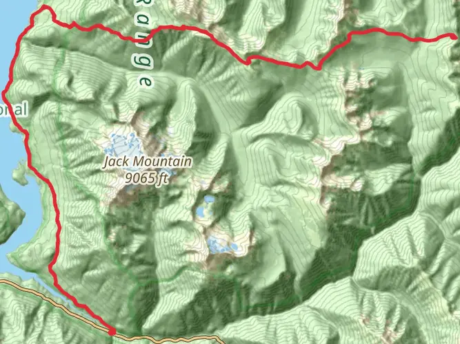
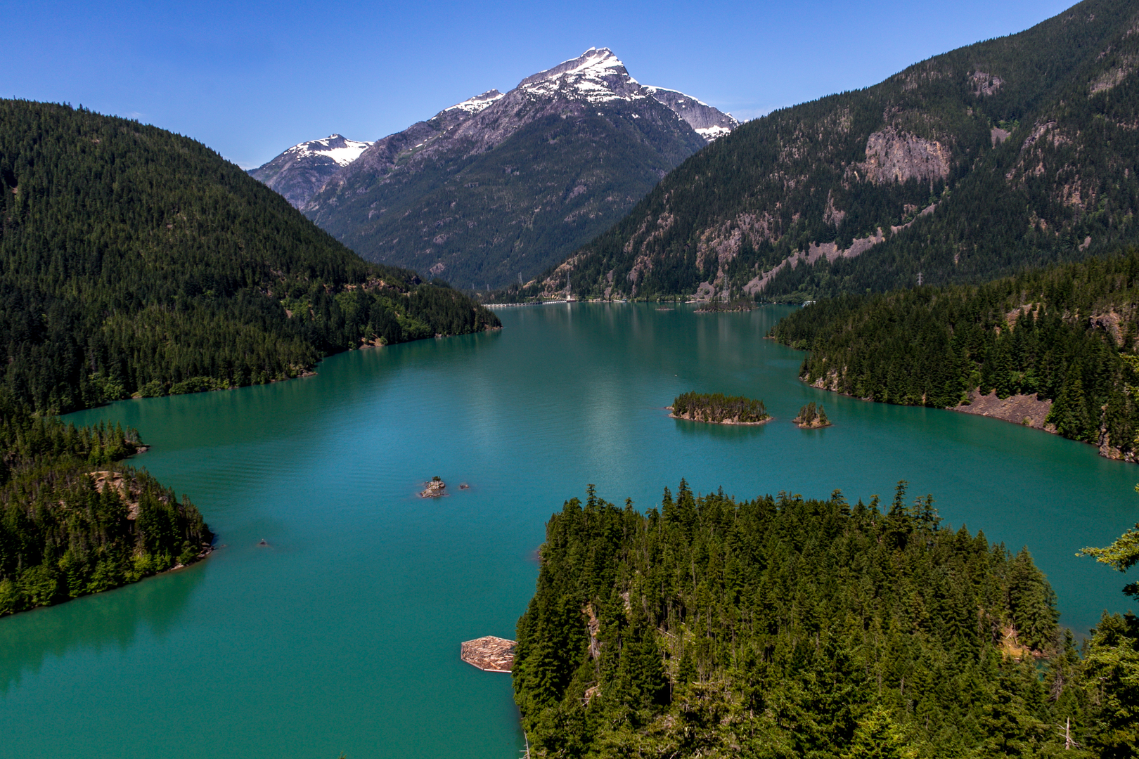
Embarking on the Western Pasayten - Ross Lake Loop, hikers will traverse a challenging and remote circuit through the North Cascades of Washington State. This approximately 118 km (73 miles) journey begins near Whatcom County, with the trailhead accessible by car from State Route 20, turning onto Hozomeen Road which leads to the Hozomeen Campground, a common starting point for the loop.
Getting to the Trailhead
For those without a car, reaching the trailhead can be a bit more challenging due to the remote nature of the area. However, during the summer months, a combination of public transportation and shuttle services may be available to get closer to the Ross Lake area. From there, hikers can arrange for a boat to Hozomeen or plan a longer hike to reach the loop's starting point.
Navigating the Trail
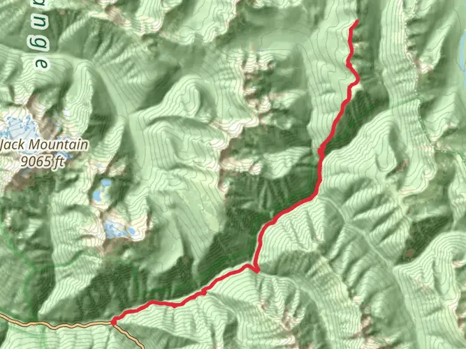
The loop's elevation gain is significant, totaling around 5300 meters (17,388 feet), which means hikers should be well-prepared for steep ascents and descents. The use of a reliable navigation tool like HiiKER is essential for staying on track, as the trail can be challenging to follow in places due to downed trees or overgrown paths.
Landmarks and Natural Features
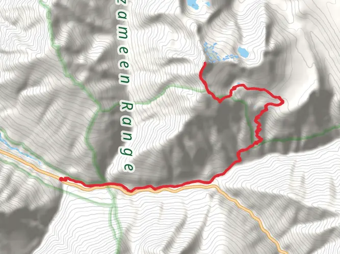
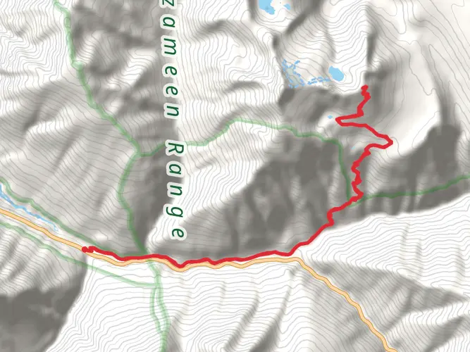
As hikers set out, they will be greeted by dense forests, alpine meadows, and the rugged peaks of the North Cascades. The trail offers stunning vistas of the surrounding mountains, including Jack Mountain and Hozomeen Mountain, which are particularly impressive. Approximately 30 km (18.6 miles) into the hike, the trail reaches the Pasayten Wilderness, a highlight of the loop known for its expansive views and wildlife.
Wildlife and Flora
The area is home to a diverse array of wildlife, including black bears, mountain goats, and mule deer. Hikers should be bear-aware, practicing safe food storage and making noise while hiking to avoid surprise encounters. The trail also winds through areas of wildflowers, especially in the late spring and early summer, adding a splash of color to the green and rocky landscape.
Historical Significance
The region holds historical significance as well, with remnants of early mining operations visible along the trail. The Pasayten Wilderness was also traditionally the land of the Okanagan and Methow tribes, and hikers walking these paths tread on lands that have been important for hunting, fishing, and gathering for thousands of years.
Preparation and Planning
Given the trail's difficulty and remote nature, hikers should be self-sufficient and well-prepared. It is recommended to carry a detailed map, a compass, and a GPS device with the HiiKER app downloaded for offline use. Hikers should also be prepared for sudden weather changes and have gear suitable for cold and wet conditions, even in the summer months.
Water sources are generally plentiful, but all water should be treated before drinking. It's also wise to plan food and supplies carefully, as there are no resupply points on the trail. Due to the length and difficulty of the hike, it's recommended to allow 7-10 days to complete the loop, which allows for a more leisurely pace and time to explore the side trails and scenic spots along the way.
Conclusion
The Western Pasayten - Ross Lake Loop is a demanding but rewarding experience for the seasoned hiker. With its breathtaking landscapes, rich wildlife, and historical significance, it offers an unforgettable adventure in one of the most beautiful and wild parts of the Pacific Northwest.

What to expect?
Activity types
Frequently asked questions
How long does the Western Pasayten - Ross Lake Loop usually take to hike?
The Western Pasayten - Ross Lake Loop is 117.59 km, or about 73 miles, with 5,322 meters of climbing, so it is typically a multi-day backpacking route rather than a weekend day hike. Most strong backpackers break it into roughly 5 to 8 days, depending on pace, camp locations, and how much time is spent on the long climbs and descents around Ross Lake and the Pasayten high country.
Where do you start the Western Pasayten - Ross Lake Loop and where can you park?
A common starting point for the Western Pasayten - Ross Lake Loop is the Hozomeen area at the north end of Ross Lake. Hozomeen Campground is reached by the Silver-Skagit Road from British Columbia, and the National Park Service notes that road access can vary by season and current conditions, so access should be confirmed before setting out.
Do you need a permit for the Western Pasayten - Ross Lake Loop?
Overnight camping on the Ross Lake National Recreation Area side of the Western Pasayten - Ross Lake Loop requires a North Cascades backcountry permit for designated camp areas. The route also connects with Pasayten Wilderness trails managed by the Forest Service, so the exact permit and camping rules can change depending on which camps are used on a given itinerary.
Is the Western Pasayten - Ross Lake Loop a difficult hike?
Yes. The Western Pasayten - Ross Lake Loop is rated Extra Difficult, and the numbers explain why: 117.59 km of distance and 5,322 meters of elevation gain make it a serious remote circuit in the North Cascades. It is best suited to experienced backpackers who are comfortable with long days, steep grades, and limited services once beyond the trailhead.
What mountains and viewpoints can you see on the Western Pasayten - Ross Lake Loop?
The Western Pasayten - Ross Lake Loop passes through terrain with major North Cascades views, including Ross Lake and the rugged skyline around Jack Mountain and Hozomeen Mountain. On the Pasayten side, the Devils Ridge corridor is known for broad open views toward Baker, Hozomeen, and Jack Mountain, making that stretch one of the visual highlights of the loop.
Can you bring a dog on the Western Pasayten - Ross Lake Loop?
Dog access on the Western Pasayten - Ross Lake Loop depends on which land unit a section crosses. North Cascades National Park states that dog rules vary by land manager, and this loop links Ross Lake National Recreation Area with adjacent wilderness and forest trails, so the route should be checked section by section before bringing a dog.
Comments and Reviews
User comments, reviews and discussions about the Western Pasayten - Ross Lake Loop, Washington.
4.89
average rating out of 5
9 rating(s)