Download
3D Flyover
Add to list
More
10.1 km
~2 hrs 58 min
569 m
Out and Back
“A moderate, scenic hike near Spokane offering forest trails, historical sites, and panoramic views.”
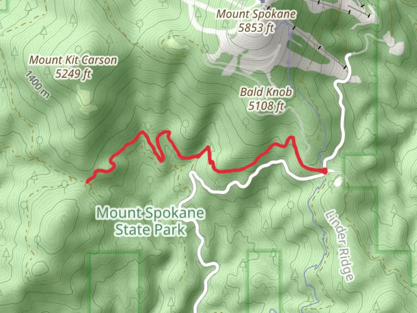
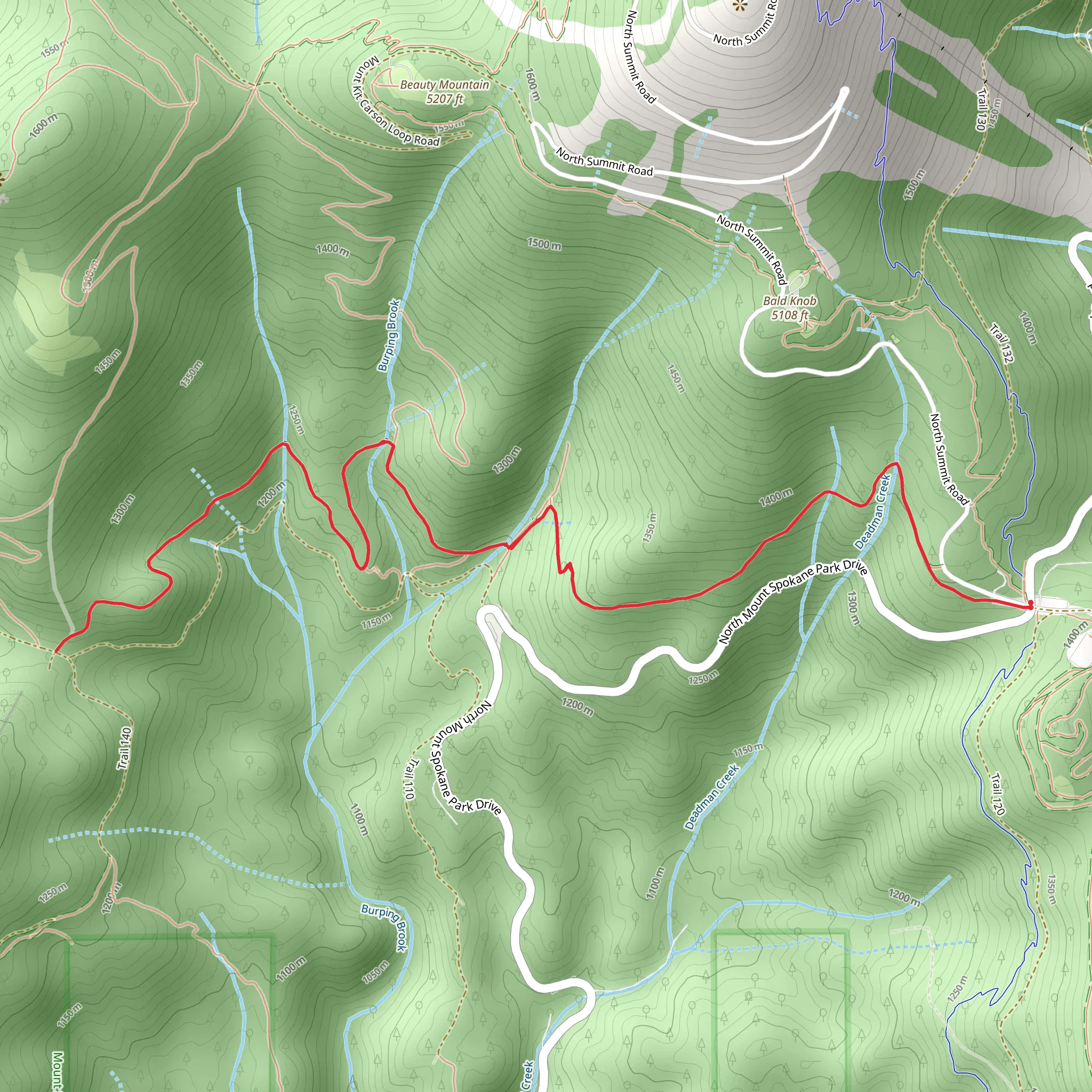
Starting near Spokane County, Washington, this 10 km (approximately 6.2 miles) out-and-back trail offers a moderate challenge with an elevation gain of around 500 meters (1,640 feet). The trailhead is conveniently located near the bustling city of Spokane, making it accessible for both locals and visitors.
Getting There
To reach the trailhead, you can drive or use public transportation. If driving, head towards the nearest known landmark, Riverside State Park, which is a short distance from the trailhead. Ample parking is available at the park. For those using public transport, Spokane Transit Authority (STA) buses can get you close to the park, and from there, a short walk will bring you to the trailhead.
Trail Overview
The trail begins with a gentle ascent through a dense forest of pine and fir trees. The initial 2 km (1.2 miles) are relatively easy, with a gradual elevation gain of about 100 meters (328 feet). This section is perfect for warming up and getting accustomed to the terrain.
Mid-Trail Highlights
As you progress, the trail becomes steeper, with the next 3 km (1.9 miles) gaining an additional 200 meters (656 feet) in elevation. This part of the trail offers stunning views of the Spokane River and the surrounding valley. Keep an eye out for local wildlife, including deer, foxes, and a variety of bird species. The area is also rich in wildflowers during the spring and summer months, adding a splash of color to your hike.
Historical Significance
Around the 5 km (3.1 miles) mark, you'll come across remnants of old mining operations from the late 19th century. This region was once a hub for silver and gold mining, and you can still see some of the old equipment and structures. It's a fascinating glimpse into the area's history and a great spot to take a break and explore.
Final Stretch
The final 2 km (1.2 miles) to the turnaround point are the most challenging, with a steep ascent that gains the remaining 200 meters (656 feet) in elevation. This section is rocky and requires careful footing, but the effort is well worth it. At the top, you'll be rewarded with panoramic views of the Spokane region, including the distant peaks of the Cascade Range.
Navigation and Safety
Given the moderate difficulty of the trail, it's advisable to use a reliable navigation tool like HiiKER to keep track of your progress and ensure you stay on the correct path. The trail is well-marked, but having a digital map can provide extra peace of mind.
Flora and Fauna
Throughout the hike, you'll encounter a diverse range of flora and fauna. The lower sections of the trail are dominated by evergreen trees, while higher elevations feature more rugged, alpine vegetation. Wildlife is abundant, so keep your camera ready for unexpected encounters.
Return Journey
The return journey follows the same path, allowing you to enjoy the views from a different perspective. The descent is much easier on the legs, but still requires caution, especially on the steeper sections.
This trail offers a perfect blend of natural beauty, historical intrigue, and moderate physical challenge, making it a must-visit for hikers in the Spokane area.
What to expect?
Activity types
Comments and Reviews
User comments, reviews and discussions about the Trail 100, Washington.
4.38
average rating out of 5
8 rating(s)
